

$750
Total Monthly Price
12 Month Lease
120 Railway St W Unit 3
Loretto, MN 55357
Favorites
120 Railway St W Unit 3

Favorites
Check Back Soon for Upcoming Availability
| Beds | Baths | Average SF |
|---|---|---|
| 1 Bedroom 1 Bedroom 1 Br | 1 Bath 1 Bath 1 Ba | 358 SF |
Fees and Policies
The fees listed below are community-provided and may exclude utilities or add-ons. All payments are made directly to the property and are non-refundable unless otherwise specified.
- Parking
-
Surface Lot--
Details
Utilities Included
-
Gas
-
Water
-
Trash Removal
-
Sewer
Property Information
-
5 units
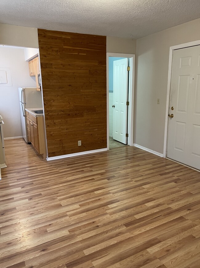
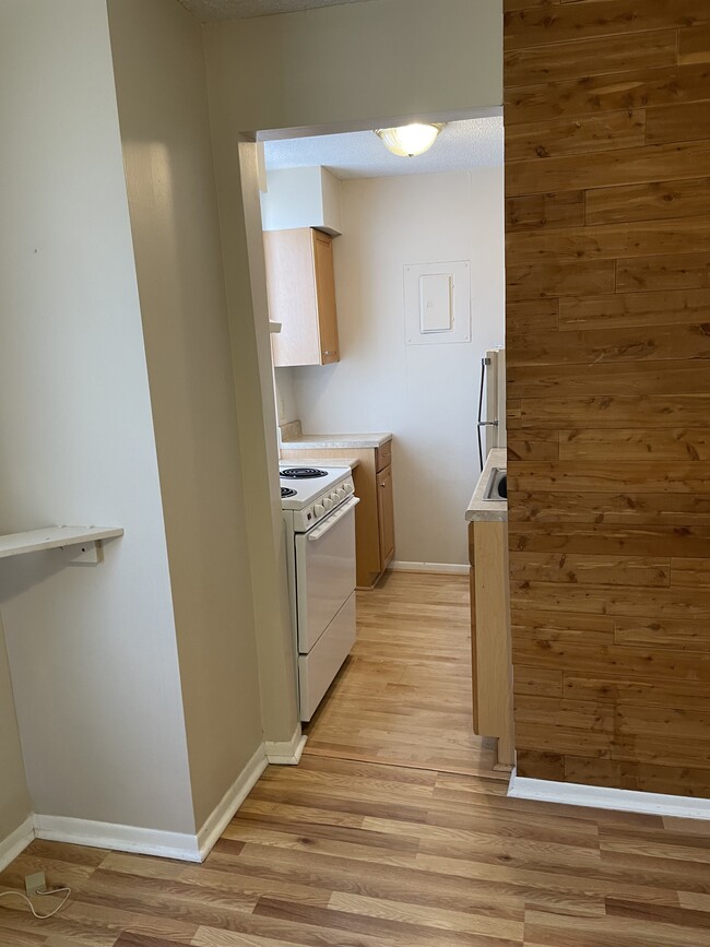
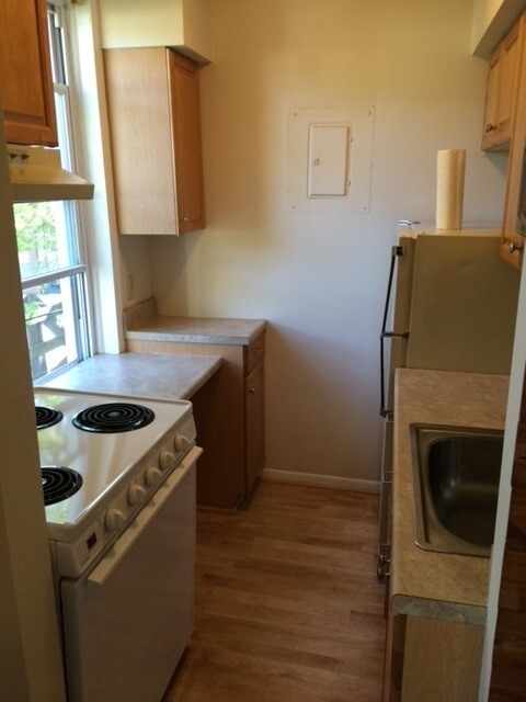
About This Property
OPEN HOUSE FRIDAY 7/7/2023 from 4:00pm - 6:00pm. Located in downtown Loretto this apartment is in the center of town and walking distance to all of the local restaurants. Loretto is right off Highway 55 and is just 10 minutes to 494 access.
120 Railway St W is an apartment community located in Hennepin County and the 55357 ZIP Code.
Apartment Features
- Smoke Free
120 Railway St W,
Loretto,
MN
55357
Amenities
- Smoke Free
Expenses
Utilities Included
Gas, Water, Trash Removal, Sewer
Included
Education
| Colleges & Universities | Distance | ||
|---|---|---|---|
| Colleges & Universities | Distance | ||
| Drive: | 32 min | 20.7 mi | |
| Drive: | 31 min | 22.8 mi | |
| Drive: | 32 min | 23.2 mi | |
| Drive: | 44 min | 27.5 mi |
120 Railway St W Unit 3 is within 32 minutes or 20.7 miles from North Hennepin Comm. Coll.. It is also near University of St. Thomas and Minneapolis College.
Walkability Near 120 Railway St W Loretto, MN 55357
Getting Around
 What do Walkability, Transit, Drivability, and Bikeability mean?
Walkability measures the walking distance to day-to-day needs.
Transit measures access to public transportation.
Drivability measures congestion, parking availability, and access to major roads.
Bikeability measures the suitability for cycling.
How It Works
What do Walkability, Transit, Drivability, and Bikeability mean?
Walkability measures the walking distance to day-to-day needs.
Transit measures access to public transportation.
Drivability measures congestion, parking availability, and access to major roads.
Bikeability measures the suitability for cycling.
How It Works
Somewhat Walkable
Walkability
20
/ 100
Exceptionally Drivable
Drivability
90
/ 100
Fairly Bikeable
Bikeability
50
/ 100
Scores provided by
-
Soundscore™
-
/ 100
Traffic
-Airport
-Businesses
-Scores provided by
HowLoud What is a Sound Score Rating? A Sound Score Rating aggregates noise caused by vehicle traffic, airplane traffic and local sources. How It WorksYou May Also Like
-
York Place Apartments Edina
3121 69th St W
Edina, MN 55435
$1,472 - $2,400 Plus Fees
1-2 Br 19.7 mi
-
Normandale Lake Estates
5233-5277 W 82nd St
Bloomington, MN 55437
$1,308 - $1,553 Total Monthly Price
1-2 Br 12 Month Lease 19.7 mi
-
Bristol Village Apartments
7301 Bristol Village Dr
Bloomington, MN 55438
$1,812 - $1,842 Total Monthly Price
2 Br 12 Month Lease 20.6 mi
Similar Rentals Nearby
-
-
-
2 Beds$1,469Total Monthly PriceTotal Monthly Price NewPrices include base rent and required monthly fees. Variable costs based on usage may apply.Discounts
Pets Allowed Pool Dishwasher Microwave Granite Countertops
-
1 Bed$1,628+2 Beds$2,115+Total Monthly PriceTotal Monthly Price NewPrices include required monthly fees of $20.Base Rent:1 Bed$1,608+2 Beds$2,095+2 Months Free
Pets Allowed Fitness Center Pool In Unit Washer & Dryer Stainless Steel Appliances Hardwood Floors
-
-
-
1 Bed$1,012+Total Monthly PriceTotal Monthly Price NewPrices include required monthly fees of $67.Base Rent:1 Bed$945+
High-Speed Internet Laundry Facilities
-
-
1 Bed$1,939+2 Beds$2,989+Total Monthly PriceTotal Monthly Price NewPrices include required monthly fees of $4.Base Rent:1 Bed$1,935+2 Beds$2,985+1 Month Free
Pets Allowed Fitness Center Pool Dishwasher Refrigerator Clubhouse Maintenance on site
-


What Are Walk Score®, Transit Score®, and Bike Score® Ratings?
Walk Score® measures the walkability of any address. Transit Score® measures access to public transit. Bike Score® measures the bikeability of any address.
What is a Sound Score Rating?
A Sound Score Rating aggregates noise caused by vehicle traffic, airplane traffic and local sources.
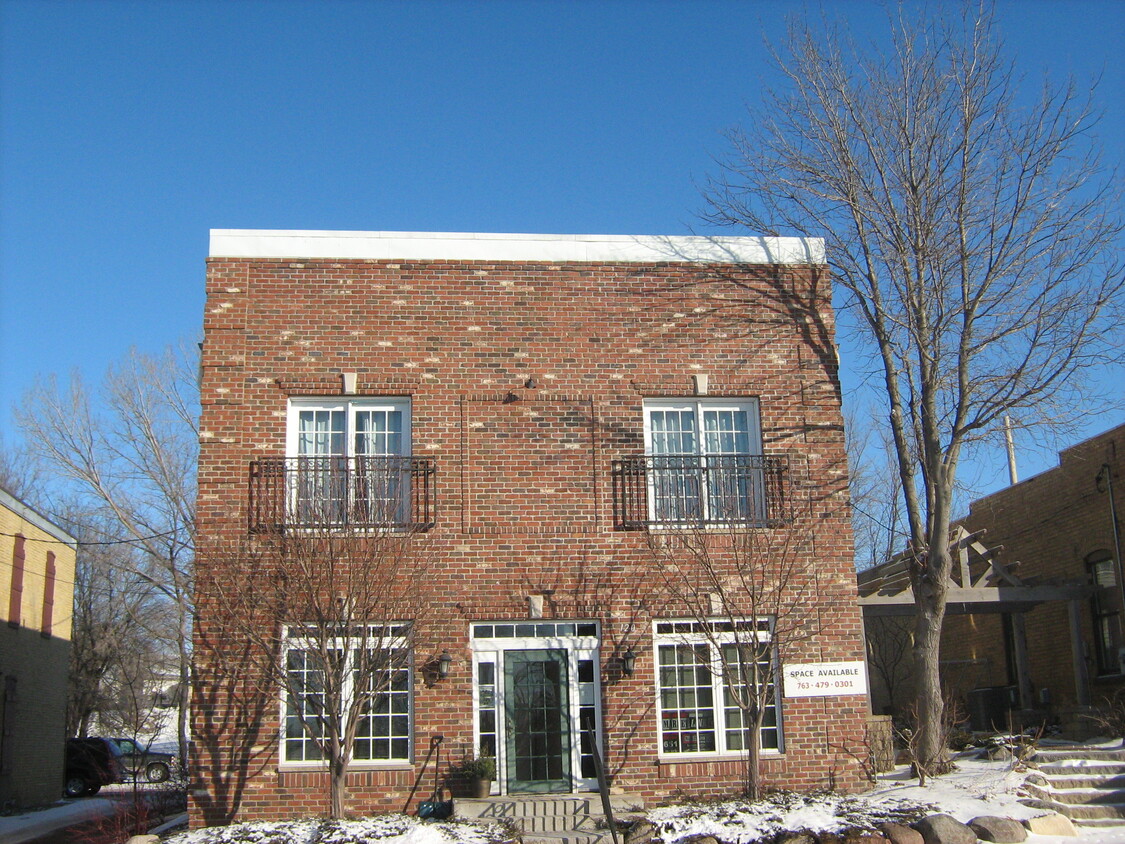
120 Railway St W
Loretto, MN 55357