12 Kings Hwy E
12 Kings Hwy E,
Haddonfield,
NJ
08033
2 Weeks Ago
Favorites
12 Kings Hwy E

Favorites
Check Back Soon for Upcoming Availability
Fees and Policies
The fees below are based on community-supplied data and may exclude additional fees and utilities.
- Parking
-
Surface Lot--
Details
Lease Options
-
12 Months
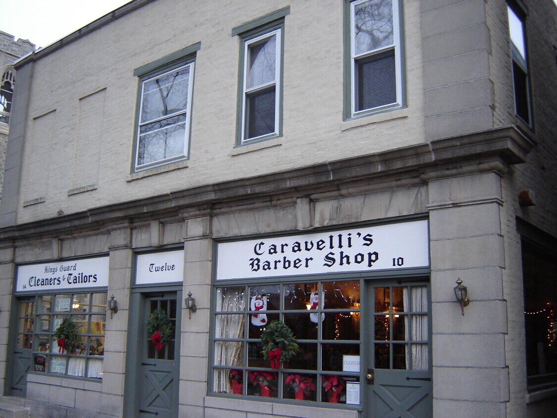
About 12 Kings Hwy E Haddonfield, NJ 08033
Located in downtown Haddonfield near PATCO station.
12 Kings Hwy E is an apartment community located in Camden County and the 08033 ZIP Code.
Apartment Features
- Washer/Dryer
- Smoke Free
Location
Get Directions
Cherry Hill is a close-knit community located 8 miles southeast of Philadelphia. Haddonfield, its neighbor immediately south, creates the border between the two towns. With a preserved historic district teeming with Victorian, colonial and federal-period houses, it's no wonder that Philadelphia Magazine chose Haddonfield as one of the best places to live in the Delaware Valley.
The close proximity to the city combined with safe neighborhoods, excellent school systems, and all the charm living in a historic town brings, checking out the area is a no-brainer to those contemplating a move in the area.
Learn more about living in Cherry Hill/HaddonfieldBelow are rent ranges for similar nearby apartments
| Beds | Average Size | Lowest | Typical | Premium |
|---|---|---|---|---|
| Studio Studio Studio | 527-530 Sq Ft | $1,200 | $2,008 | $3,445 |
| 1 Bed 1 Bed 1 Bed | 794-798 Sq Ft | $742 | $2,130 | $5,940 |
| 2 Beds 2 Beds 2 Beds | 1084 Sq Ft | $1,158 | $2,561 | $6,840 |
| 3 Beds 3 Beds 3 Beds | 1544 Sq Ft | $1,287 | $3,205 | $5,625 |
| 4 Beds 4 Beds 4 Beds | 2508 Sq Ft | $2,695 | $3,695 | $5,600 |
Amenities
- Washer/Dryer
- Smoke Free
Education
| Colleges & Universities | Distance | ||
|---|---|---|---|
| Colleges & Universities | Distance | ||
| Drive: | 10 min | 6.2 mi | |
| Drive: | 11 min | 6.6 mi | |
| Drive: | 16 min | 9.7 mi | |
| Drive: | 17 min | 9.9 mi |
12 Kings Hwy E is within 10 minutes or 6.2 miles from Camden Co. Coll., Camden City. It is also near Rutgers, Camden Campus and Thomas Jefferson University.
Transportation options available in Haddonfield include Haddonfield, located 0.2 mile from 12 Kings Hwy E. 12 Kings Hwy E is near Philadelphia International, located 15.3 miles or 27 minutes away, and Trenton Mercer, located 38.9 miles or 54 minutes away.
| Transit / Subway | Distance | ||
|---|---|---|---|
| Transit / Subway | Distance | ||
|
|
Walk: | 2 min | 0.2 mi |
|
|
Drive: | 3 min | 1.4 mi |
|
|
Drive: | 4 min | 2.5 mi |
|
|
Drive: | 6 min | 3.0 mi |
|
|
Drive: | 7 min | 4.6 mi |
| Commuter Rail | Distance | ||
|---|---|---|---|
| Commuter Rail | Distance | ||
|
|
Drive: | 6 min | 3.2 mi |
|
|
Drive: | 9 min | 6.0 mi |
| Drive: | 13 min | 6.9 mi | |
|
|
Drive: | 15 min | 9.5 mi |
|
|
Drive: | 16 min | 10.0 mi |
| Airports | Distance | ||
|---|---|---|---|
| Airports | Distance | ||
|
Philadelphia International
|
Drive: | 27 min | 15.3 mi |
|
Trenton Mercer
|
Drive: | 54 min | 38.9 mi |
Time and distance from 12 Kings Hwy E.
| Shopping Centers | Distance | ||
|---|---|---|---|
| Shopping Centers | Distance | ||
| Walk: | 8 min | 0.5 mi | |
| Drive: | 3 min | 1.2 mi | |
| Drive: | 3 min | 1.3 mi |
12 Kings Hwy E has 3 shopping centers within 1.3 miles, which is about a 3-minute walk. The miles and minutes will be for the farthest away property.
| Parks and Recreation | Distance | ||
|---|---|---|---|
| Parks and Recreation | Distance | ||
|
Croft Farm Nature Trail
|
Drive: | 3 min | 1.5 mi |
|
Erlton North Trails
|
Drive: | 5 min | 2.7 mi |
|
Downs Farms Trails
|
Drive: | 5 min | 2.9 mi |
|
Barclay Farmstead Nature Trail
|
Drive: | 6 min | 3.1 mi |
|
Kresson Nature Trails
|
Drive: | 8 min | 3.7 mi |
12 Kings Hwy E has 5 parks within 3.7 miles, including Croft Farm Nature Trail, Erlton North Trails, and Downs Farms Trails.
| Hospitals | Distance | ||
|---|---|---|---|
| Hospitals | Distance | ||
| Drive: | 7 min | 4.3 mi | |
| Drive: | 8 min | 5.8 mi | |
| Drive: | 17 min | 9.0 mi |
12 Kings Hwy E has 3 hospitals within 9.0 miles, the nearest is Virtua Our Lady of Lourdes Hospital which is 4.3 miles away and a 7 minute drive.
| Military Bases | Distance | ||
|---|---|---|---|
| Military Bases | Distance | ||
| Drive: | 18 min | 10.4 mi |
12 Kings Hwy E is 10.4 miles and a 18 minute drive from Philadelphia Naval Busi Center.
You May Also Like
Similar Rentals Nearby


What Are Walk Score®, Transit Score®, and Bike Score® Ratings?
Walk Score® measures the walkability of any address. Transit Score® measures access to public transit. Bike Score® measures the bikeability of any address.
What is a Sound Score Rating?
A Sound Score Rating aggregates noise caused by vehicle traffic, airplane traffic and local sources