

$775
/ Month
11968 US Highway 431
Ohatchee, AL 36271
Favorites
11968 US Highway 431

Favorites
Check Back Soon for Upcoming Availability
| Beds | Baths | Average SF |
|---|---|---|
| 3 Bedrooms 3 Bedrooms 3 Br | 1 Bath 1 Bath 1 Ba | — |
Fees and Policies
The fees listed below are community-provided and may exclude utilities or add-ons. All payments are made directly to the property and are non-refundable unless otherwise specified.
About This Property
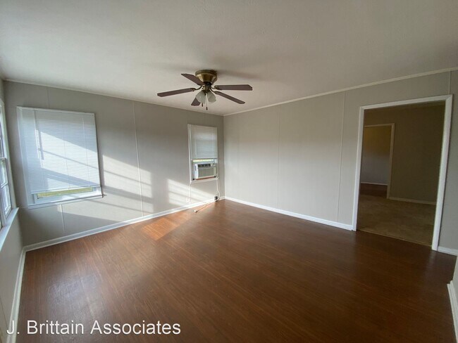
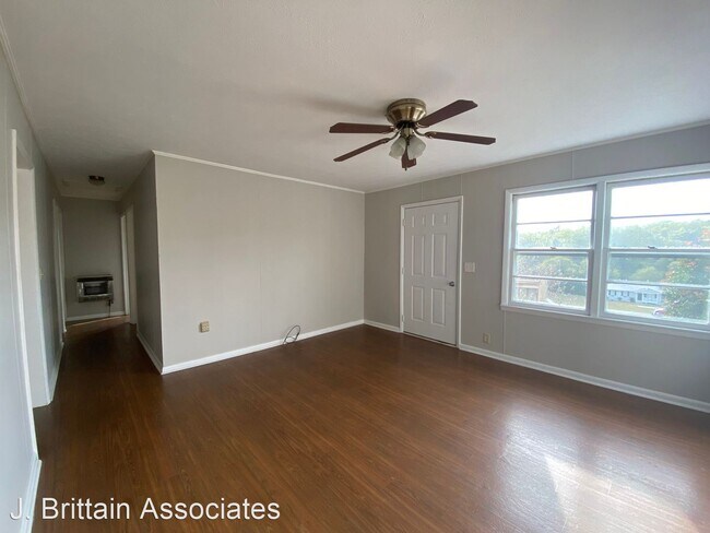
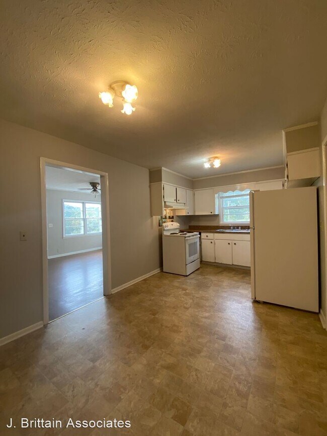
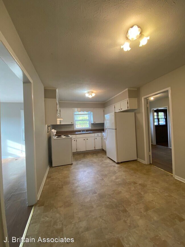
- 11968 US Highway 431 - One level 3 bedroom, 1 bath home with mostly hard surface flooring throughout, featuring a den, living room, eat-in-kitchen with range and fridge, over-sized utility room with hook-ups, window a/c unit and propane gas wall heater, all located on a private lot. Alexandria Schools. No Section 8. (RLNE1855535) Other Amenities: Other (no utilities included). Appliances: Refrigerator, Range, Washer & Dryer Hookup.
11968 Us Highway 431 is a house located in Calhoun County and the 36271 ZIP Code. This area is served by the Calhoun County School District attendance zone.
Unique Features
- Amenities - no utilities included
11968 US Highway 431,
Ohatchee,
AL
36271
Amenities
- Amenities - no utilities included
Education
| Colleges & Universities | Distance | ||
|---|---|---|---|
| Colleges & Universities | Distance | ||
| Drive: | 17 min | 10.2 mi | |
| Drive: | 21 min | 13.6 mi | |
| Drive: | 55 min | 39.8 mi |
11968 US Highway 431 is within 17 minutes or 10.2 miles from Jacksonville State University. It is also near Gadsden State Comm. Coll. and Talladega College.
Schools


Public Elementary School
Grades PK-5
390 Students
Nearby
Public Elementary School
Grades PK-5
720 Students
Attendance Zone
Public High School
Grades 9-12
513 Students
Attendance Zone
Private Elementary, Middle & High School
Grades PK-12
206 Students
Nearby
School data provided by
 The GreatSchools Rating helps parents compare schools within a state based on a variety of school quality indicators and provides a helpful picture of how effectively each school serves all of its students. Ratings are on a scale of 1 (below average) to 10 (above average) and can include test scores, college readiness, academic progress, advanced courses, equity, discipline and attendance data. We also advise parents to visit schools, consider other information on school performance and programs, and consider family needs as part of the school selection process.
View GreatSchools Rating Methodology
Data provided by GreatSchools.org © 2026. All rights reserved.
View GreatSchools Rating Methodology
Data provided by GreatSchools.org © 2026. All rights reserved.
Walkability Near 11968 US Highway 431 Ohatchee, AL 36271
Getting Around
 What do Walkability, Transit, Drivability, and Bikeability mean?
Walkability measures the walking distance to day-to-day needs.
Transit measures access to public transportation.
Drivability measures congestion, parking availability, and access to major roads.
Bikeability measures the suitability for cycling.
How It Works
What do Walkability, Transit, Drivability, and Bikeability mean?
Walkability measures the walking distance to day-to-day needs.
Transit measures access to public transportation.
Drivability measures congestion, parking availability, and access to major roads.
Bikeability measures the suitability for cycling.
How It Works
Not Walkable
Walkability
10
/ 100
Exceptionally Drivable
Drivability
100
/ 100
Not Bikeable
Bikeability
10
/ 100
Scores provided by
-
Soundscore™
-
/ 100
Traffic
-Airport
-Businesses
-Scores provided by
HowLoud What is a Sound Score Rating? A Sound Score Rating aggregates noise caused by vehicle traffic, airplane traffic and local sources. How It WorksYou May Also Like
Similar Rentals Nearby


What Are Walk Score®, Transit Score®, and Bike Score® Ratings?
Walk Score® measures the walkability of any address. Transit Score® measures access to public transit. Bike Score® measures the bikeability of any address.
What is a Sound Score Rating?
A Sound Score Rating aggregates noise caused by vehicle traffic, airplane traffic and local sources.

11968 US Highway 431
Ohatchee, AL 36271