
SoLA
10930 Garfield Ave,
South Gate, CA 90280
$2,399 - $3,999
1-3 Beds
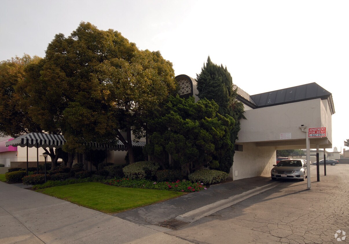
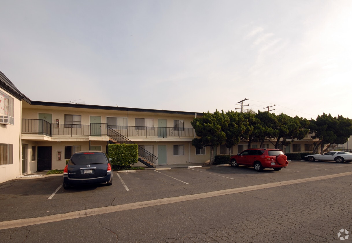
Experience your new home at 11932 Paramount Blvd. This apartment community is located on Paramount Blvd in the 90242 area of Downey. Schedule a time to check out the apartment floorplan options. Here at this community, the leasing staff is available to assist you in finding your perfect fit. Drop by the leasing office to check current floorplan availability.
11932 Paramount Blvd is an apartment community located in Los Angeles County and the 90242 ZIP Code. This area is served by the Downey Unified School District attendance zone.
Southeast Los Angeles is directly south of the Fashion District and east of the University of Southern California (USC). This large neighborhood is minutes from downtown Los Angeles, Hollywood, and Beverly Hills, with easy access to the 110 Freeway. This great location places you near sunny beaches, nature trails, and a bevy of leading employers. Students can access both USC and California State University Long Beach from their Southeast LA apartment.
This densely populated, diverse neighborhood features everything from food trucks and corner markets to wide sidewalks and residential areas filled with bungalows, ranch, and Spanish Colonial architecture. Southeast LA features palm trees and mountain views, tampered with gritty undertones to give it a cool, funky vibe.
As for outdoor fun, take your pick between Catalina Island, Venus Beach, or the Santa Monica Pier. Nearby, you’ll find more sunny beaches like White Point, Cabrillo, and Long Beach.
Learn more about living in Southeast Los AngelesCompare neighborhood and city base rent averages by bedroom.
| Southeast Los Angeles | Downey, CA | |
|---|---|---|
| Studio | - | $1,255 |
| 1 Bedroom | $1,133 | $1,738 |
| 2 Bedrooms | $1,221 | $2,226 |
| 3 Bedrooms | $1,289 | $2,780 |
| Colleges & Universities | Distance | ||
|---|---|---|---|
| Colleges & Universities | Distance | ||
| Drive: | 12 min | 6.6 mi | |
| Drive: | 14 min | 7.8 mi | |
| Drive: | 15 min | 8.4 mi | |
| Drive: | 18 min | 8.8 mi |


Transportation options available in Downey include Lakewood Station, located 2.2 miles from 11932 Paramount Blvd. 11932 Paramount Blvd is near Long Beach (Daugherty Field), located 9.4 miles or 19 minutes away, and Los Angeles International, located 17.9 miles or 25 minutes away.
| Transit / Subway | Distance | ||
|---|---|---|---|
| Transit / Subway | Distance | ||
|
|
Drive: | 4 min | 2.2 mi |
|
|
Drive: | 9 min | 5.1 mi |
|
|
Drive: | 9 min | 5.5 mi |
|
|
Drive: | 13 min | 6.8 mi |
|
|
Drive: | 13 min | 8.7 mi |
| Commuter Rail | Distance | ||
|---|---|---|---|
| Commuter Rail | Distance | ||
|
|
Drive: | 10 min | 5.2 mi |
|
|
Drive: | 10 min | 5.9 mi |
|
|
Drive: | 11 min | 6.6 mi |
|
|
Drive: | 19 min | 11.3 mi |
| Drive: | 22 min | 16.9 mi |
| Airports | Distance | ||
|---|---|---|---|
| Airports | Distance | ||
|
Long Beach (Daugherty Field)
|
Drive: | 19 min | 9.4 mi |
|
Los Angeles International
|
Drive: | 25 min | 17.9 mi |
Scores provided by
Traffic
ActiveAirport
CalmBusinesses
ActiveScores provided by
HowLoud What is a Sound Score Rating? A Sound Score Rating aggregates noise caused by vehicle traffic, airplane traffic and local sources. How It WorksTime and distance from 11932 Paramount Blvd.
| Shopping Centers | Distance | ||
|---|---|---|---|
| Shopping Centers | Distance | ||
| Walk: | 12 min | 0.6 mi | |
| Walk: | 16 min | 0.8 mi | |
| Drive: | 3 min | 1.4 mi |
| Parks and Recreation | Distance | ||
|---|---|---|---|
| Parks and Recreation | Distance | ||
|
Watts Senior Center & Rose Garden
|
Drive: | 13 min | 7.1 mi |
|
Compton Creek Natural Park at George Washington Elementary
|
Drive: | 13 min | 7.2 mi |
|
Watts Towers-Rodia State Park
|
Drive: | 13 min | 7.8 mi |
|
Pio Pico State Historic Park
|
Drive: | 12 min | 8.5 mi |
|
Augustus Hawkins Natural Park
|
Drive: | 15 min | 9.1 mi |
| Hospitals | Distance | ||
|---|---|---|---|
| Hospitals | Distance | ||
| Walk: | 20 min | 1.0 mi | |
| Drive: | 5 min | 2.1 mi | |
| Drive: | 7 min | 4.1 mi |
| Military Bases | Distance | ||
|---|---|---|---|
| Military Bases | Distance | ||
| Drive: | 22 min | 16.3 mi | |
| Drive: | 25 min | 16.6 mi |
What Are Walk Score®, Transit Score®, and Bike Score® Ratings?
Walk Score® measures the walkability of any address. Transit Score® measures access to public transit. Bike Score® measures the bikeability of any address.
What is a Sound Score Rating?
A Sound Score Rating aggregates noise caused by vehicle traffic, airplane traffic and local sources.

11932 Paramount Blvd
Downey, CA 90242


