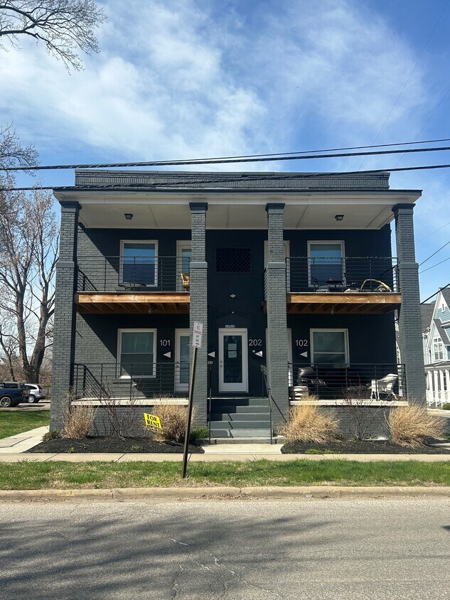
11915 Ashbury Ave
11915 Ashbury Ave,
Cleveland,
OH
44106
-
Monthly Rent
$1,600 - $1,900
-
Bedrooms
2 bd
-
Bathrooms
1 ba
-
Square Feet
1,000 sq ft

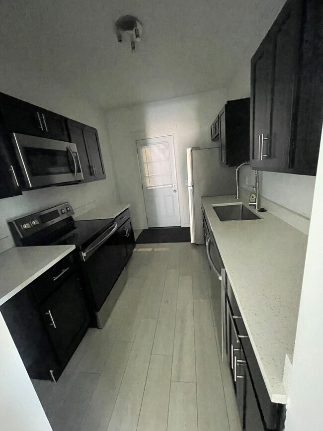
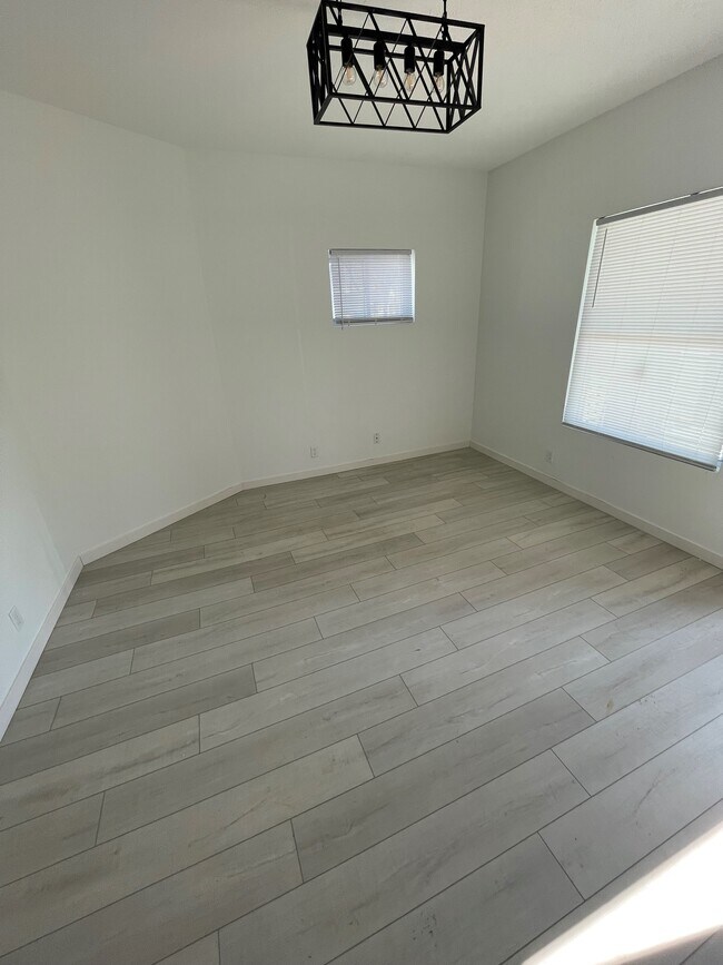
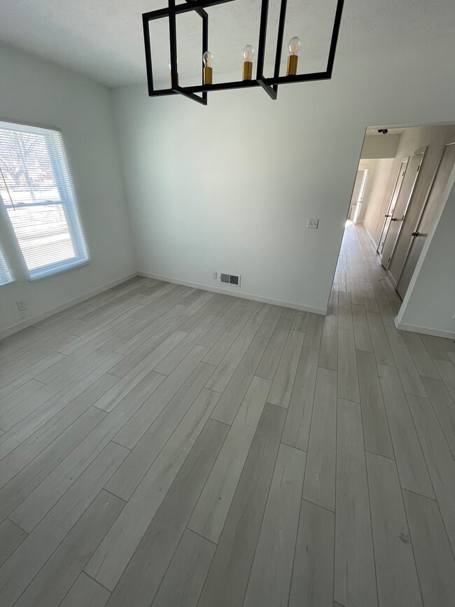
Este edificio recientemente renovado ofrece una selección de impecables apartamentos de dos habitaciones, cada uno con balcón privado y cocinas modernas equipadas con electrodomésticos nuevos. Con una ubicación privilegiada, se encuentra a poca distancia a pie del centro comercial University Circle, hospitales de la zona y universidades de renombre como CWRU, CIM y CAI.
Highlights
- Porche
- Control de accesos
- Balcón
Pricing & Floor Plans
-
Unit 202price $1,660square feet 1,000availibility Now
-
Unit 203price $1,660square feet 1,000availibility Now
-
Unit 101price $1,660square feet 1,000availibility Now
-
Unit 202price $1,660square feet 1,000availibility Now
-
Unit 203price $1,660square feet 1,000availibility Now
-
Unit 101price $1,660square feet 1,000availibility Now
Fees and Policies
The fees listed below are community-provided and may exclude utilities or add-ons. All payments are made directly to the property and are non-refundable unless otherwise specified. Use the Cost Calculator to determine costs based on your needs.
Property Fee Disclaimer: Based on community-supplied data and independent market research. Subject to change without notice. May exclude fees for mandatory or optional services and usage-based utilities.
Details
Utilities Included
-
Trash Removal
-
Cable
-
Air Conditioning
Lease Options
-
12 meses
Property Information
-
Built in 1910
-
6 units/2 stories
Matterport 3D Tours
About 11915 Ashbury Ave Cleveland, OH 44106
Este edificio recientemente renovado ofrece una selección de impecables apartamentos de dos habitaciones, cada uno con balcón privado y cocinas modernas equipadas con electrodomésticos nuevos. Con una ubicación privilegiada, se encuentra a poca distancia a pie del centro comercial University Circle, hospitales de la zona y universidades de renombre como CWRU, CIM y CAI.
11915 Ashbury Ave is an apartment community located in Cuyahoga County and the 44106 ZIP Code. This area is served by the Cleveland Metropolitan School District attendance zone.
Contact
Community Amenities
- Instalaciones de lavandería
- Control de accesos
Apartment Features
Aire acondicionado
Lavavajillas
Microondas
Nevera
- Aire acondicionado
- Calefacción
- Preinstalación de cables
- Lavavajillas
- Zona de eliminación de desechos
- Máquina de hielo
- Electrodomésticos de acero inoxidable
- Cocina
- Microondas
- Horno
- Fogón
- Nevera
- Congelador
- Suelos de vinilo
- Sala familiar
- Balcón
- Porche
The neighborhood of Glenville lies between six and eight miles from downtown Cleveland. A short trip on I-90 takes commuters from their houses with porches on quiet, leafy streets to the city's center.
For rest and relaxation, head to the Cleveland Lakefront Nature Preserve right on Lake Erie with its winding, easy-to-walk trails, bird meadows, and wildflowers. While in the park, take in the views at the scenic Doan Brook Outflow and the Intercity Yacht Club. Locals also delight in Gordon Park, with its wild landscape in the middle of a big city. Don’t leave out the nearby Russian Cultural Garden, the Cleveland Cultural Gardens, and the Rockefeller Park Greenhouse. For those into pop culture, fans of the Superman character flock to the boyhood home of its creator, Jerry Siegel.
Learn more about living in GlenvilleCompare neighborhood and city base rent averages by bedroom.
| Glenville | Cleveland, OH | |
|---|---|---|
| Studio | - | $1,207 |
| 1 Bedroom | $811 | $1,373 |
| 2 Bedrooms | $1,079 | $1,711 |
| 3 Bedrooms | $1,980 | $2,170 |
- Instalaciones de lavandería
- Control de accesos
- Aire acondicionado
- Calefacción
- Preinstalación de cables
- Lavavajillas
- Zona de eliminación de desechos
- Máquina de hielo
- Electrodomésticos de acero inoxidable
- Cocina
- Microondas
- Horno
- Fogón
- Nevera
- Congelador
- Suelos de vinilo
- Sala familiar
- Balcón
- Porche
| Monday | By Appointment |
|---|---|
| Tuesday | By Appointment |
| Wednesday | By Appointment |
| Thursday | By Appointment |
| Friday | By Appointment |
| Saturday | By Appointment |
| Sunday | By Appointment |
| Colleges & Universities | Distance | ||
|---|---|---|---|
| Colleges & Universities | Distance | ||
| Walk: | 12 min | 0.6 mi | |
| Walk: | 14 min | 0.8 mi | |
| Walk: | 16 min | 0.8 mi | |
| Drive: | 12 min | 5.2 mi |


View GreatSchools Rating Methodology
Data provided by GreatSchools.org © 2026. All rights reserved.
Transportation options available in Cleveland include Little Italy-Univ Circle Station, located 0.8 mile from 11915 Ashbury Ave. 11915 Ashbury Ave is near Cleveland-Hopkins International, located 18.5 miles or 32 minutes away.
| Transit / Subway | Distance | ||
|---|---|---|---|
| Transit / Subway | Distance | ||
| Walk: | 15 min | 0.8 mi | |
|
|
Walk: | 17 min | 0.9 mi |
|
|
Drive: | 4 min | 1.6 mi |
|
|
Drive: | 4 min | 1.7 mi |
|
|
Drive: | 6 min | 2.2 mi |
| Commuter Rail | Distance | ||
|---|---|---|---|
| Commuter Rail | Distance | ||
|
|
Drive: | 15 min | 6.9 mi |
| Drive: | 24 min | 12.1 mi | |
| Drive: | 26 min | 13.8 mi | |
| Drive: | 34 min | 19.7 mi | |
|
Boston Mill
|
Drive: | 41 min | 24.7 mi |
| Airports | Distance | ||
|---|---|---|---|
| Airports | Distance | ||
|
Cleveland-Hopkins International
|
Drive: | 32 min | 18.5 mi |
Time and distance from 11915 Ashbury Ave.
| Shopping Centers | Distance | ||
|---|---|---|---|
| Shopping Centers | Distance | ||
| Walk: | 13 min | 0.7 mi | |
| Walk: | 18 min | 1.0 mi | |
| Drive: | 3 min | 1.6 mi |
| Parks and Recreation | Distance | ||
|---|---|---|---|
| Parks and Recreation | Distance | ||
|
Cleveland Botanical Garden
|
Walk: | 16 min | 0.9 mi |
|
Cleveland Museum of Natural History
|
Walk: | 19 min | 1.0 mi |
|
Children's Museum of Cleveland
|
Drive: | 4 min | 1.3 mi |
|
Nature Center at Shaker Lakes
|
Drive: | 10 min | 4.1 mi |
|
Euclid Creek Reservation
|
Drive: | 11 min | 5.5 mi |
| Hospitals | Distance | ||
|---|---|---|---|
| Hospitals | Distance | ||
| Walk: | 17 min | 0.9 mi | |
| Walk: | 17 min | 0.9 mi | |
| Drive: | 5 min | 1.9 mi |
| Military Bases | Distance | ||
|---|---|---|---|
| Military Bases | Distance | ||
| Drive: | 107 min | 87.3 mi | |
| Drive: | 110 min | 88.1 mi |
11915 Ashbury Ave Photos
-
Balcones exteriores
-
2 habitaciones, 1 baño - 1000 pies cuadrados
-
Nueva cocina
-
Dormitorio
-
-
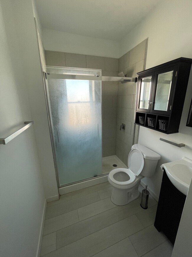
Baño
-
-
-
Models
-
2 habitaciones, 1 baño - 1000 pies cuadrados
While 11915 Ashbury Ave does not provide in‑unit laundry, on‑site laundry facilities are available for shared resident use.
Select utilities are included in rent at 11915 Ashbury Ave, including trash removal, cable, and air conditioning. Residents are responsible for any other utilities not listed.
Parking is available at 11915 Ashbury Ave. Contact this property for details.
11915 Ashbury Ave has two-bedrooms available with rent ranges from $1,600/mo. to $1,900/mo.
Yes, 11915 Ashbury Ave welcomes pets. Breed restrictions, weight limits, and additional fees may apply. View this property's pet policy.
A good rule of thumb is to spend no more than 30% of your gross income on rent. Based on the lowest available rent of $1,600 for a two-bedrooms, you would need to earn about $64,000 per year to qualify. Want to double-check your budget? Calculate how much rent you can afford with our Rent Affordability Calculator.
11915 Ashbury Ave is not currently offering any rent specials. Check back soon, as promotions change frequently.
Yes! 11915 Ashbury Ave offers 2 Matterport 3D Tours. Explore different floor plans and see unit level details, all without leaving home.
What Are Walk Score®, Transit Score®, and Bike Score® Ratings?
Walk Score® measures the walkability of any address. Transit Score® measures access to public transit. Bike Score® measures the bikeability of any address.
What is a Sound Score Rating?
A Sound Score Rating aggregates noise caused by vehicle traffic, airplane traffic and local sources.

11915 Ashbury Ave
Cleveland, OH 44106