
$3,995
/ Month
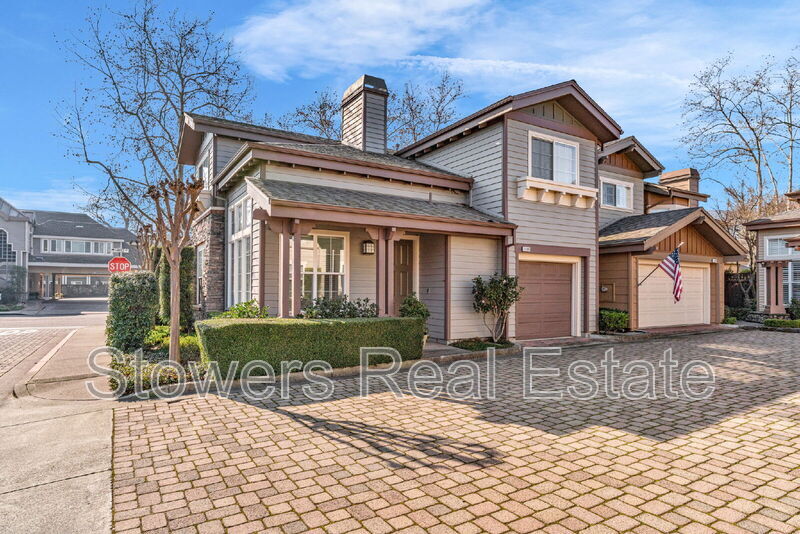
1188 River Rock Lane
Danville, CA 94526
Today
|
Edit
Favorites
925-856-5782
-
Bedrooms
3
-
Bathrooms
2
-
Square Feet
1,375 sq ft
-
Available
Available Feb 2
1188 River Rock Lane

Favorites
About This Home
$3,995 deposit,
Available Feb 2
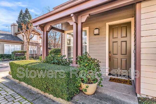
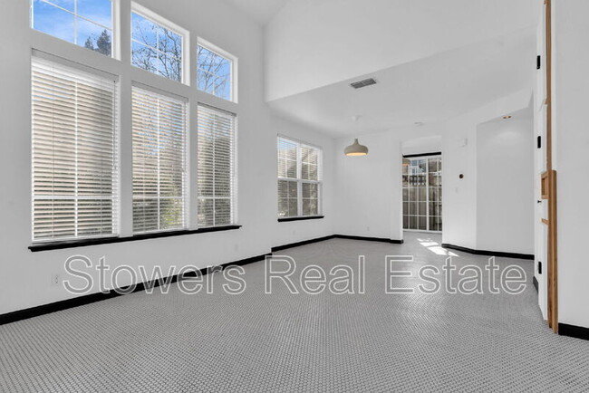
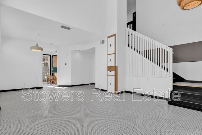
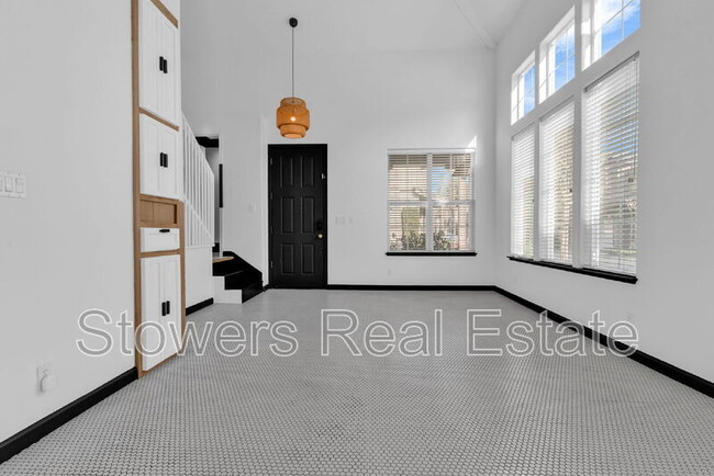
This 3-bedroom, 2.5-bath detached home offering 1,375 square feet is located in the desirable Stonybrook community, right in the heart of downtown Danville. Positioned on a corner lot and backing to Hartz Avenue, the home offers privacy along with exceptional walkability. The interior features high ceilings and abundant natural light throughout. The kitchen includes ample cabinetry, a breakfast bar, recessed lighting, and a dedicated eating area. Additional highlights include central HVAC, dual-pane windows, and a primary suite with a walk-in closet and private bathroom. Residents enjoy access to a community pool and an unbeatable location near the Iron Horse Trail, shopping, restaurants, nightlife, art district, library, and top-rated schools. Pet Details: Would consider a small pet
1188 River Rock Lane is a house located in Contra Costa County and the 94526 ZIP Code.
* Price shown is base rent. Excludes user-selected optional fees and variable or usage-based fees and required charges due at or prior to move-in or at move-out. Price, availability, fees, and any applicable rent special are subject to change without notice.
* Square footage definitions vary. Displayed square footage is approximate.
Fees and Policies
The fees below are based on community-supplied data and may exclude additional fees and utilities.
-
One-Time Basics
-
Due at Move-In
-
Security Deposit - RefundableCharged per unit.$3,995
-
-
Due at Move-In
-
Dogs
-
Allowed
-
-
Cats
-
Allowed
-
Property Fee Disclaimer: Based on community-supplied data and independent market research. Subject to change without notice. May exclude fees for mandatory or optional services and usage-based utilities.
House Features
- Dishwasher
- Refrigerator
Contact
- Phone Number
- Contact
Location
Get Directions
Amenities
- Dishwasher
- Refrigerator
Danville is an upscale suburban community located just south of Walnut Creek and about twenty miles east of Oakland. Residents enjoy an ideal location, surrounded by scenic rolling hills and lush greenery while still being within minutes of the Bay Area’s biggest cities. The thriving Downtown district along Hartz Boulevard is packed with terrific restaurants, specialty shops, and bars, as well as unique attractions like the Village Theatre and Art Gallery and the Danville Farmers’ Market. The surrounding landscape offers terrific opportunities to make the most of California’s natural beauty, with Las Trampas Regional Wilderness and the Diablo Foothills just outside of town providing great venues for hiking and camping.
Learn more about living in Danville
Education
| Colleges & Universities | Distance | ||
|---|---|---|---|
| Colleges & Universities | Distance | ||
| Drive: | 17 min | 9.7 mi | |
| Drive: | 25 min | 12.9 mi | |
| Drive: | 21 min | 13.2 mi | |
| Drive: | 36 min | 24.4 mi |
1188 River Rock Lane is within 17 minutes or 9.7 miles from Diablo Valley Coll, San Ramon. It is also near Saint Marys Coll. of Calif. and Diablo Valley, Pleasant Hill.
Transportation options available in Danville include Walnut Creek Station, located 8.3 miles from 1188 River Rock Lane. 1188 River Rock Lane is near Metro Oakland International, located 28.0 miles or 36 minutes away, and San Francisco International, located 37.2 miles or 56 minutes away.
| Transit / Subway | Distance | ||
|---|---|---|---|
| Transit / Subway | Distance | ||
|
|
Drive: | 13 min | 8.3 mi |
|
|
Drive: | 13 min | 9.6 mi |
|
|
Drive: | 14 min | 9.9 mi |
|
|
Drive: | 15 min | 10.4 mi |
|
|
Drive: | 15 min | 10.6 mi |
| Commuter Rail | Distance | ||
|---|---|---|---|
| Commuter Rail | Distance | ||
| Drive: | 19 min | 14.0 mi | |
| Drive: | 19 min | 14.1 mi | |
|
|
Drive: | 28 min | 15.1 mi |
| Drive: | 28 min | 15.1 mi | |
|
|
Drive: | 32 min | 23.5 mi |
| Airports | Distance | ||
|---|---|---|---|
| Airports | Distance | ||
|
Metro Oakland International
|
Drive: | 36 min | 28.0 mi |
|
San Francisco International
|
Drive: | 56 min | 37.2 mi |
Time and distance from 1188 River Rock Lane.
| Shopping Centers | Distance | ||
|---|---|---|---|
| Shopping Centers | Distance | ||
| Walk: | 2 min | 0.1 mi | |
| Walk: | 4 min | 0.2 mi | |
| Walk: | 7 min | 0.4 mi |
1188 River Rock Lane has 3 shopping centers within 0.4 mile, which is about a 7-minute walk. The miles and minutes will be for the farthest away property.
| Parks and Recreation | Distance | ||
|---|---|---|---|
| Parks and Recreation | Distance | ||
|
Eugene O'Neill National Historic Site
|
Drive: | 8 min | 2.5 mi |
|
Rudgear Park
|
Drive: | 11 min | 5.7 mi |
|
Little Hills Picnic Ranch (By Reservation)
|
Drive: | 23 min | 8.4 mi |
|
Las Trampas Regional Wilderness
|
Drive: | 24 min | 8.9 mi |
|
Mount Diablo State Park
|
Drive: | 37 min | 11.0 mi |
1188 River Rock Lane has 5 parks within 11.0 miles, including Eugene O'Neill National Historic Site, Las Trampas Regional Wilderness, and Little Hills Picnic Ranch (By Reservation).
| Hospitals | Distance | ||
|---|---|---|---|
| Hospitals | Distance | ||
| Drive: | 8 min | 4.7 mi | |
| Drive: | 10 min | 6.7 mi | |
| Drive: | 14 min | 9.6 mi |
1188 River Rock Lane has 3 hospitals within 9.6 miles, the nearest is San Ramon Regional Medical Center which is 4.7 miles away and a 8 minute drive.
You May Also Like
Similar Rentals Nearby


What Are Walk Score®, Transit Score®, and Bike Score® Ratings?
Walk Score® measures the walkability of any address. Transit Score® measures access to public transit. Bike Score® measures the bikeability of any address.
What is a Sound Score Rating?
A Sound Score Rating aggregates noise caused by vehicle traffic, airplane traffic and local sources

1188 River Rock Lane
Danville, CA 94526