$1,650
/ Month
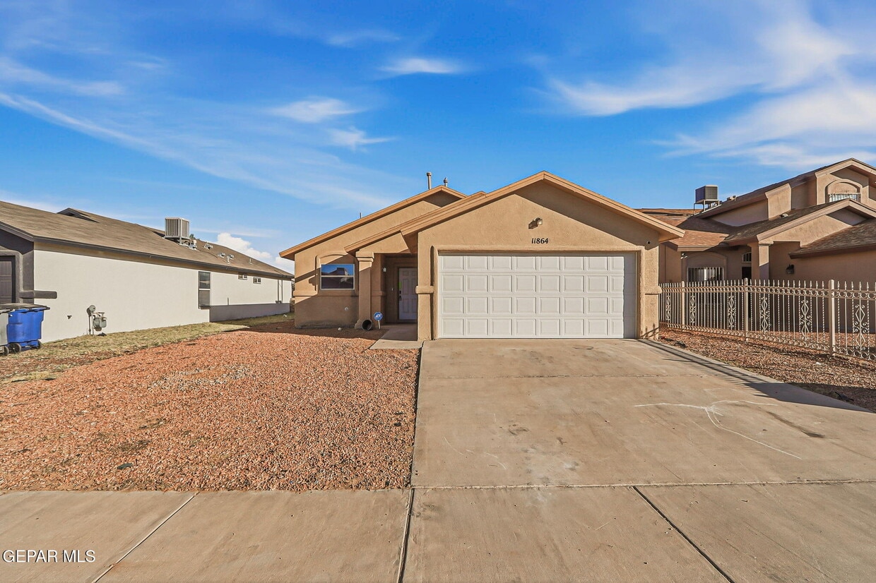
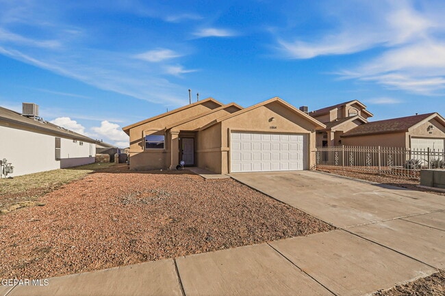
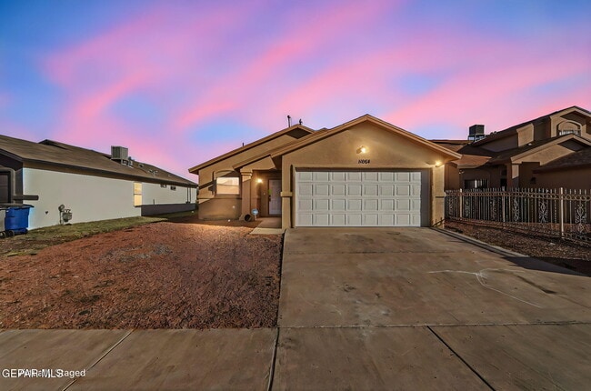
11864 Mesquite Rock Dr
El Paso, TX 79934
Today
|
Edit
Favorites
915-259-2532
-
Bedrooms
3
-
Bathrooms
2
-
Square Feet
1,210 sq ft
-
Available
Available Now
Highlights
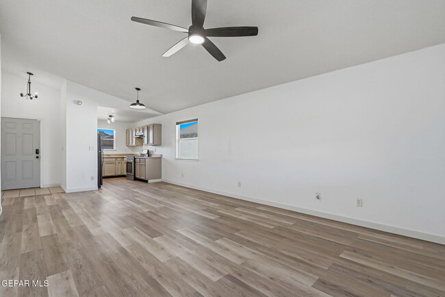
- Utility Closet
- Attached Garage
- Evaporated cooling system
- Tile Flooring
- 1-Story Property
- Ceiling Fan
11864 Mesquite Rock Dr

Favorites
About This Home
Available Now
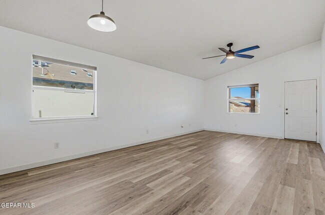
Beautiful 3-bedroom,2-bathroom rental home featuring a very large open floor plan and a completely landscaped backyard. Conveniently located near Fort Bliss,this home offers a spacious layout perfect for comfortable living and entertaining. The backyard provides a great space to relax and enjoy the outdoors. Must see rental opportunity.
11864 Mesquite Rock Dr is a house located in El Paso County and the 79934 ZIP Code. This area is served by the Ysleta Independent School District attendance zone.
* Price shown is base rent. Excludes user-selected optional fees and variable or usage-based fees and required charges due at or prior to move-in or at move-out. Price, availability, fees, and any applicable rent special are subject to change without notice.
* Square footage definitions vary. Displayed square footage is approximate.
Home Details
Home Type
Single Family Detached Home
Year Built
Built in 2007
Bedrooms and Bathrooms
2 Full Bathrooms
3 Bedrooms
Flooring
Tile
Vinyl
Interior Spaces
Utility Closet
1-Story Property
Ceiling Fan
1,210 Sq Ft Home
Kitchen
Free-Standing Gas Oven
Listing and Financial Details
Property Available on 3/19/26
Assessor Parcel Number M39599900500400
Tenant pays for all utilities
Parking
Attached Garage
Schools
Desertaire Elementary School
Parkland Middle School
Parkland High School
Utilities
Evaporated cooling system
Heating System Uses Natural Gas
Community Details
Overview
No Home Owners Association
Mesquite Hills Subdivision
Pet Policy
No Pets Allowed
Contact
- Listed by Kevin LaPlante | Bliss Home Realty & Relocation Group
- Phone Number
- Contact
-
Source
 Greater El Paso Association of Realtors
Copyright © 2026 Greater El Paso Association of Realtors. All rights reserved. All information provided by the listing agent/broker is deemed reliable but is not guaranteed and should be independently verified.
Location
Get Directions
North of Fort Bliss and east of Franklin Mountains State Park, Northeast El Paso is a region of the city that didn’t see much development until the 1950s and 1960s. Today, it’s a diverse suburban community with fantastic convenience to the sprawling state parks to the west, and Downtown El Paso and Fort Bliss to the south.
Houses in Northeast El Paso display the classic characteristics of a tan exterior and tile roof, some with Pueblo-style influence. Apartment communities come laden with features, many with pools. Regardless of your rental situation, you can enjoy all that this border city has to offer by enjoying the views at North Franklin Mountain, or by enjoying the local cuisine in the city center. There’s plenty of highways that serve Northeast El Paso, and I-10 in the west makes a longer trip easy.
Learn more about living in Northeast El Paso
Amenities
- Ceiling Fans
- Refrigerator
- Tile Floors
- Vinyl Flooring
Education
| Colleges & Universities | Distance | ||
|---|---|---|---|
| Colleges & Universities | Distance | ||
| Drive: | 15 min | 9.2 mi | |
| Drive: | 29 min | 18.1 mi | |
| Drive: | 30 min | 20.1 mi | |
| Drive: | 31 min | 21.2 mi |
11864 Mesquite Rock Dr is within 15 minutes or 9.2 miles from El Paso C.C., Transmountain. It is also near UT El Paso and El Paso C.C., Valle Verde.
Schools

Public High School
Grades 9-12
Nearby
School data provided by
 The GreatSchools Rating helps parents compare schools within a state based on a variety of school quality indicators and provides a helpful picture of how effectively each school serves all of its students. Ratings are on a scale of 1 (below average) to 10 (above average) and can include test scores, college readiness, academic progress, advanced courses, equity, discipline and attendance data. We also advise parents to visit schools, consider other information on school performance and programs, and consider family needs as part of the school selection process.
View GreatSchools Rating Methodology
Data provided by GreatSchools.org © 2026. All rights reserved.
View GreatSchools Rating Methodology
Data provided by GreatSchools.org © 2026. All rights reserved.
Getting Around
 What do Walkability, Transit, Drivability, and Bikeability mean?
Walkability measures the walking distance to day-to-day needs.
Transit measures access to public transportation.
Drivability measures congestion, parking availability, and access to major roads.
Bikeability measures the suitability for cycling.
How It Works
What do Walkability, Transit, Drivability, and Bikeability mean?
Walkability measures the walking distance to day-to-day needs.
Transit measures access to public transportation.
Drivability measures congestion, parking availability, and access to major roads.
Bikeability measures the suitability for cycling.
How It Works
Not Walkable
Walkability
10
/ 100
Limited Public Transit
Transit
30
/ 100
Exceptionally Drivable
Drivability
90
/ 100
Somewhat Bikeable
Bikeability
30
/ 100
Scores provided by
-
Soundscore™
-
/ 100
Traffic
-Airport
-Businesses
-Scores provided by
HowLoud What is a Sound Score Rating? A Sound Score Rating aggregates noise caused by vehicle traffic, airplane traffic and local sources. How It WorksYou May Also Like
Similar Rentals Nearby


What Are Walk Score®, Transit Score®, and Bike Score® Ratings?
Walk Score® measures the walkability of any address. Transit Score® measures access to public transit. Bike Score® measures the bikeability of any address.
What is a Sound Score Rating?
A Sound Score Rating aggregates noise caused by vehicle traffic, airplane traffic and local sources.

11864 Mesquite Rock Dr
El Paso, TX 79934