
$1,575
/ Month
118 Belmont St Unit 2S
Manchester, NH 03103
Favorites
603-315-3060
-
Bedrooms
1
-
Bathrooms
1
-
Square Feet
800 sq ft
-
Available
Available Now
Highlights
- Bonus Room
- Combination Dining and Living Room
118 Belmont St Unit 2S

Favorites
About This Home
Available Now
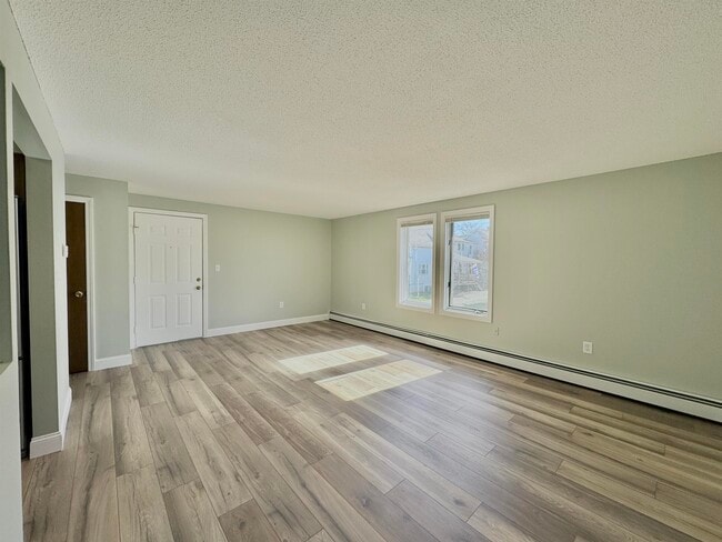
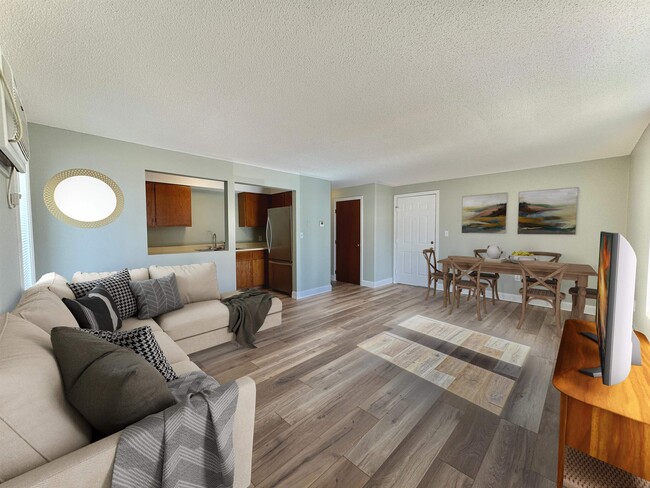
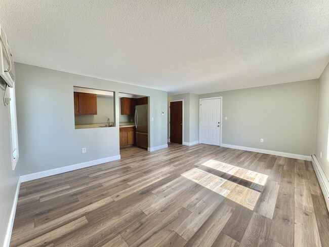
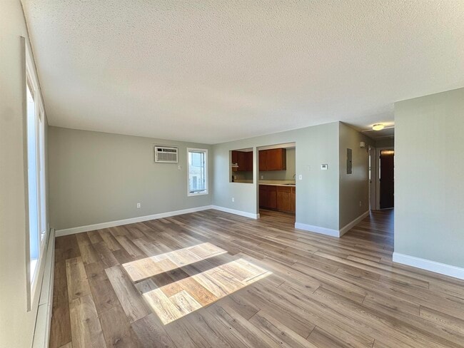
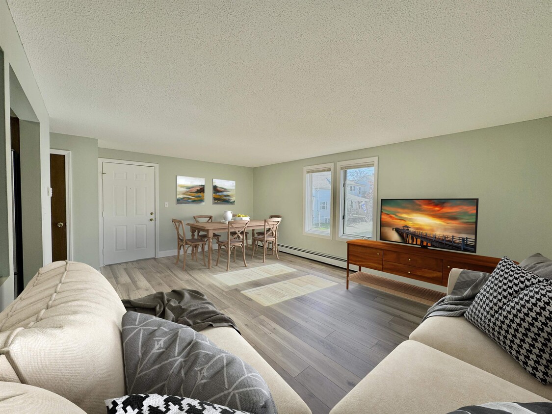
This bright and freshly updated 1-bedroom apartment with approximately 800 square feet of open-concept living, features fresh paint, brand-new flooring, and modern stainless steel appliances. A built-in wall A/C unit to help keep the space comfortable year-round. The shared coin-operated washer and dryer adds everyday convenience. Off-street parking included. Enjoy a small outdoor sitting area, perfect for relaxing with your morning coffee or unwinding after a long day.! The unit directly below will be available June 1st as well. Come check it out! -No Pets, utilities not included- MLS# 5089480
118 Belmont St is an apartment community located in Hillsborough County and the 03103 ZIP Code.
* Price shown is base rent. Excludes user-selected optional fees and variable or usage-based fees and required charges due at or prior to move-in or at move-out. Price, availability, fees, and any applicable rent special are subject to change without notice.
* Square footage definitions vary. Displayed square footage is approximate.
Home Details
Year Built
Built in 1985
Bedrooms and Bathrooms
1 Full Bathroom
1 Bedroom
Home Design
Multi-Family
Fixer Upper
Interior Spaces
Bonus Room
Combination Dining and Living Room
800 Sq Ft Home
Property has 2 Levels
Listing and Financial Details
Residential Lease
Location
City Lot
Parking
Off-Street Parking
Driveway
Paved Parking
Utilities
Cable TV Available
100 Amp Service
Heating System Uses Natural Gas
Cooling System Mounted In Outer Wall Opening
Community Details
Contact
- Listed by Amelia Paraskos | Coldwell Banker Realty Bedford NH
- Phone Number
- Contact
-
Source
 Prime MLS
Copyright 2026 PrimeMLS, Inc. All rights reserved. This information is deemed reliable, but not guaranteed. The data relating to real estate displayed on this display comes in part from the IDX Program of PrimeMLS. The information being provided is for consumers’ personal, noncommercial use and may not be used for any purpose other than to identify. prospective properties consumers may be interested in purchasing.
Location
Get Directions
Somerville is a residential neighborhood with several markets, cafes, and parks. The two parks in town, Prout Park and Howe Park, provide opportunities for all kinds of outdoor recreation. Local Pigeon’s Supermarket has been a neighborhood fixture since the 1920s.
With close proximity to Downtown Manchester and its many museums, parks, and restaurants, Somerville has access to all of the city’s amenities while maintaining a close community.
Somerville is accessible to I-93 and I-293 as well as Manchester-Boston Regional Airport, making travels and commutes simple.
Learn more about living in Somerville
Education
| Colleges & Universities | Distance | ||
|---|---|---|---|
| Colleges & Universities | Distance | ||
| Drive: | 5 min | 2.3 mi | |
| Drive: | 9 min | 4.0 mi | |
| Drive: | 12 min | 5.4 mi | |
| Drive: | 31 min | 21.9 mi |
118 Belmont St Unit 2S is within 5 minutes or 2.3 miles from MCPHS University, Manchester. It is also near Saint Anselm College and Southern New Hampshire Univ..
Getting Around
 What do Walkability, Transit, Drivability, and Bikeability mean?
Walkability measures the walking distance to day-to-day needs.
Transit measures access to public transportation.
Drivability measures congestion, parking availability, and access to major roads.
Bikeability measures the suitability for cycling.
How It Works
What do Walkability, Transit, Drivability, and Bikeability mean?
Walkability measures the walking distance to day-to-day needs.
Transit measures access to public transportation.
Drivability measures congestion, parking availability, and access to major roads.
Bikeability measures the suitability for cycling.
How It Works
Moderately Walkable
Walkability
70
/ 100
Limited Public Transit
Transit
30
/ 100
Moderately Drivable
Drivability
60
/ 100
Fairly Bikeable
Bikeability
40
/ 100
Scores provided by
-
Soundscore™
-
/ 100
Traffic
-Airport
-Businesses
-Scores provided by
HowLoud What is a Sound Score Rating? A Sound Score Rating aggregates noise caused by vehicle traffic, airplane traffic and local sources. How It WorksYou May Also Like
Similar Rentals Nearby


What Are Walk Score®, Transit Score®, and Bike Score® Ratings?
Walk Score® measures the walkability of any address. Transit Score® measures access to public transit. Bike Score® measures the bikeability of any address.
What is a Sound Score Rating?
A Sound Score Rating aggregates noise caused by vehicle traffic, airplane traffic and local sources.
118 Belmont St
Manchester, NH 03103