
$3,100
/ Month
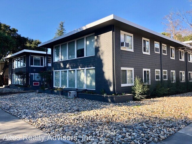
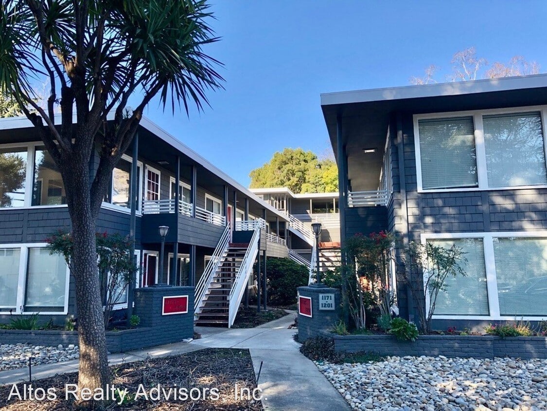
1171-1201 Noel Dr
Menlo Park, CA 94025
2 Weeks Ago
|
Edit
Favorites
1171-1201 Noel Dr

Favorites
Check Back Soon for Upcoming Availability
| Beds | Baths | Average SF |
|---|---|---|
| 2 Bedrooms 2 Bedrooms 2 Br | 1 Bath 1 Bath 1 Ba | 950 SF |
Fees and Policies
The fees listed below are community-provided and may exclude utilities or add-ons. All payments are made directly to the property and are non-refundable unless otherwise specified.
About This Property
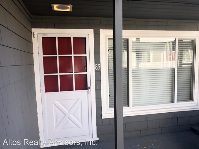
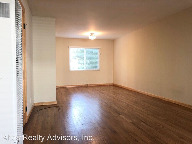
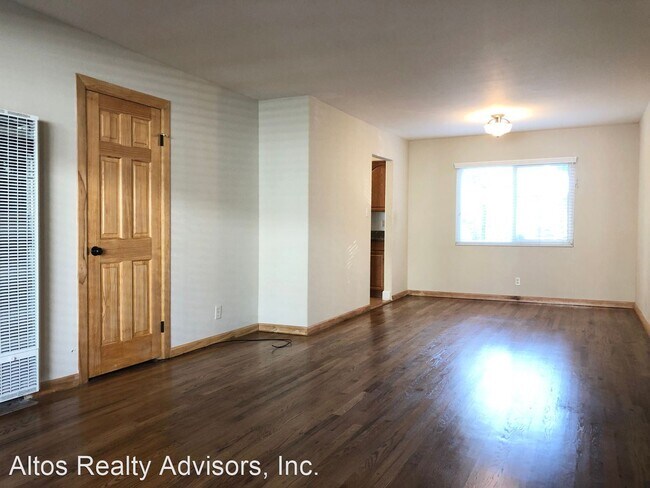
(408) 720-0920 x101 - Updated 2 Bed 1 Bath - Downtown Menlo Park - Updated 2 bed 1 bath unit featuring around 950 square feet of living space in a well-maintained 16-unit building. Remodeled kitchen with gas range, garbage disposal, and dishwasher. Large living area with wood floors. Tons of closet space. Updated bathroom with stall shower. Incredible location- at the corner of Noel Drive and Laurel Street. A couple blocks to downtown Menlo Park. Shopping, restaurants and the Menlo Park CalTrain station all walking distance. Quick access to El Camino Real and Alma. Parking -One Assigned Uncovered Parking Spot Pets -None Laundry -Common Laundry Room HVAC -Wall Heater -No Air Conditioning Utilities -Water & Garbage Included -Tenant Pays Other Utilities If this doesn’t quite meet your needs, check out our other available properties at www.goaltos.com or give us a call at 408-720-0920. No Pets Allowed (RLNE5031712) Pet policies: No Dogs Allowed, No Cats Allowed.
1171-1201 Noel Dr is an apartment community located in San Mateo County and the 94025 ZIP Code.
Unique Features
- No Dogs Allowed, No Cats Allowed
1171-1201 Noel Dr,
Menlo Park,
CA
94025
Minutes north of the Stanford University campus and just a couple blocks from the 101, Lindenwood is a charming suburban community offering something for all walks of life. The local division of the Palo Alto VA Hospital sits just a few blocks east of the neighborhood, making it a highly convenient location for healthcare professional.
Trees and greenery surround you everywhere in the neighborhood, particularly in public recreation areas like Flood Park and Holbrook-Palmer Park, which feature networks of trails that are perfect for jogging or just a leisurely stroll through the foliage. Numerous public and private schools can be found throughout the community and just beyond, giving students the option to walk to class easily.
In addition to the local bus system, rail service from Menlo Park Station makes it easy to get to work without a personal vehicle – be sure to grab a cup of coffee at Café Borrone before you catch your train.
Learn more about living in LindenwoodBelow are rent ranges for similar nearby apartments
Amenities
- No Dogs Allowed, No Cats Allowed
Education
| Colleges & Universities | Distance | ||
|---|---|---|---|
| Colleges & Universities | Distance | ||
| Walk: | 17 min | 0.9 mi | |
| Drive: | 9 min | 3.5 mi | |
| Drive: | 17 min | 7.1 mi | |
| Drive: | 15 min | 7.6 mi |
1171-1201 Noel Dr is within 17 minutes or 0.9 mile from Menlo College. It is also near Stanford University and Foothill College, Middlefield.
Transportation options available in Menlo Park include Bayshore Nasa Station, located 9.9 miles from 1171-1201 Noel Dr. 1171-1201 Noel Dr is near Norman Y Mineta San Jose International, located 17.5 miles or 26 minutes away, and San Francisco International, located 18.9 miles or 27 minutes away.
| Transit / Subway | Distance | ||
|---|---|---|---|
| Transit / Subway | Distance | ||
| Drive: | 16 min | 9.9 mi | |
| Drive: | 16 min | 10.3 mi | |
|
|
Drive: | 17 min | 10.5 mi |
|
|
Drive: | 17 min | 10.5 mi |
| Drive: | 17 min | 10.8 mi |
| Commuter Rail | Distance | ||
|---|---|---|---|
| Commuter Rail | Distance | ||
| Walk: | 4 min | 0.3 mi | |
| Drive: | 4 min | 1.6 mi | |
| Drive: | 8 min | 3.4 mi | |
| Drive: | 9 min | 3.8 mi | |
| Drive: | 15 min | 6.2 mi |
| Airports | Distance | ||
|---|---|---|---|
| Airports | Distance | ||
|
Norman Y Mineta San Jose International
|
Drive: | 26 min | 17.5 mi |
|
San Francisco International
|
Drive: | 27 min | 18.9 mi |
Walkability Near 1171-1201 Noel Dr Menlo Park, CA 94025
Getting Around
 What do Walkability, Transit, Drivability, and Bikeability mean?
Walkability measures the walking distance to day-to-day needs.
Transit measures access to public transportation.
Drivability measures congestion, parking availability, and access to major roads.
Bikeability measures the suitability for cycling.
How It Works
What do Walkability, Transit, Drivability, and Bikeability mean?
Walkability measures the walking distance to day-to-day needs.
Transit measures access to public transportation.
Drivability measures congestion, parking availability, and access to major roads.
Bikeability measures the suitability for cycling.
How It Works
Moderately Walkable
Walkability
70
/ 100
Good Public Transit
Transit
60
/ 100
Very Drivable
Drivability
80
/ 100
Very Bikeable
Bikeability
80
/ 100
Scores provided by
Active
Soundscore™
71
/ 100
Traffic
BusyAirport
CalmBusinesses
ActiveScores provided by
HowLoud What is a Sound Score Rating? A Sound Score Rating aggregates noise caused by vehicle traffic, airplane traffic and local sources. How It WorksTime and distance from 1171-1201 Noel Dr.
| Shopping Centers | Distance | ||
|---|---|---|---|
| Shopping Centers | Distance | ||
| Walk: | 8 min | 0.5 mi | |
| Walk: | 9 min | 0.5 mi | |
| Walk: | 9 min | 0.5 mi |
1171-1201 Noel Dr has 3 shopping centers within 0.5 mile, which is about a 9-minute walk. The miles and minutes will be for the farthest away property.
| Parks and Recreation | Distance | ||
|---|---|---|---|
| Parks and Recreation | Distance | ||
|
Burgess Park
|
Walk: | 10 min | 0.5 mi |
|
Fremont Park
|
Walk: | 13 min | 0.7 mi |
|
El Palo Alto Park
|
Walk: | 19 min | 1.0 mi |
|
Jack W. Lyle Park
|
Drive: | 3 min | 1.2 mi |
|
Holbrook-Palmer Park
|
Drive: | 4 min | 1.5 mi |
1171-1201 Noel Dr has 5 parks within 1.5 miles, including Burgess Park, Fremont Park, and El Palo Alto Park.
| Hospitals | Distance | ||
|---|---|---|---|
| Hospitals | Distance | ||
| Drive: | 6 min | 2.1 mi | |
| Drive: | 6 min | 2.5 mi | |
| Drive: | 9 min | 3.9 mi |
1171-1201 Noel Dr has 3 hospitals within 3.9 miles, the nearest is Lucile Salter Packard Children's Hospital at Stanford which is 2.1 miles away and a 6 minute drive.
| Military Bases | Distance | ||
|---|---|---|---|
| Military Bases | Distance | ||
| Drive: | 19 min | 10.4 mi |
1171-1201 Noel Dr is 10.4 miles and a 19 minute drive from Ames Research Center.
You May Also Like
Similar Rentals Nearby
-
-
-
-
-
-
-
-
2 Beds$4,561+Total Monthly PriceTotal Monthly Price NewPrices include base rent and required monthly fees of $8. Variable costs based on usage may apply.Base Rent:2 Beds$4,553+2 Months Free
Fitness Center Pool In Unit Washer & Dryer High-Speed Internet Stainless Steel Appliances Package Service
-
-


What Are Walk Score®, Transit Score®, and Bike Score® Ratings?
Walk Score® measures the walkability of any address. Transit Score® measures access to public transit. Bike Score® measures the bikeability of any address.
What is a Sound Score Rating?
A Sound Score Rating aggregates noise caused by vehicle traffic, airplane traffic and local sources.
1171-1201 Noel Dr
Menlo Park, CA 94025