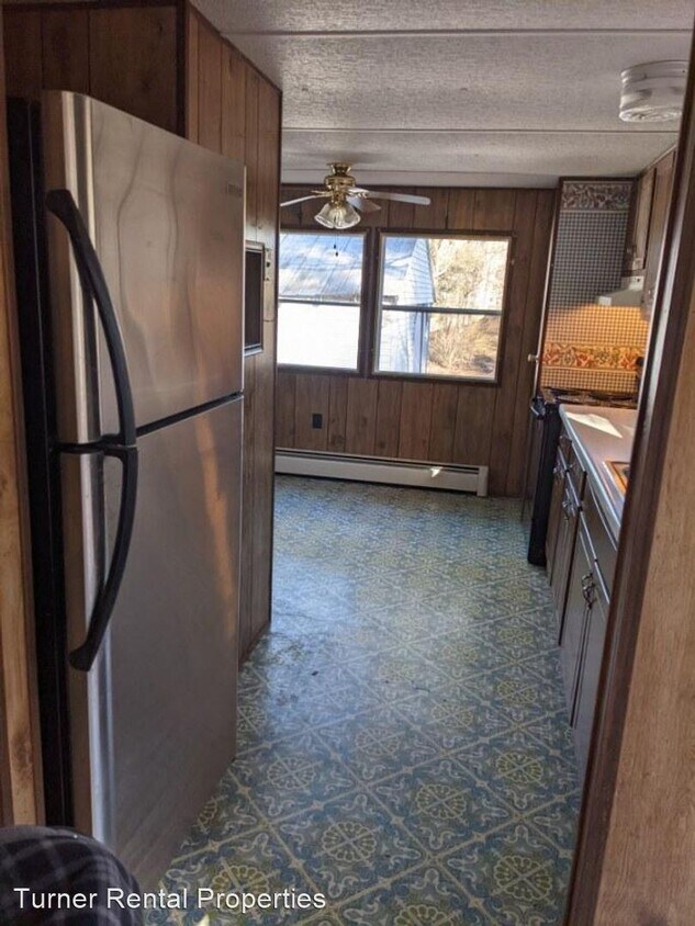
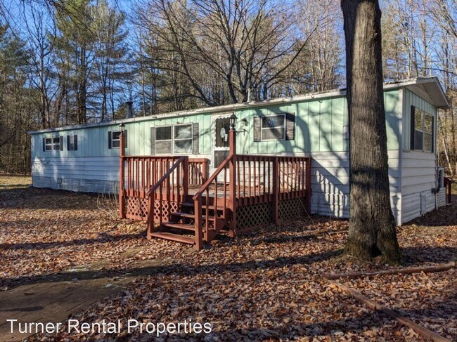
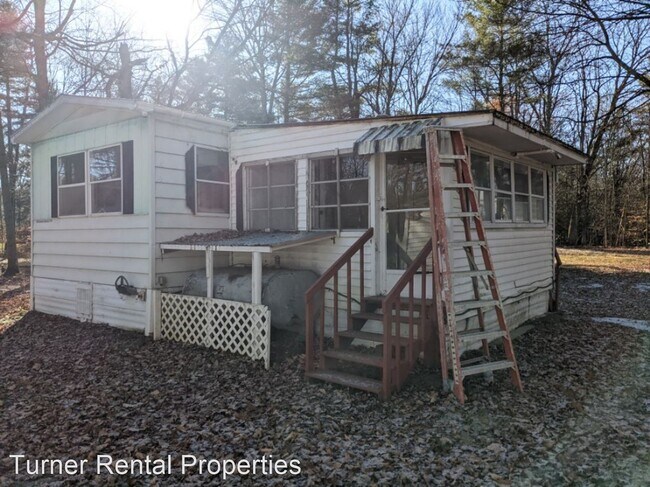
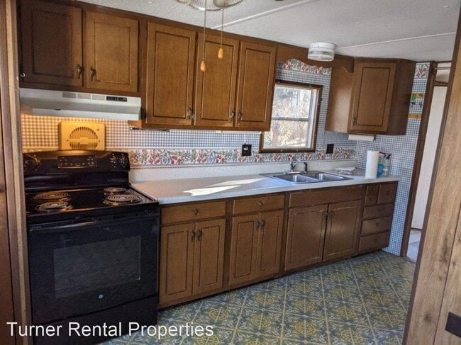
$1,400 / Month

117 Poor Farm Rd

,

Milton, VT 05468

2 Weeks Ago
| Edit

Under 30 minutes

Commute Time is calculated at rush hour.
Share Listing
Favorites
117 Poor Farm Rd
Share Listing
Favorites

Check Back Soon for Upcoming Availability

Beds Baths Average SF
2 Bedrooms 2 Bedrooms 2 Br 1 Bath 1 Bath 1 Ba

Fees and Policies

The fees listed below are community-provided and may exclude utilities or add-ons. All payments are made directly to the property and are non-refundable unless otherwise specified.

About This Property

(802) 893-0680 - 2 Bedroom in Private Location with Detached Garage - Mobile home with detached garage in ideal Milton location. The unit has new appliances and brand new luxury vinyl plank flooring. You can find a rental application at www.TurnerRentalProperties.com Emails only. No phone calls please. No Dogs Allowed (RLNE7394762) Pet policies: Cats Allowed, No Dogs Allowed.

117 Poor Farm Rd is a house located in Chittenden County and the 05468 ZIP Code. This area is served by the Milton School District attendance zone.

Unique Features

  • No Dogs Allowed
Location
117 Poor Farm Rd, Milton,
VT 05468
Get Directions
City - Milton

Situated about 16 miles north of Burlington in Chittenden County, Milton occupies a stretch of northwestern Vermont where the Lamoille River winds through farmland and the shoreline of Lake Champlain anchors the town's western edge. It carries the feel of a small New England community that has held onto its rural character while staying well connected to a larger regional economy. Quick access to Interstate 89 puts Burlington's employment base, healthcare institutions, and the University of Vermont within a short commute, making Milton a practical choice for those who want space without sacrificing proximity to a city. The town center offers everyday essentials, and Sand Bar State Park along with Niquette Bay State Park draw residents outdoors across all four seasons. Housing here leans toward single-family homes and smaller apartment communities rather than high-rises, reflecting the town's modest scale and low density across its 61 square miles.

Learn more about living in Milton 
Amenities
  • No Dogs Allowed
Education
Colleges & Universities Distance
Drive: 27 min 16.4 mi
Drive: 27 min 17.6 mi
Drive: 28 min 18.1 mi
Drive: 61 min 29.2 mi
117 Poor Farm Rd is within 27 minutes or 16.4 miles from Saint Michael's College. It is also near University of Vermont and Champlain College.
Schools
Public Elementary & Middle School
Grades K-8
389 Students
Attendance Zone
Public Elementary School
Grades PK-5
631 Students
Attendance Zone
Public High School
Grades 9-12
439 Students
Attendance Zone
Private Elementary & Middle School
Grades PK-8
Nearby
Private Elementary, Middle & High School
Grades K-12
16 Students
Nearby
Transportation

117 Poor Farm Rd is near Patrick Leahy Burlington International, located 18.0 miles or 34 minutes away, and Plattsburgh International, located 31.6 miles or 65 minutes away.

Commuter Rail Distance
Drive: 21 min 13.7 mi
Drive: 27 min 15.5 mi
Drive: 30 min 18.7 mi
Plattsburgh Amtrak Station
Drive: 60 min 28.8 mi
Drive: 50 min 40.1 mi
Airports Distance
Airports Distance
Patrick Leahy Burlington International
Drive: 34 min 18.0 mi
Plattsburgh International
Drive: 65 min 31.6 mi

Walkability Near 117 Poor Farm Rd Milton, VT 05468

Getting Around
Not Walkable
Walkability
10 / 100
Minimal Public Transit
Transit
0 / 100
Exceptionally Drivable
Drivability
90 / 100
Somewhat Bikeable
Bikeability
30 / 100

Scores provided by

What do Walkability, Transit, Drivability, and Bikeability mean? Walkability measures the walking distance to day-to-day needs. Transit measures access to public transportation. Drivability measures congestion, parking availability, and access to major roads. Bikeability measures the suitability for cycling. How It Works
-
Soundscore
- / 100

Traffic

-

Airport

-

Businesses

-

Scores provided by

HowLoud What is a Sound Score Rating? A Sound Score Rating aggregates noise caused by vehicle traffic, airplane traffic and local sources. How It Works
Points of Interest

Time and distance from 117 Poor Farm Rd.

Shopping Centers Distance
Drive: 7 min 3.1 mi
Drive: 18 min 10.4 mi
Drive: 26 min 15.0 mi
117 Poor Farm Rd has 3 shopping centers within 15.0 miles, which is about a 26-minute drive. The miles and minutes will be for the farthest away property.
Parks and Recreation Distance
Niquette Bay State Park
Drive: 16 min 8.9 mi
Sand Bar State Park
Drive: 20 min 12.5 mi
Kill Kare State Park
Drive: 33 min 19.9 mi
Burton Island State Park
Drive: 35 min 20.3 mi
Grand Isle State Park on Lake Champlain
Drive: 33 min 20.4 mi
117 Poor Farm Rd has 5 parks within 20.4 miles, including Niquette Bay State Park, Sand Bar State Park, and Kill Kare State Park.
Military Bases Distance
Drive: 66 min 31.8 mi
117 Poor Farm Rd is 31.8 miles and a 66 minute drive from Plattsburgh Air Force Base.

You May Also Like

Similar Rentals Nearby