
11640 Menlo Ave
11640 Menlo Ave,
Hawthorne,
CA
90250
-
Monthly Rent
$1,845
-
Bedrooms
1 bd
-
Bathrooms
1 ba
-
Square Feet
650 sq ft

Welcome home to 11640 Menlo. The property is located near LAX Airport with easy access to the 105, 110 & 405 freeways. Call today to schedule your tour and learn more!
Pricing & Floor Plans
Fees and Policies
The fees listed below are community-provided and may exclude utilities or add-ons. All payments are made directly to the property and are non-refundable unless otherwise specified.
-
One-Time Basics
-
Amenity Fee$0
-
Application Fee Per Applicant$0
-
Other$0
-
-
CoveredParking Available
Property Fee Disclaimer: Based on community-supplied data and independent market research. Subject to change without notice. May exclude fees for mandatory or optional services and usage-based utilities.
Details
Property Information
-
Built in 1986
-
7 units/2 stories
About 11640 Menlo Ave Hawthorne, CA 90250
Welcome home to 11640 Menlo. The property is located near LAX Airport with easy access to the 105, 110 & 405 freeways. Call today to schedule your tour and learn more!
11640 Menlo Ave is an apartment community located in Los Angeles County and the 90250 ZIP Code. This area is served by the Hawthorne attendance zone.
Contact
Apartment Features
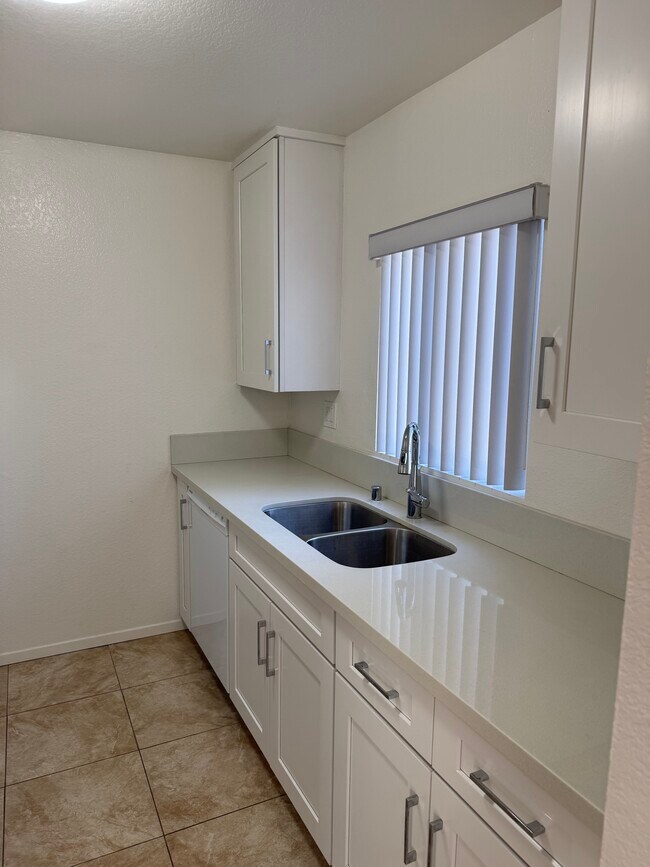
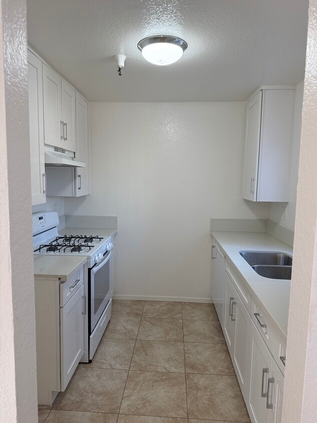
Dishwasher
High Speed Internet Access
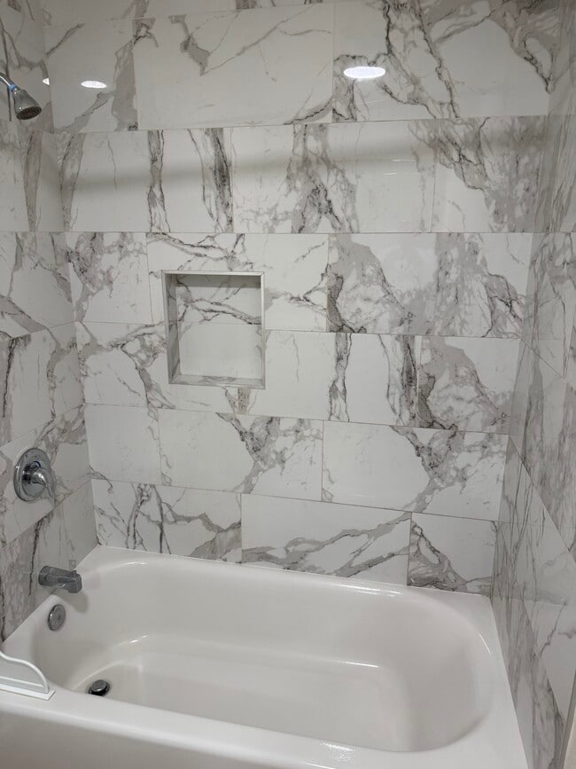
Tile Floors
Security System
- High Speed Internet Access
- Smoke Free
- Security System
- Dishwasher
- Oven
- Range
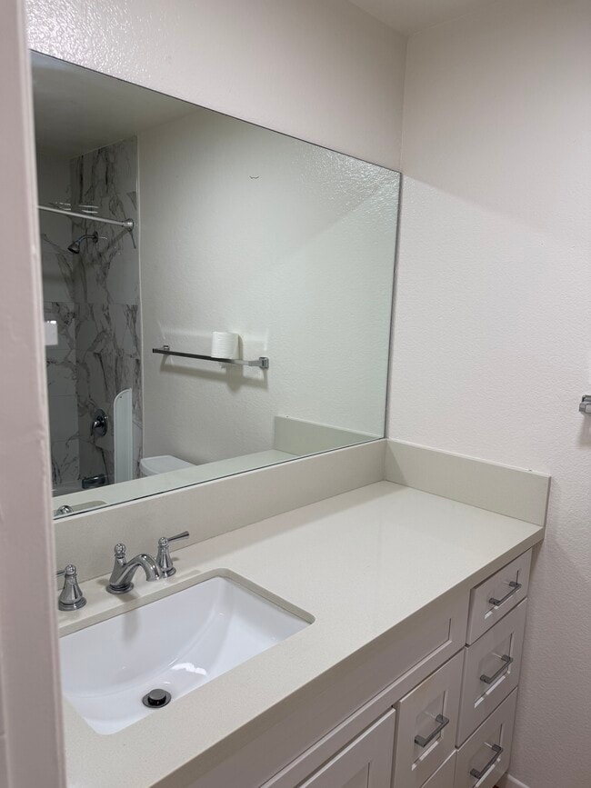
- Quartz Countertops
- Carpet
- Tile Floors
- Balcony
South Bay is a sprawling region of the Los Angeles metropolitan area in the southwest corner of the county. Spread across the city of Torrance, South Bay sits just off the coast, where you’ll find beautiful beaches and waterfront cities like Redondo Beach, Hermosa Beach, Manhattan Beach, and Long Beach. Abundant shopping opportunities are available in this sector of LA, including the South Bay Galleria, Del Amo Fashion Center, and Torrance Promenade. Residents of South Bay can easily commute into Santa Monica, Inglewood, or Downtown Los Angeles for work or leisure. Locals enjoy being so close to the coast, where they can enjoy the great outdoors by swimming, fishing, boating, and more.
Learn more about living in South Bay- High Speed Internet Access
- Smoke Free
- Security System
- Dishwasher
- Oven
- Range
- Quartz Countertops
- Carpet
- Tile Floors
- Balcony
| Monday | 12am - 12am |
|---|---|
| Tuesday | 12am - 12am |
| Wednesday | 12am - 12am |
| Thursday | 12am - 12am |
| Friday | 12am - 12am |
| Saturday | 12am - 12am |
| Sunday | 12am - 12am |
| Colleges & Universities | Distance | ||
|---|---|---|---|
| Colleges & Universities | Distance | ||
| Drive: | 7 min | 2.7 mi | |
| Drive: | 9 min | 4.7 mi | |
| Drive: | 10 min | 6.2 mi | |
| Drive: | 12 min | 7.3 mi |


View GreatSchools Rating Methodology
Data provided by GreatSchools.org © 2026. All rights reserved.
Transportation options available in Hawthorne include Crenshaw Station, located 1.6 miles from 11640 Menlo Ave. 11640 Menlo Ave is near Los Angeles International, located 5.3 miles or 10 minutes away, and Long Beach (Daugherty Field), located 16.7 miles or 24 minutes away.
| Transit / Subway | Distance | ||
|---|---|---|---|
| Transit / Subway | Distance | ||
|
|
Drive: | 3 min | 1.6 mi |
| Drive: | 5 min | 2.1 mi | |
| Drive: | 5 min | 3.0 mi | |
|
|
Drive: | 7 min | 3.1 mi |
|
|
Drive: | 6 min | 3.2 mi |
| Commuter Rail | Distance | ||
|---|---|---|---|
| Commuter Rail | Distance | ||
|
|
Drive: | 21 min | 15.1 mi |
|
|
Drive: | 24 min | 15.3 mi |
|
|
Drive: | 26 min | 17.4 mi |
|
|
Drive: | 28 min | 18.8 mi |
| Drive: | 25 min | 19.2 mi |
| Airports | Distance | ||
|---|---|---|---|
| Airports | Distance | ||
|
Los Angeles International
|
Drive: | 10 min | 5.3 mi |
|
Long Beach (Daugherty Field)
|
Drive: | 24 min | 16.7 mi |
Time and distance from 11640 Menlo Ave.
| Shopping Centers | Distance | ||
|---|---|---|---|
| Shopping Centers | Distance | ||
| Walk: | 9 min | 0.5 mi | |
| Walk: | 17 min | 0.9 mi | |
| Walk: | 25 min | 1.3 mi |
| Parks and Recreation | Distance | ||
|---|---|---|---|
| Parks and Recreation | Distance | ||
|
Dockweiler State Beach
|
Drive: | 10 min | 6.4 mi |
|
Ballona Creek Trail - Ballona Wetlands Ecological Reserve Access
|
Drive: | 11 min | 7.1 mi |
|
Watts Towers-Rodia State Park
|
Drive: | 11 min | 7.4 mi |
|
Watts Senior Center & Rose Garden
|
Drive: | 11 min | 7.8 mi |
|
Kenneth Hahn State Recreation Area
|
Drive: | 16 min | 8.0 mi |
| Hospitals | Distance | ||
|---|---|---|---|
| Hospitals | Distance | ||
| Drive: | 4 min | 2.0 mi | |
| Drive: | 10 min | 6.3 mi | |
| Drive: | 10 min | 7.2 mi |
| Military Bases | Distance | ||
|---|---|---|---|
| Military Bases | Distance | ||
| Drive: | 6 min | 2.8 mi |
11640 Menlo Ave Photos
11640 Menlo Ave does not offer in-unit laundry or shared facilities. Please contact the property to learn about nearby laundry options.
Utilities are not included in rent. Residents should plan to set up and pay for all services separately.
Parking is available at 11640 Menlo Ave. Contact this property for details.
11640 Menlo Ave has one-bedroom apartments renting for $1,845/mo.
11640 Menlo Ave does not allow pets, though service animals are always welcome in accordance with applicable laws.
A good rule of thumb is to spend no more than 30% of your gross income on rent. Based on the lowest available rent of $1,845 for a one-bedroom, you would need to earn about $73,800 per year to qualify. Want to double-check your budget? Calculate how much rent you can afford with our Rent Affordability Calculator.
11640 Menlo Ave is not currently offering any rent specials. Check back soon, as promotions change frequently.
While 11640 Menlo Ave does not offer Matterport 3D tours, renters can request a tour directly through our online platform.
What Are Walk Score®, Transit Score®, and Bike Score® Ratings?
Walk Score® measures the walkability of any address. Transit Score® measures access to public transit. Bike Score® measures the bikeability of any address.
What is a Sound Score Rating?
A Sound Score Rating aggregates noise caused by vehicle traffic, airplane traffic and local sources
11640 Menlo Ave
Hawthorne, CA 90250
Property Manager Responded