
$950
Total Monthly Price
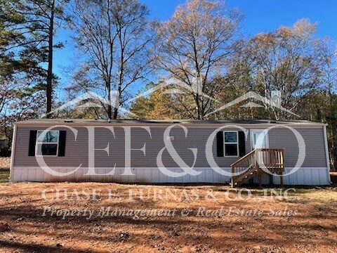
11508 Highway 56
Enoree, SC 29335
Favorites
11508 Highway 56

Favorites
Check Back Soon for Upcoming Availability
| Beds | Baths | Average SF |
|---|---|---|
| 2 Bedrooms 2 Bedrooms 2 Br | 1 Bath 1 Bath 1 Ba | 850 SF |
Fees and Policies
The fees listed below are community-provided and may exclude utilities or add-ons. All payments are made directly to the property and are non-refundable unless otherwise specified.
About This Property
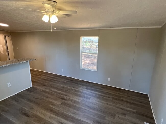
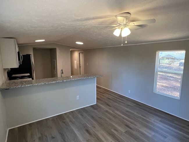
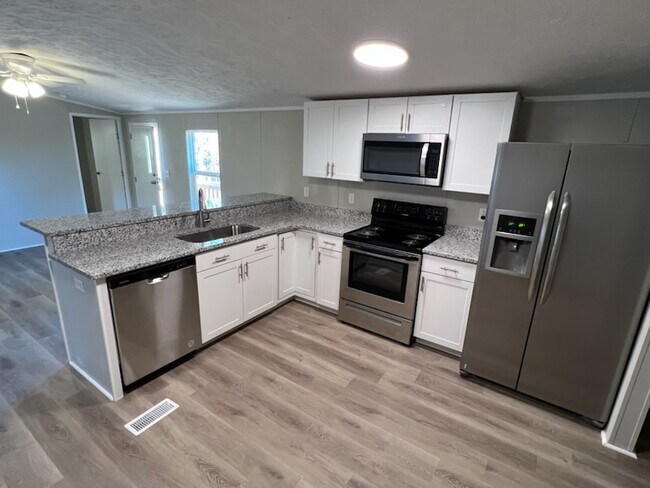
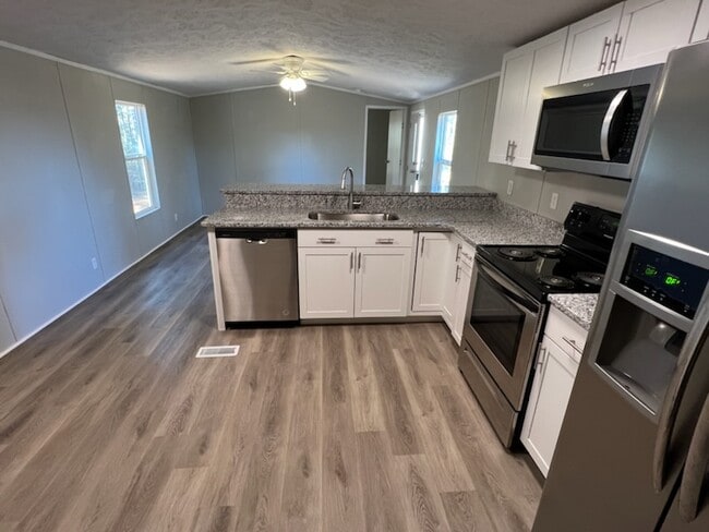
Single Family House in District 4 of Spartanburg, SC. Newly renovated 2015 building. 2 bedroom and 1 bathroom. Comes with a refrigerator, stove, dishwasher, and washer/dryer connections. New LVP flooring throughout. Garbage service provided! NO SMOKING/NO PETS ALLOWED! Visit Chase Furnas & Company's website to tour/apply under the "Available Rentals" tab.
11508 Highway 56 is a house located in Spartanburg County and the 29335 ZIP Code.
House Features
Dishwasher
Washer/Dryer Hookup
Refrigerator
Tub/Shower
- Washer/Dryer Hookup
- Heating
- Ceiling Fans
- Smoke Free
- Tub/Shower
- Dishwasher
- Refrigerator
11508 Highway 56,
Enoree,
SC
29335
Amenities
- Washer/Dryer Hookup
- Heating
- Ceiling Fans
- Smoke Free
- Tub/Shower
- Dishwasher
- Refrigerator
Education
| Colleges & Universities | Distance | ||
|---|---|---|---|
| Colleges & Universities | Distance | ||
| Drive: | 22 min | 15.5 mi | |
| Drive: | 40 min | 25.8 mi | |
| Drive: | 36 min | 25.9 mi | |
| Drive: | 40 min | 26.0 mi |
11508 Highway 56 is within 22 minutes or 15.5 miles from Presbyterian College. It is also near Converse College and Wofford College.
Walkability Near 11508 Highway 56 Enoree, SC 29335
Getting Around
 What do Walkability, Transit, Drivability, and Bikeability mean?
Walkability measures the walking distance to day-to-day needs.
Transit measures access to public transportation.
Drivability measures congestion, parking availability, and access to major roads.
Bikeability measures the suitability for cycling.
How It Works
What do Walkability, Transit, Drivability, and Bikeability mean?
Walkability measures the walking distance to day-to-day needs.
Transit measures access to public transportation.
Drivability measures congestion, parking availability, and access to major roads.
Bikeability measures the suitability for cycling.
How It Works
Not Walkable
Walkability
10
/ 100
Exceptionally Drivable
Drivability
100
/ 100
Not Bikeable
Bikeability
0
/ 100
Scores provided by
-
Soundscore™
-
/ 100
Traffic
-Airport
-Businesses
-Scores provided by
HowLoud What is a Sound Score Rating? A Sound Score Rating aggregates noise caused by vehicle traffic, airplane traffic and local sources. How It WorksYou May Also Like
Similar Rentals Nearby
-
-

-

-

-

-

-
 3 Beds$1,925Total Monthly PriceTotal Monthly Price NewPrices include all required monthly fees.House for Rent
 -

-
 3 Beds$1,990Total Monthly PriceTotal Monthly Price NewPrices include all required monthly fees.House for Rent
 -

What Are Walk Score®, Transit Score®, and Bike Score® Ratings?
Walk Score® measures the walkability of any address. Transit Score® measures access to public transit. Bike Score® measures the bikeability of any address.
What is a Sound Score Rating?
A Sound Score Rating aggregates noise caused by vehicle traffic, airplane traffic and local sources.

11508 Highway 56
Enoree, SC 29335