$4,388
/ Month
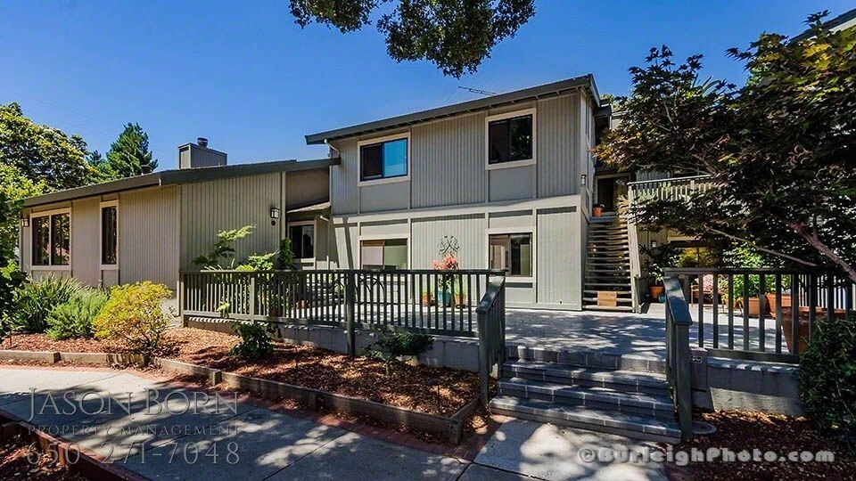
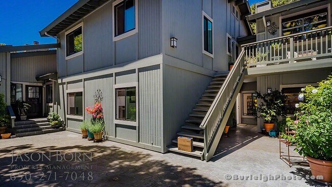
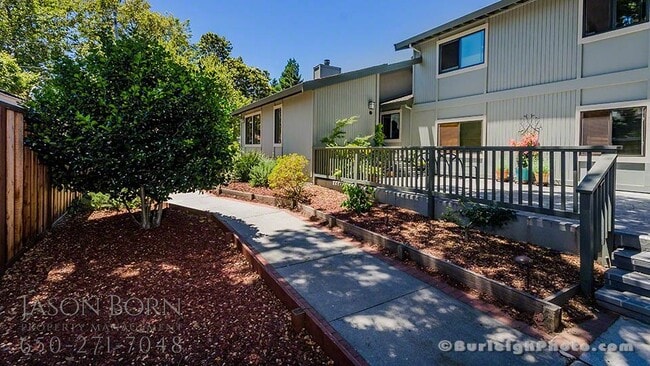
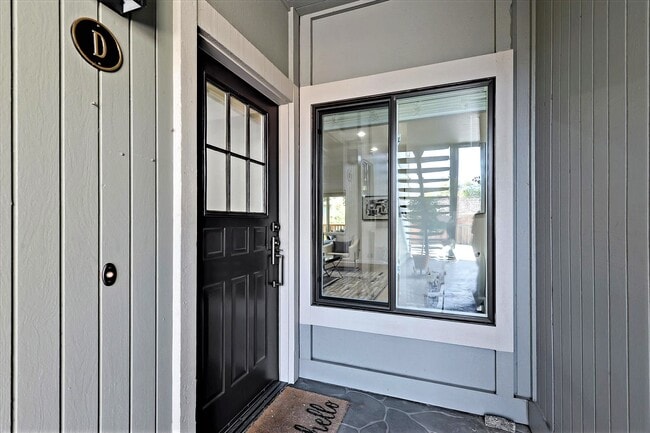
1150 Pine St
West Menlo Park, CA 94025
Favorites
650-271-7048
-
Bedrooms
2
-
Bathrooms
2
-
Square Feet
1,250 sq ft
-
Available
Available Now
1150 Pine St

Favorites
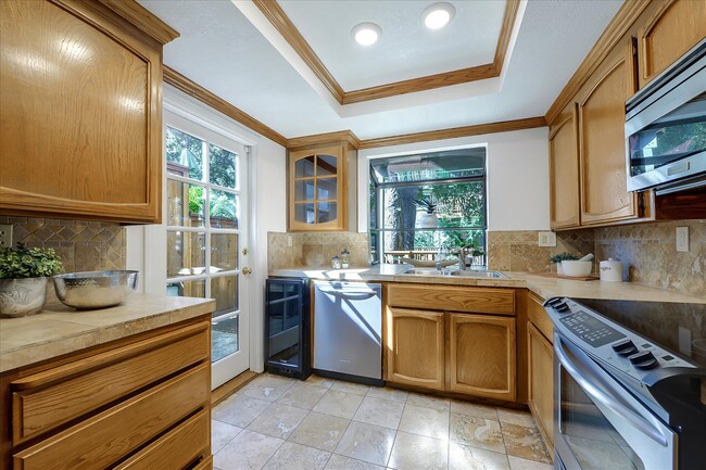
About This Home
Available Now
Schedule an Appointment online, please visit: See more Pics, please visit: CA License: 02002900
1150 Pine St is a townhome located in San Mateo County and the 94025 ZIP Code. This area is served by the Menlo Park City Elementary School District attendance zone.
* Price shown is base rent. Excludes user-selected optional fees and variable or usage-based fees and required charges due at or prior to move-in or at move-out. Price, availability, fees, and any applicable rent special are subject to change without notice.
* Square footage definitions vary. Displayed square footage is approximate.
Fees and Policies
The fees listed below are community-provided and may exclude utilities or add-ons. All payments are made directly to the property and are non-refundable unless otherwise specified.
-
One-Time Basics
-
Due at Move-In
-
Security Deposit - RefundableCharged per unit.$0
-
-
Due at Move-In
Property Fee Disclaimer: Based on community-supplied data and independent market research. Subject to change without notice. May exclude fees for mandatory or optional services and usage-based utilities.
Contact
- Listed by Jason Born
- Phone Number
- Contact
Location
Get Directions
Minutes north of the Stanford University campus and just a couple blocks from the 101, Lindenwood is a charming suburban community offering something for all walks of life. The local division of the Palo Alto VA Hospital sits just a few blocks east of the neighborhood, making it a highly convenient location for healthcare professional.
Trees and greenery surround you everywhere in the neighborhood, particularly in public recreation areas like Flood Park and Holbrook-Palmer Park, which feature networks of trails that are perfect for jogging or just a leisurely stroll through the foliage. Numerous public and private schools can be found throughout the community and just beyond, giving students the option to walk to class easily.
In addition to the local bus system, rail service from Menlo Park Station makes it easy to get to work without a personal vehicle – be sure to grab a cup of coffee at Café Borrone before you catch your train.
Learn more about living in Lindenwood
Education
| Colleges & Universities | Distance | ||
|---|---|---|---|
| Colleges & Universities | Distance | ||
| Drive: | 3 min | 1.2 mi | |
| Drive: | 10 min | 3.6 mi | |
| Drive: | 17 min | 7.2 mi | |
| Drive: | 15 min | 7.5 mi |
1150 Pine St is within 3 minutes or 1.2 miles from Menlo College. It is also near Stanford University and Foothill College, Middlefield.
Schools


Public Elementary School
Grades K-5
604 Students
Attendance Zone
Public Elementary School
Grades K-5
407 Students
Nearby
Public Middle School
Grades 6-8
846 Students
Attendance Zone
Public High School
Grades 9-12
2,158 Students
Attendance Zone
Private Elementary & Middle School
Grades K-8
183 Students
Nearby
Private Elementary & Middle School
Grades PK-8
261 Students
Nearby
Private Middle & High School
Grades 6-12
Nearby
School data provided by
 The GreatSchools Rating helps parents compare schools within a state based on a variety of school quality indicators and provides a helpful picture of how effectively each school serves all of its students. Ratings are on a scale of 1 (below average) to 10 (above average) and can include test scores, college readiness, academic progress, advanced courses, equity, discipline and attendance data. We also advise parents to visit schools, consider other information on school performance and programs, and consider family needs as part of the school selection process.
View GreatSchools Rating Methodology
Data provided by GreatSchools.org © 2026. All rights reserved.
View GreatSchools Rating Methodology
Data provided by GreatSchools.org © 2026. All rights reserved.
Transportation options available in West Menlo Park include Bayshore Nasa Station, located 9.8 miles from 1150 Pine St. 1150 Pine St is near Norman Y Mineta San Jose International, located 17.4 miles or 26 minutes away, and San Francisco International, located 18.8 miles or 27 minutes away.
| Transit / Subway | Distance | ||
|---|---|---|---|
| Transit / Subway | Distance | ||
| Drive: | 16 min | 9.8 mi | |
| Drive: | 16 min | 10.2 mi | |
|
|
Drive: | 17 min | 10.4 mi |
|
|
Drive: | 18 min | 10.5 mi |
| Drive: | 18 min | 10.8 mi |
| Commuter Rail | Distance | ||
|---|---|---|---|
| Commuter Rail | Distance | ||
| Walk: | 6 min | 0.3 mi | |
| Drive: | 4 min | 1.7 mi | |
| Drive: | 9 min | 3.4 mi | |
| Drive: | 9 min | 3.9 mi | |
| Drive: | 15 min | 6.2 mi |
| Airports | Distance | ||
|---|---|---|---|
| Airports | Distance | ||
|
Norman Y Mineta San Jose International
|
Drive: | 26 min | 17.4 mi |
|
San Francisco International
|
Drive: | 27 min | 18.8 mi |
Getting Around
 What do Walkability, Transit, Drivability, and Bikeability mean?
Walkability measures the walking distance to day-to-day needs.
Transit measures access to public transportation.
Drivability measures congestion, parking availability, and access to major roads.
Bikeability measures the suitability for cycling.
How It Works
What do Walkability, Transit, Drivability, and Bikeability mean?
Walkability measures the walking distance to day-to-day needs.
Transit measures access to public transportation.
Drivability measures congestion, parking availability, and access to major roads.
Bikeability measures the suitability for cycling.
How It Works
Moderately Walkable
Walkability
70
/ 100
Good Public Transit
Transit
60
/ 100
Moderately Drivable
Drivability
70
/ 100
Very Bikeable
Bikeability
80
/ 100
Scores provided by
-
Soundscore™
-
/ 100
Traffic
-Airport
-Businesses
-Scores provided by
HowLoud What is a Sound Score Rating? A Sound Score Rating aggregates noise caused by vehicle traffic, airplane traffic and local sources. How It WorksTime and distance from 1150 Pine St.
| Shopping Centers | Distance | ||
|---|---|---|---|
| Shopping Centers | Distance | ||
| Walk: | 10 min | 0.5 mi | |
| Walk: | 11 min | 0.6 mi | |
| Walk: | 11 min | 0.6 mi |
1150 Pine St has 3 shopping centers within 0.6 mile, which is about a 11-minute walk. The miles and minutes will be for the farthest away property.
| Parks and Recreation | Distance | ||
|---|---|---|---|
| Parks and Recreation | Distance | ||
|
Burgess Park
|
Walk: | 11 min | 0.6 mi |
|
Fremont Park
|
Walk: | 15 min | 0.8 mi |
|
Jack W. Lyle Park
|
Drive: | 3 min | 1.3 mi |
|
Seminary Oaks Park
|
Drive: | 4 min | 1.5 mi |
|
Holbrook-Palmer Park
|
Drive: | 4 min | 1.5 mi |
1150 Pine St has 5 parks within 1.5 miles, including Burgess Park, Fremont Park, and Jack W. Lyle Park.
| Hospitals | Distance | ||
|---|---|---|---|
| Hospitals | Distance | ||
| Drive: | 6 min | 2.2 mi | |
| Drive: | 7 min | 2.6 mi | |
| Drive: | 9 min | 4.0 mi |
1150 Pine St has 3 hospitals within 4.0 miles, the nearest is Lucile Salter Packard Children's Hospital at Stanford which is 2.2 miles away and a 6 minute drive.
| Military Bases | Distance | ||
|---|---|---|---|
| Military Bases | Distance | ||
| Drive: | 19 min | 10.3 mi | |
| Drive: | 28 min | 19.7 mi | |
| Drive: | 33 min | 21.1 mi |
1150 Pine St has 3 military bases within 21.1 miles, the nearest is Ames Research Center which is 10.3 miles away and a 19 minute drive.
You May Also Like
Similar Rentals Nearby


What Are Walk Score®, Transit Score®, and Bike Score® Ratings?
Walk Score® measures the walkability of any address. Transit Score® measures access to public transit. Bike Score® measures the bikeability of any address.
What is a Sound Score Rating?
A Sound Score Rating aggregates noise caused by vehicle traffic, airplane traffic and local sources.

1150 Pine St
West Menlo Park, CA 94025