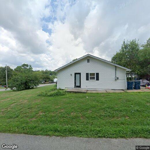

114 Waveland Ave
114 Waveland Ave
Danville, KY 40422
2 Weeks Ago
|
Edit
Favorites
114 Waveland Ave

Favorites
Check Back Soon for Upcoming Availability
114 Waveland Ave,
Danville,
KY
40422
An hour southwest of Lexington, Danville is a small town with big-city culture. The area is suburban and walkable with lush natural areas. Known as the City of Firsts, this town is packed with American history. Take a visit to one of Danville’s historical landmarks like the Abraham Lincoln Museum to learn about the town’s unique history.
Danville has a thriving art scene with multiple visual and performing art centers hosting events constantly. Enjoy a head-banging rock show or elegant ballet at the Norton Center for the Arts. Fittingly, Danville is home to Centre College, one of the most prestigious small liberal arts college in the nation. The public and private schools are excellent as well, with state level and national recognitions.
Danville is located on the southern edge of Kentucky’s renowned Bluegrass Region making it perfect for biking, hiking, birdwatching, golfing, and camping. There are plenty of activities in town any age can enjoy.
Learn more about living in Danville
Education
| Colleges & Universities | Distance | ||
|---|---|---|---|
| Colleges & Universities | Distance | ||
| Drive: | 55 min | 33.4 mi | |
| Drive: | 49 min | 34.4 mi | |
| Drive: | 55 min | 35.7 mi | |
| Drive: | 53 min | 36.3 mi |
114 Waveland Ave is within 55 minutes or 33.4 miles from Berea College. It is also near Eastern Kentucky University and University of Kentucky.
Walkability Near 114 Waveland Ave Danville, KY 40422
Getting Around
 What do Walkability, Transit, Drivability, and Bikeability mean?
Walkability measures the walking distance to day-to-day needs.
Transit measures access to public transportation.
Drivability measures congestion, parking availability, and access to major roads.
Bikeability measures the suitability for cycling.
How It Works
What do Walkability, Transit, Drivability, and Bikeability mean?
Walkability measures the walking distance to day-to-day needs.
Transit measures access to public transportation.
Drivability measures congestion, parking availability, and access to major roads.
Bikeability measures the suitability for cycling.
How It Works
Fairly Walkable
Walkability
40
/ 100
Limited Public Transit
Transit
20
/ 100
Exceptionally Drivable
Drivability
100
/ 100
Somewhat Bikeable
Bikeability
30
/ 100
Scores provided by
-
Soundscore™
-
/ 100
Traffic
-Airport
-Businesses
-Scores provided by
HowLoud What is a Sound Score Rating? A Sound Score Rating aggregates noise caused by vehicle traffic, airplane traffic and local sources. How It WorksYou May Also Like
Similar Rentals Nearby
-
-

-

-

-

-

-

-

-
 4 Beds, 2.5 Baths, 1,900 sq ft$2,300504 Cripple Creek Cir
 -

What Are Walk Score®, Transit Score®, and Bike Score® Ratings?
Walk Score® measures the walkability of any address. Transit Score® measures access to public transit. Bike Score® measures the bikeability of any address.
What is a Sound Score Rating?
A Sound Score Rating aggregates noise caused by vehicle traffic, airplane traffic and local sources.