

$875
/ Month
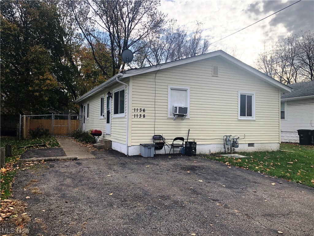
1138 Delos St
Akron, OH 44306
Favorites
1138 Delos St

Favorites
Check Back Soon for Upcoming Availability
| Beds | Baths | Average SF |
|---|---|---|
| 2 Bedrooms 2 Bedrooms 2 Br | 1 Bath 1 Bath 1 Ba | — |
About This Property
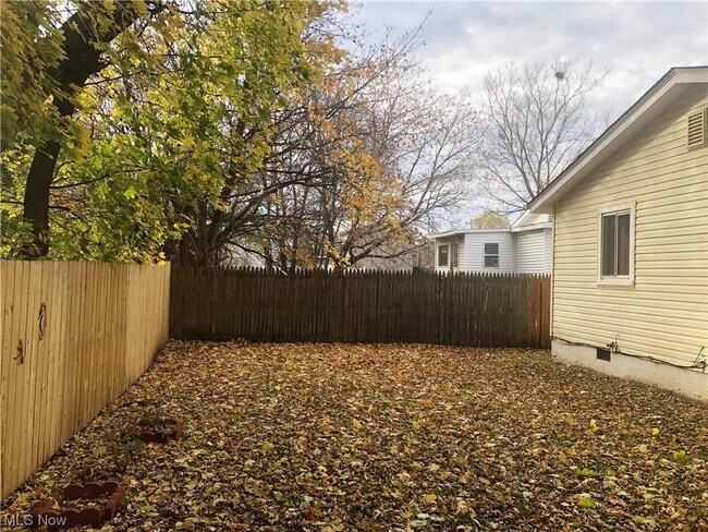
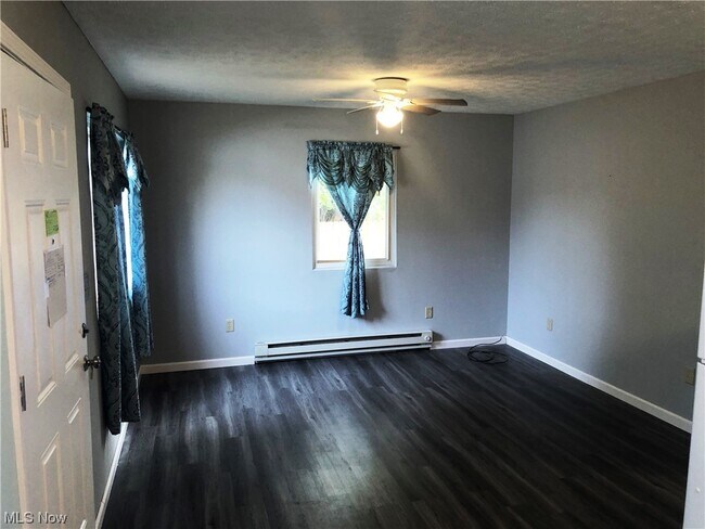
Updated 2 bedroom,1 bath with in unit laundry hook up. Large fenced in yard.
1138 Delos St is an apartment community located in Summit County and the 44306 ZIP Code.
1138 Delos St,
Akron,
OH
44306
East Akron is a lively neighborhood situated southeast of the city’s center off the Interstate 76 and 77 intersection. Within East Akron, Arlington Street and Archwood Avenue is where residents go to find a variety of dining and shopping choices. To the east of town, residents have access to great amenities like the Akron Executive Airport, parks like Wilbeth Arlington Park, and sprawling golf courses. The majority of East Akron is made up of classic suburban neighborhoods. Renters have the choice between affordable apartments, condos, and cozy single-family homes.
Learn more about living in East AkronBelow are rent ranges for similar nearby apartments
Education
| Colleges & Universities | Distance | ||
|---|---|---|---|
| Colleges & Universities | Distance | ||
| Drive: | 9 min | 3.1 mi | |
| Drive: | 21 min | 12.9 mi | |
| Drive: | 22 min | 15.2 mi | |
| Drive: | 25 min | 15.7 mi |
1138 Delos St is within 9 minutes or 3.1 miles from University of Akron. It is also near Kent State University and Stark State College.
Walkability Near 1138 Delos St Akron, OH 44306
Getting Around
 What do Walkability, Transit, Drivability, and Bikeability mean?
Walkability measures the walking distance to day-to-day needs.
Transit measures access to public transportation.
Drivability measures congestion, parking availability, and access to major roads.
Bikeability measures the suitability for cycling.
How It Works
What do Walkability, Transit, Drivability, and Bikeability mean?
Walkability measures the walking distance to day-to-day needs.
Transit measures access to public transportation.
Drivability measures congestion, parking availability, and access to major roads.
Bikeability measures the suitability for cycling.
How It Works
Fairly Walkable
Walkability
50
/ 100
Limited Public Transit
Transit
30
/ 100
Very Drivable
Drivability
80
/ 100
Fairly Bikeable
Bikeability
40
/ 100
Scores provided by
-
Soundscore™
-
/ 100
Traffic
-Airport
-Businesses
-Scores provided by
HowLoud What is a Sound Score Rating? A Sound Score Rating aggregates noise caused by vehicle traffic, airplane traffic and local sources. How It WorksYou May Also Like
Similar Rentals Nearby


What Are Walk Score®, Transit Score®, and Bike Score® Ratings?
Walk Score® measures the walkability of any address. Transit Score® measures access to public transit. Bike Score® measures the bikeability of any address.
What is a Sound Score Rating?
A Sound Score Rating aggregates noise caused by vehicle traffic, airplane traffic and local sources.

1138 Delos St
Akron, OH 44306