$4,200
/ Month
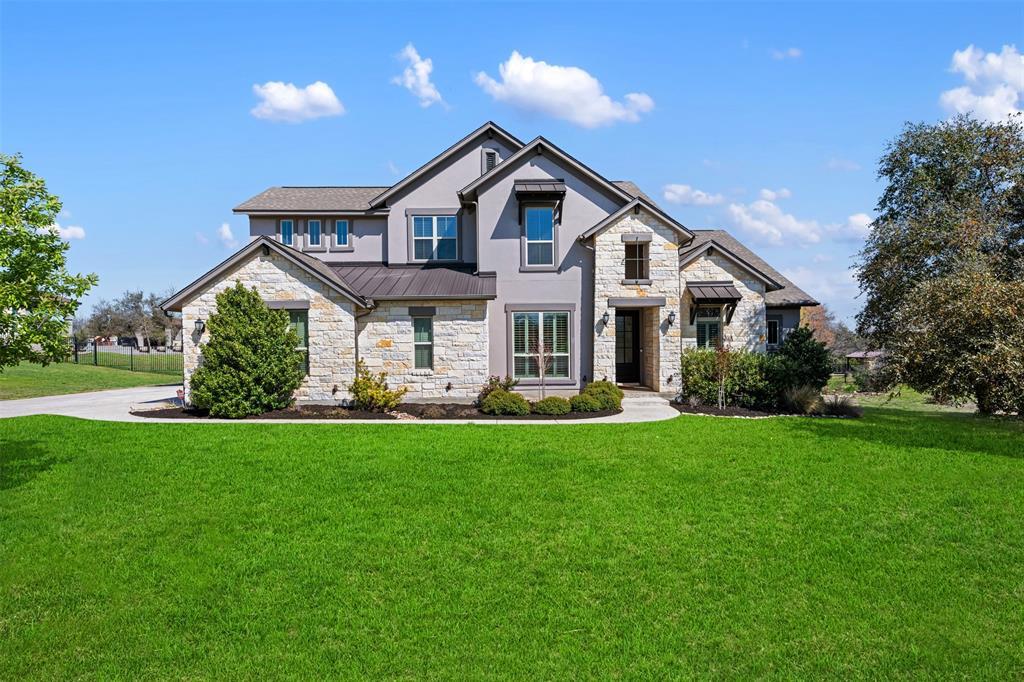
113 Cerro Picacho Trail
Liberty Hill, TX 78642
Favorites
113 Cerro Picacho Trail

Favorites
Check Back Soon for Upcoming Availability
| Beds | Baths | Average SF |
|---|---|---|
| 5 Bedrooms 5 Bedrooms 5 Br | 4 Baths 4 Baths 4 Ba | 3,960 SF |
Fees and Policies
The fees listed below are community-provided and may exclude utilities or add-ons. All payments are made directly to the property and are non-refundable unless otherwise specified.
Pet policies are negotiable.
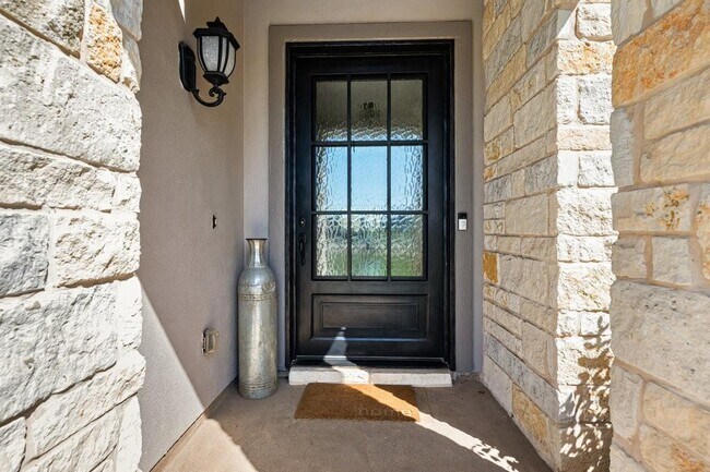
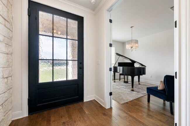
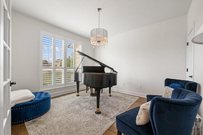
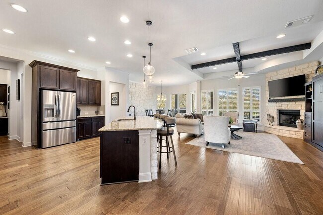
About This Property
Pool and yard maintenance included in monthly rental.
113 Cerro Picacho Trail is a house located in Williamson County and the 78642 ZIP Code. This area is served by the Liberty Hill Independent School District attendance zone.
House Features
Dishwasher
Hardwood Floors
Microwave
Disposal
- Dishwasher
- Disposal
- Microwave
- Hardwood Floors
- Carpet
- Tile Floors
- Pool
- Grill
113 Cerro Picacho Trail,
Liberty Hill,
TX
78642
Formed from remnants of small ranching and farming villages, Liberty Hill has transformed into one of the fastest growing communities in the Austin metro area. Residents are drawn to Liberty Hill for its scenic hill-laden landscape, relaxed atmosphere, excellent schools, and abundant opportunities.
Situated between the North and South Forks of the San Gabriel River, Liberty Hill is convenient to all kinds of outdoor adventure. Nearby parks include Canyonlands National Wildlife Refuge, Southwest Williamson County Regional Park, and Pace Bend Park. Liberty Hill is also just a short drive away from Inner Space Cavern.
Shopping options in Liberty Hill range from local stores in town to national retailers in nearby Lakeline Mall and Round Rock Premium Outlets. Metropolitan delights abound in Austin, which is less than an hour’s drive from Liberty Hill. Quick access to Route 29 makes getting around from Liberty Hill easy.
Learn more about living in Liberty Hill
Amenities
- Dishwasher
- Disposal
- Microwave
- Hardwood Floors
- Carpet
- Tile Floors
- Grill
- Pool
Education
| Colleges & Universities | Distance | ||
|---|---|---|---|
| Colleges & Universities | Distance | ||
| Drive: | 24 min | 15.6 mi | |
| Drive: | 21 min | 16.2 mi | |
| Drive: | 30 min | 21.6 mi | |
| Drive: | 33 min | 22.1 mi |
113 Cerro Picacho Trail is within 24 minutes or 15.6 miles from Southwestern University. It is also near Austin C.C., Cypress Creek and Austin C.C., Round Rock Campus.
Schools


Public Elementary School
Grades PK-5
927 Students
Attendance Zone
Public Elementary School
Grades PK-5
704 Students
Attendance Zone
Public Middle School
Grades 6-8
944 Students
Attendance Zone
Public High School
Grades 9-12
2,001 Students
Attendance Zone
Private Elementary, Middle & High School
Grades PK-12
Nearby
School data provided by
 The GreatSchools Rating helps parents compare schools within a state based on a variety of school quality indicators and provides a helpful picture of how effectively each school serves all of its students. Ratings are on a scale of 1 (below average) to 10 (above average) and can include test scores, college readiness, academic progress, advanced courses, equity, discipline and attendance data. We also advise parents to visit schools, consider other information on school performance and programs, and consider family needs as part of the school selection process.
View GreatSchools Rating Methodology
Data provided by GreatSchools.org © 2026. All rights reserved.
View GreatSchools Rating Methodology
Data provided by GreatSchools.org © 2026. All rights reserved.
Transportation options available in Liberty Hill include Leander Station, located 7.3 miles from 113 Cerro Picacho Trail. 113 Cerro Picacho Trail is near Robert Gray AAF, located 32.9 miles or 53 minutes away, and Killeen Municipal, located 38.9 miles or 51 minutes away.
| Transit / Subway | Distance | ||
|---|---|---|---|
| Transit / Subway | Distance | ||
| Drive: | 11 min | 7.3 mi |
| Commuter Rail | Distance | ||
|---|---|---|---|
| Commuter Rail | Distance | ||
|
|
Drive: | 41 min | 32.9 mi |
|
|
Drive: | 50 min | 36.0 mi |
| Airports | Distance | ||
|---|---|---|---|
| Airports | Distance | ||
|
Robert Gray AAF
|
Drive: | 53 min | 32.9 mi |
|
Killeen Municipal
|
Drive: | 51 min | 38.9 mi |
Walkability Near 113 Cerro Picacho Trail Liberty Hill, TX 78642
Getting Around
 What do Walkability, Transit, Drivability, and Bikeability mean?
Walkability measures the walking distance to day-to-day needs.
Transit measures access to public transportation.
Drivability measures congestion, parking availability, and access to major roads.
Bikeability measures the suitability for cycling.
How It Works
What do Walkability, Transit, Drivability, and Bikeability mean?
Walkability measures the walking distance to day-to-day needs.
Transit measures access to public transportation.
Drivability measures congestion, parking availability, and access to major roads.
Bikeability measures the suitability for cycling.
How It Works
Not Walkable
Walkability
10
/ 100
Exceptionally Drivable
Drivability
100
/ 100
Not Bikeable
Bikeability
0
/ 100
Scores provided by
-
Soundscore™
-
/ 100
Traffic
-Airport
-Businesses
-Scores provided by
HowLoud What is a Sound Score Rating? A Sound Score Rating aggregates noise caused by vehicle traffic, airplane traffic and local sources. How It WorksTime and distance from 113 Cerro Picacho Trail.
| Shopping Centers | Distance | ||
|---|---|---|---|
| Shopping Centers | Distance | ||
| Drive: | 6 min | 3.3 mi | |
| Drive: | 5 min | 3.5 mi | |
| Drive: | 6 min | 3.6 mi |
113 Cerro Picacho Trail has 3 shopping centers within 3.6 miles, which is about a 6-minute drive. The miles and minutes will be for the farthest away property.
| Parks and Recreation | Distance | ||
|---|---|---|---|
| Parks and Recreation | Distance | ||
|
Garey Park
|
Drive: | 23 min | 11.6 mi |
113 Cerro Picacho Trail has a nearby park, Garey Park , located 11.6 miles or 23 minutes away.
| Military Bases | Distance | ||
|---|---|---|---|
| Military Bases | Distance | ||
| Drive: | 58 min | 44.1 mi |
113 Cerro Picacho Trail is 44.1 miles and a 58 minute drive from Fort Hood.
You May Also Like
Similar Rentals Nearby
-
-
4 Beds$2,960Total Monthly PriceTotal Monthly Price NewPrices include base rent and required monthly fees of $160. Variable costs based on usage may apply.Base Rent:4 Beds$2,800Specials
-
4 Beds$2,555+Total Monthly PriceTotal Monthly Price NewPrices include base rent and required monthly fees of $105. Variable costs based on usage may apply.Base Rent:4 Beds$2,450+2 Months Free
-
-

-

-

-

-

-


What Are Walk Score®, Transit Score®, and Bike Score® Ratings?
Walk Score® measures the walkability of any address. Transit Score® measures access to public transit. Bike Score® measures the bikeability of any address.
What is a Sound Score Rating?
A Sound Score Rating aggregates noise caused by vehicle traffic, airplane traffic and local sources.

113 Cerro Picacho Trail
Liberty Hill, TX 78642