
$5,000
/ Month
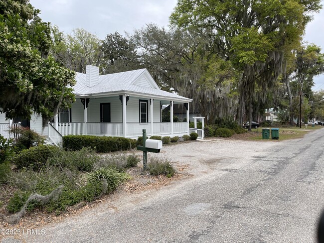
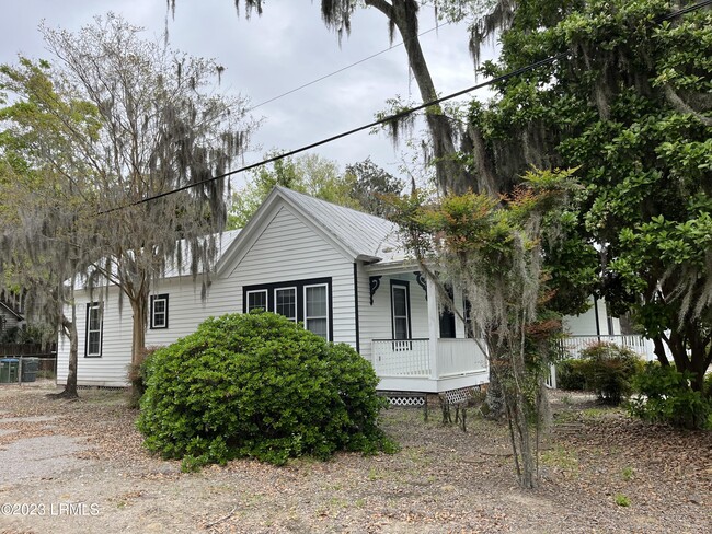
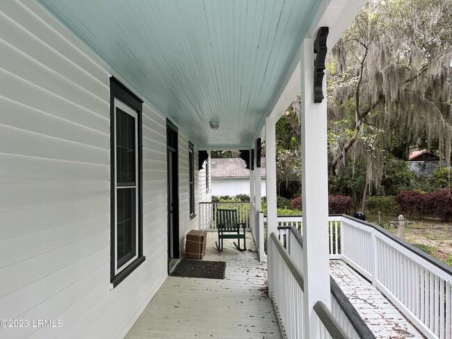
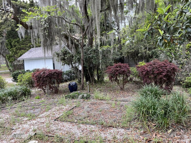
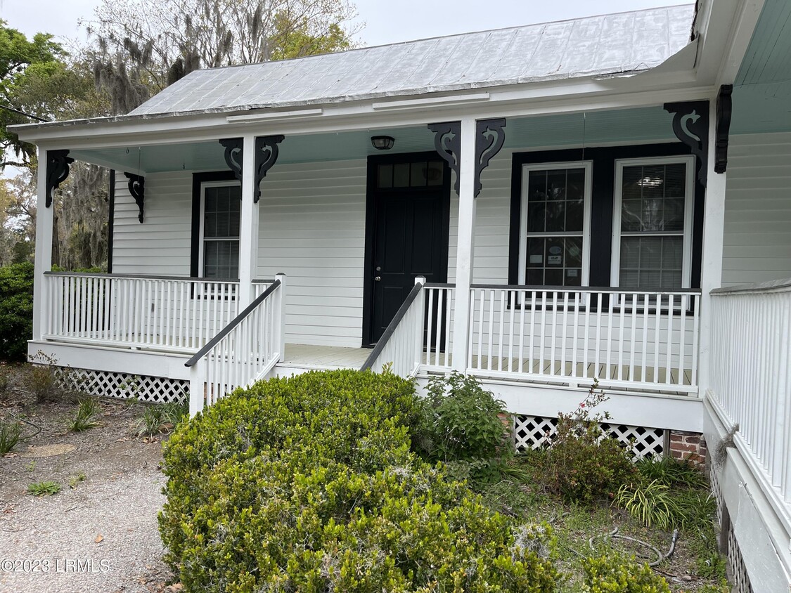
1110 13th St
Port Royal, SC 29935
Favorites
1110 13th St
Favorites
Check Back Soon for Upcoming Availability
| Beds | Baths | Average SF |
|---|---|---|
| 1 Bedroom 1 Bedroom 1 Br | 2.5 Baths 2.5 Baths 2.5 Ba | 2,328 SF |
About This Property
Residential/Commercial zoning allows for broad range of use entitlements from Office to Retail, Medical, Restaurant with alcohol service and more. Strategic location poised to take highest advantage of Port of Port Royal re-development project.
1110 13th St is a house located in Beaufort County and the 29935 ZIP Code. This area is served by the Beaufort County School District attendance zone.
1110 13th St,
Port Royal,
SC
29935
Education
| Colleges & Universities | Distance | ||
|---|---|---|---|
| Colleges & Universities | Distance | ||
| Drive: | 59 min | 40.0 mi | |
| Drive: | 57 min | 43.9 mi | |
| Drive: | 70 min | 46.3 mi |
1110 13th St is within 59 minutes or 40.0 miles from Savannah Coll. of Art & Design. It is also near Savannah Technical College and Savannah State University.
Schools


Public Elementary School
Grades PK-5
169 Students
Attendance Zone
Public Middle School
Grades 6-8
384 Students
Attendance Zone
Public High School
Grades 9-12
1,191 Students
Attendance Zone
Private Elementary, Middle & High School
Grades PK-12
114 Students
Nearby
Private Elementary, Middle & High School
Grades K-12
13 Students
Nearby
School data provided by
 The GreatSchools Rating helps parents compare schools within a state based on a variety of school quality indicators and provides a helpful picture of how effectively each school serves all of its students. Ratings are on a scale of 1 (below average) to 10 (above average) and can include test scores, college readiness, academic progress, advanced courses, equity, discipline and attendance data. We also advise parents to visit schools, consider other information on school performance and programs, and consider family needs as part of the school selection process.
View GreatSchools Rating Methodology
Data provided by GreatSchools.org © 2026. All rights reserved.
View GreatSchools Rating Methodology
Data provided by GreatSchools.org © 2026. All rights reserved.
Walkability Near 1110 13th St Port Royal, SC 29935
Getting Around
 What do Walkability, Transit, Drivability, and Bikeability mean?
Walkability measures the walking distance to day-to-day needs.
Transit measures access to public transportation.
Drivability measures congestion, parking availability, and access to major roads.
Bikeability measures the suitability for cycling.
How It Works
What do Walkability, Transit, Drivability, and Bikeability mean?
Walkability measures the walking distance to day-to-day needs.
Transit measures access to public transportation.
Drivability measures congestion, parking availability, and access to major roads.
Bikeability measures the suitability for cycling.
How It Works
Somewhat Walkable
Walkability
30
/ 100
Exceptionally Drivable
Drivability
100
/ 100
Somewhat Bikeable
Bikeability
30
/ 100
Scores provided by
-
Soundscore™
-
/ 100
Traffic
-Airport
-Businesses
-Scores provided by
HowLoud What is a Sound Score Rating? A Sound Score Rating aggregates noise caused by vehicle traffic, airplane traffic and local sources. How It WorksYou May Also Like
Similar Rentals Nearby
-
-
-
 4 Beds$2,325Total Monthly PriceTotal Monthly Price NewPrices include all required monthly fees.House for Rent
 -

-
 3 Beds$2,330Total Monthly PriceTotal Monthly Price NewPrices include all required monthly fees.House for Rent
 -
 4 Beds$2,550Total Monthly PriceTotal Monthly Price NewPrices include all required monthly fees.House for Rent
 -
 3 Beds$2,360Total Monthly PriceTotal Monthly Price NewPrices include all required monthly fees.House for Rent
 -
 3 Beds$2,420Total Monthly PriceTotal Monthly Price NewPrices include all required monthly fees.House for Rent
 -
 4 Beds$2,695Total Monthly PriceTotal Monthly Price NewPrices include all required monthly fees.House for Rent
 -
 3 Beds$2,705Total Monthly PriceTotal Monthly Price NewPrices include all required monthly fees.House for Rent


What Are Walk Score®, Transit Score®, and Bike Score® Ratings?
Walk Score® measures the walkability of any address. Transit Score® measures access to public transit. Bike Score® measures the bikeability of any address.
What is a Sound Score Rating?
A Sound Score Rating aggregates noise caused by vehicle traffic, airplane traffic and local sources.
1110 13th St
Port Royal, SC 29935