
$750
/ Month
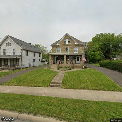
1106 Robbins Ave
Niles, OH 44446
2 Weeks Ago
|
Edit
Favorites
1106 Robbins Ave

Favorites
Check Back Soon for Upcoming Availability
| Beds | Baths | Average SF |
|---|---|---|
| 3 Bedrooms 3 Bedrooms 3 Br | 1 Bath 1 Bath 1 Ba | — |
1106 Robbins Ave is an apartment community located in Trumbull County and the 44446 ZIP Code.
Features
- Basement
- Porch
1106 Robbins Ave,
Niles,
OH
44446
The small city of Niles is a suburban community in northeastern Ohio, between Youngstown and Warren. The city sits at the confluence of Mosquito Creek and the Mahoning River, which effectively split Niles into three parts. The west side is almost entirely residential, while the south side is home to many of the city’s industrial facilities and the east side features a mix of neighborhoods, restaurants, shops, and other small businesses. Eastwood Mall Complex dominates the north side, anchoring a large cluster of shopping centers. In the summertime, locals flock to see the Mahoning Valley Scrappers minor league baseball team play at Eastwood Field, also on the north end of town.
Learn more about living in Niles
Amenities
- Basement
- Porch
Education
| Colleges & Universities | Distance | ||
|---|---|---|---|
| Colleges & Universities | Distance | ||
| Drive: | 13 min | 8.6 mi | |
| Drive: | 19 min | 9.5 mi | |
| Drive: | 55 min | 37.0 mi | |
| Drive: | 51 min | 39.0 mi |
1106 Robbins Ave is within 13 minutes or 8.6 miles from Youngstown State University. It is also near Kent State Univ., Trumbull and Kent State University.
Walkability Near 1106 Robbins Ave Niles, OH 44446
Getting Around
 What do Walkability, Transit, Drivability, and Bikeability mean?
Walkability measures the walking distance to day-to-day needs.
Transit measures access to public transportation.
Drivability measures congestion, parking availability, and access to major roads.
Bikeability measures the suitability for cycling.
How It Works
What do Walkability, Transit, Drivability, and Bikeability mean?
Walkability measures the walking distance to day-to-day needs.
Transit measures access to public transportation.
Drivability measures congestion, parking availability, and access to major roads.
Bikeability measures the suitability for cycling.
How It Works
Fairly Walkable
Walkability
50
/ 100
Minimal Public Transit
Transit
0
/ 100
Moderately Drivable
Drivability
70
/ 100
Fairly Bikeable
Bikeability
40
/ 100
Scores provided by
-
Soundscore™
-
/ 100
Traffic
-Airport
-Businesses
-Scores provided by
HowLoud What is a Sound Score Rating? A Sound Score Rating aggregates noise caused by vehicle traffic, airplane traffic and local sources. How It WorksYou May Also Like
Similar Rentals Nearby
-
-
3 Beds$1,750Total Monthly Price12 Month LeaseTotal Monthly Price NewPrices include all required monthly fees.Specials
-
3 Beds$1,750+Total Monthly Price12 Month LeaseTotal Monthly Price NewPrices include all required monthly fees.Specials
-
-
-
-
-
-
-


What Are Walk Score®, Transit Score®, and Bike Score® Ratings?
Walk Score® measures the walkability of any address. Transit Score® measures access to public transit. Bike Score® measures the bikeability of any address.
What is a Sound Score Rating?
A Sound Score Rating aggregates noise caused by vehicle traffic, airplane traffic and local sources.
1106 Robbins Ave
Niles, OH 44446