$1,450
/ Month
1104 Lisadale Cir Unit 3A
Catonsville, MD 21228
Favorites
1104 Lisadale Cir Unit 3A

Favorites
Check Back Soon for Upcoming Availability
| Beds | Baths | Average SF |
|---|---|---|
| 2 Bedrooms 2 Bedrooms 2 Br | 2 Baths 2 Baths 2 Ba | — |
About This Property
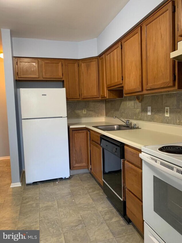
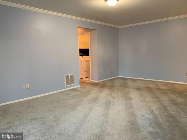
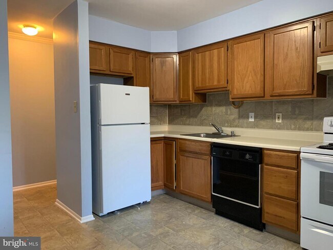
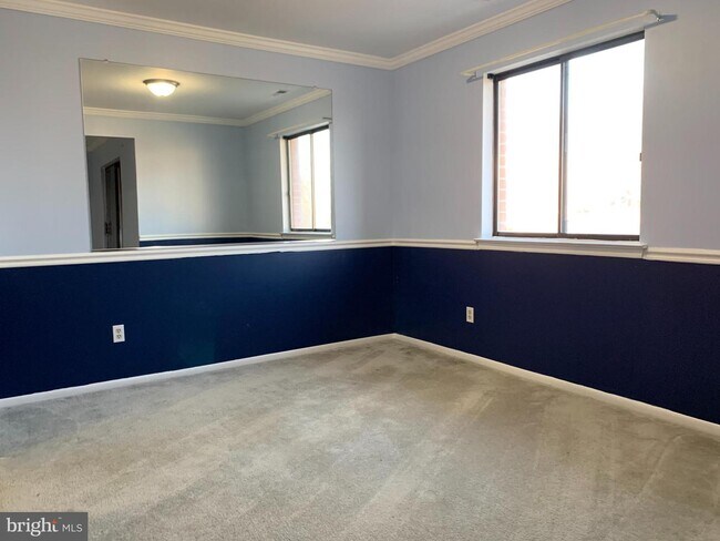
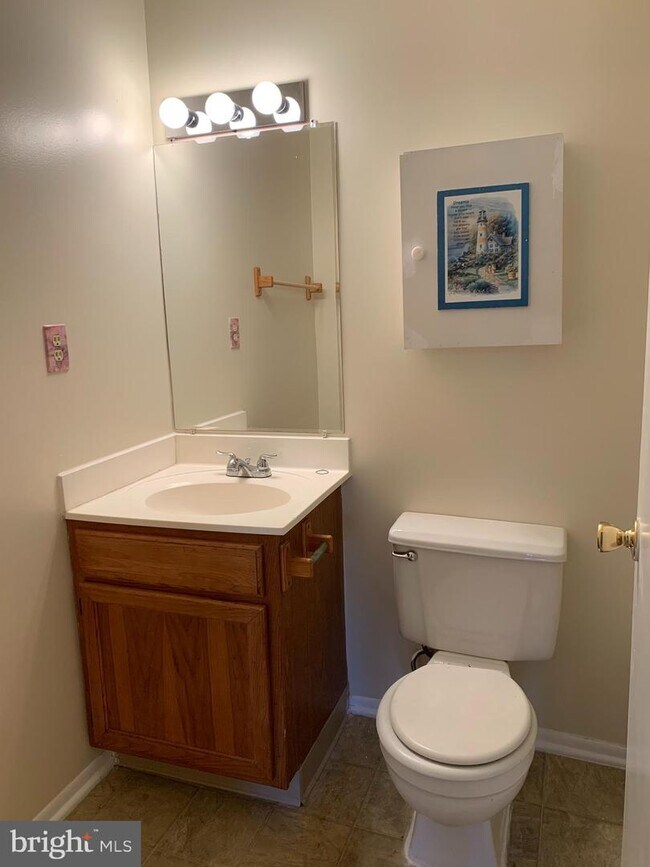
Amazing location, very convenient, next to shops & restaurants. This is Top floor 2 bedroom with 2 full bath, big kitchen, dining area, washer & dryer in unit, balcony large condo 1077 SQ FT
1104 Lisadale Cir is an apartment community located in Baltimore County and the 21228 ZIP Code.
1104 Lisadale Cir,
Catonsville,
MD
21228
Catonsville sits just west of Baltimore along the Patapsco River corridor, earning the official nickname "Music City, Maryland" for its deep-rooted love of live performance and local arts culture. The community of roughly 44,000 spans 15 square miles in Baltimore County, offering a pace that feels distinctly residential while keeping downtown Baltimore within easy reach. The University of Maryland, Baltimore County anchors much of the city's intellectual and creative energy, bringing a steady presence of students, faculty, and cultural programming to the area. Frederick Road serves as the beating heart of the community, lined with galleries, cafes, and locally owned shops that give the streetscape real character.
Learn more about living in Catonsville
Education
| Colleges & Universities | Distance | ||
|---|---|---|---|
| Colleges & Universities | Distance | ||
| Drive: | 11 min | 4.8 mi | |
| Drive: | 13 min | 5.3 mi | |
| Drive: | 17 min | 7.5 mi | |
| Drive: | 18 min | 8.1 mi |
1104 Lisadale Cir Unit 3A is within 11 minutes or 4.8 miles from CCBC Cantonsville. It is also near UMBC and Coppin State University.
Transportation options available in Catonsville include Rogers Avenue, located 7.1 miles from 1104 Lisadale Cir Unit 3A. 1104 Lisadale Cir Unit 3A is near Baltimore/Washington International Thurgood Marshall, located 10.7 miles or 19 minutes away, and Ronald Reagan Washington Ntl, located 38.8 miles or 61 minutes away.
| Transit / Subway | Distance | ||
|---|---|---|---|
| Transit / Subway | Distance | ||
| Drive: | 17 min | 7.1 mi | |
| Drive: | 18 min | 7.5 mi | |
| Drive: | 16 min | 8.4 mi | |
| Drive: | 18 min | 8.7 mi | |
| Drive: | 17 min | 9.1 mi |
| Commuter Rail | Distance | ||
|---|---|---|---|
| Commuter Rail | Distance | ||
| Drive: | 11 min | 6.4 mi | |
| Drive: | 11 min | 6.4 mi | |
| Drive: | 15 min | 6.6 mi | |
| Drive: | 14 min | 8.2 mi | |
| Drive: | 21 min | 13.8 mi |
| Airports | Distance | ||
|---|---|---|---|
| Airports | Distance | ||
|
Baltimore/Washington International Thurgood Marshall
|
Drive: | 19 min | 10.7 mi |
|
Ronald Reagan Washington Ntl
|
Drive: | 61 min | 38.8 mi |
Walkability Near 1104 Lisadale Cir Catonsville, MD 21228
Getting Around
 What do Walkability, Transit, Drivability, and Bikeability mean?
Walkability measures the walking distance to day-to-day needs.
Transit measures access to public transportation.
Drivability measures congestion, parking availability, and access to major roads.
Bikeability measures the suitability for cycling.
How It Works
What do Walkability, Transit, Drivability, and Bikeability mean?
Walkability measures the walking distance to day-to-day needs.
Transit measures access to public transportation.
Drivability measures congestion, parking availability, and access to major roads.
Bikeability measures the suitability for cycling.
How It Works
Fairly Walkable
Walkability
50
/ 100
Minimal Public Transit
Transit
10
/ 100
Exceptionally Drivable
Drivability
90
/ 100
Moderately Bikeable
Bikeability
60
/ 100
Scores provided by
-
Soundscore™
-
/ 100
Traffic
-Airport
-Businesses
-Scores provided by
HowLoud What is a Sound Score Rating? A Sound Score Rating aggregates noise caused by vehicle traffic, airplane traffic and local sources. How It WorksTime and distance from 1104 Lisadale Cir Unit 3A.
| Shopping Centers | Distance | ||
|---|---|---|---|
| Shopping Centers | Distance | ||
| Walk: | 4 min | 0.3 mi | |
| Walk: | 5 min | 0.3 mi | |
| Walk: | 8 min | 0.4 mi |
1104 Lisadale Cir Unit 3A has 3 shopping centers within 0.4 mile, which is about a 8-minute walk. The miles and minutes will be for the farthest away property.
| Parks and Recreation | Distance | ||
|---|---|---|---|
| Parks and Recreation | Distance | ||
|
Benjamin Banneker Historical Park and Museum
|
Drive: | 7 min | 2.7 mi |
|
Banneker Planetarium
|
Drive: | 11 min | 4.7 mi |
|
Gwynns Falls Trail
|
Drive: | 11 min | 4.8 mi |
|
Carrie Murray Nature Center
|
Drive: | 10 min | 4.9 mi |
|
Gwynns Falls - Leakin Park
|
Drive: | 11 min | 4.9 mi |
1104 Lisadale Cir Unit 3A has 5 parks within 4.9 miles, including Benjamin Banneker Historical Park and Museum, Banneker Planetarium, and Gwynns Falls Trail.
| Hospitals | Distance | ||
|---|---|---|---|
| Hospitals | Distance | ||
| Drive: | 7 min | 3.3 mi | |
| Drive: | 9 min | 4.6 mi | |
| Drive: | 16 min | 8.7 mi |
1104 Lisadale Cir Unit 3A has 3 hospitals within 8.7 miles, the nearest is Spring Grove Hospital Center which is 3.3 miles away and a 7 minute drive.
| Military Bases | Distance | ||
|---|---|---|---|
| Military Bases | Distance | ||
| Drive: | 33 min | 18.7 mi | |
| Drive: | 47 min | 32.0 mi | |
| Drive: | 55 min | 35.4 mi |
1104 Lisadale Cir Unit 3A has 3 military bases within 35.4 miles, the nearest is Fort George Meade which is 18.7 miles away and a 33 minute drive.
You May Also Like
Similar Rentals Nearby
-
-
-
-
1 / 25
 2 Beds$2,756+3 Beds$3,896+Total Monthly PriceTotal Monthly Price NewPrices include base rent and required monthly fees of $100. Variable costs based on usage may apply.Base Rent:2 Beds$2,655+3 Beds$3,795+2 Months Free
Pets Allowed Fitness Center Pool Dishwasher In Unit Washer & Dryer
-
-
-
-
-
-


What Are Walk Score®, Transit Score®, and Bike Score® Ratings?
Walk Score® measures the walkability of any address. Transit Score® measures access to public transit. Bike Score® measures the bikeability of any address.
What is a Sound Score Rating?
A Sound Score Rating aggregates noise caused by vehicle traffic, airplane traffic and local sources.

1104 Lisadale Cir
Catonsville, MD 21228