1100 Duncan Street

1100-1108 Duncan St, Herrin, IL 62948

2 Weeks Ago
Share Listing
Favorites
1100 Duncan Street
Share Listing
Favorites

Highlights

  • By-The-Bed Leasing
  • Bay Window
  • Hardwood Floors

About 1100 Duncan Street

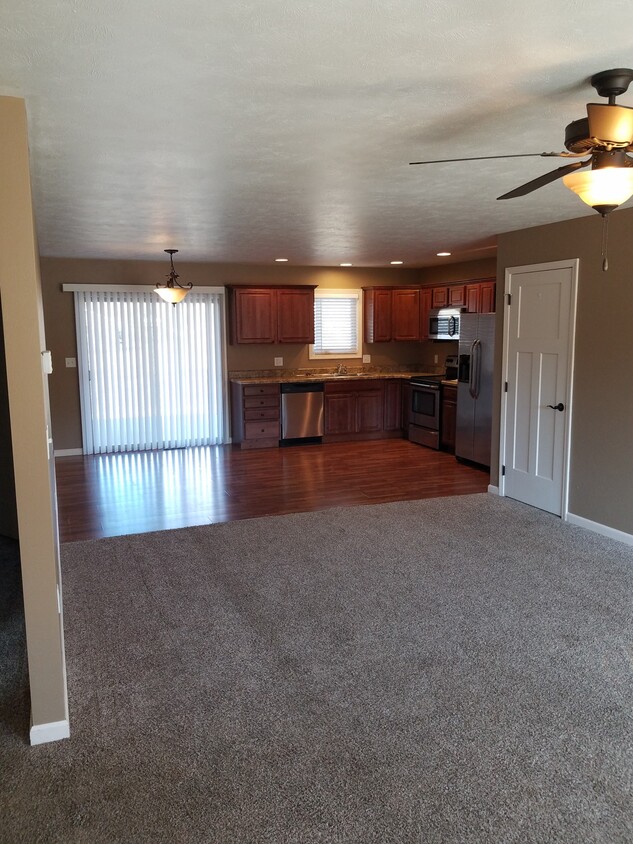
Experience Herrin living at 1100 Duncan Street. Located at 1100-1108 Duncan St in Herrin, this community is a terrific place to live. The leasing staff is available to help you find your perfect new place. This community offers a selection of amenities and features. Some of these include: hardwood floors, convenient on-site parking options, and washers and dryers. At 1100 Duncan Street you'll feel right at home.

1100 Duncan Street is an apartment community located in Williamson County and the 62948 ZIP Code. This area is served by the Herrin Community Unit School District 4 attendance zone.

Apartment Features

Washer/Dryer

Air Conditioning

Dishwasher

Hardwood Floors

  • Washer/Dryer
  • Air Conditioning
  • Cable Ready
  • Dishwasher
  • Disposal
  • Kitchen
  • Microwave
  • Hardwood Floors
  • Tile Floors
  • Bay Window
Location
1100-1108 Duncan St, Herrin,
IL 62948
Get Directions
Education
Colleges & Universities Distance
Drive: 18 min 9.3 mi
Drive: 30 min 17.1 mi
Drive: 44 min 31.0 mi
1100 Duncan Street is within 18 minutes or 9.3 miles from John A. Logan College. It is also near Southern Ill. Univ. Carbondale and Rend Lake College.
Schools
Public Elementary School
Grades K-5
712 Students
Attendance Zone
Public Elementary School
Grades PK-5
433 Students
Attendance Zone
Public Middle School
Grades 6-8
505 Students
Attendance Zone
Public High School
Grades 9-12
635 Students
Attendance Zone
Private Elementary & Middle School
Grades PK-8
255 Students
Nearby
Private High School
Grades 9-12
Nearby
Transportation
Commuter Rail Distance
Drive: 27 min 16.3 mi
Drive: 47 min 27.6 mi

Walkability Near 1100 Duncan Street

Getting Around
Somewhat Walkable
Walkability
30 / 100
Very Drivable
Drivability
80 / 100
Somewhat Bikeable
Bikeability
30 / 100

Scores provided by

What do Walkability, Transit, Drivability, and Bikeability mean? Walkability measures the walking distance to day-to-day needs. Transit measures access to public transportation. Drivability measures congestion, parking availability, and access to major roads. Bikeability measures the suitability for cycling. How It Works
-
Soundscore
- / 100

Traffic

-

Airport

-

Businesses

-

Scores provided by

HowLoud What is a Sound Score Rating? A Sound Score Rating aggregates noise caused by vehicle traffic, airplane traffic and local sources. How It Works
Points of Interest

Time and distance from 1100 Duncan Street.

Shopping Centers Distance
Drive: 14 min 5.4 mi
Drive: 14 min 7.2 mi
Drive: 14 min 7.8 mi
1100 Duncan Street has 3 shopping centers within 7.8 miles, which is about a 14-minute drive. The miles and minutes will be for the farthest away property.
Parks and Recreation Distance
Crab Orchard National Wildlife Refuge
Drive: 13 min 6.9 mi
Middle Mississippi River National Wildlife Refuge
Drive: 13 min 6.9 mi
1100 Duncan Street has 2 parks within 6.9 miles, including Crab Orchard National Wildlife Refuge, and Middle Mississippi River National Wildlife Refuge.
Hospitals Distance
Hospitals Distance
Drive: 5 min 1.5 mi
Drive: 11 min 6.4 mi
1100 Duncan Street is 1.5 miles from Herrin Hospital, and is convenient to other hospitals, including Heartland Regional Medical Center.
Military Bases Distance
Drive: 121 min 97.8 mi
1100 Duncan Street is 97.8 miles and a 121 minute drive from Scott Air Force Base.