

$14,000
/ Month
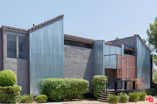
110 N Barrington Ave
Los Angeles, CA 90049
2 Weeks Ago
|
Edit
Favorites
110 N Barrington Ave

Favorites
Check Back Soon for Upcoming Availability
| Beds | Baths | Average SF |
|---|---|---|
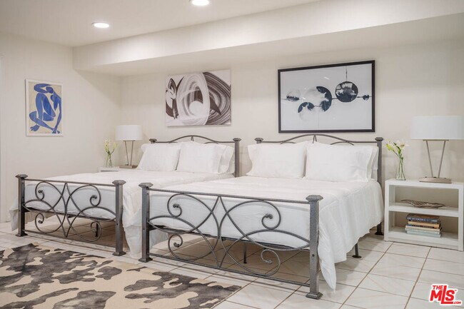
| 5 Bedrooms 5 Bedrooms 5 Br | 5 Baths 5 Baths 5 Ba | 4,569 SF |
110 N Barrington Ave is a house located in Los Angeles County and the 90049 ZIP Code. This area is served by the Los Angeles Unified attendance zone.
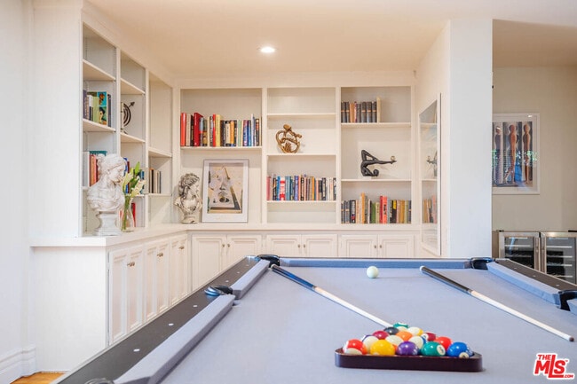
House Features
Washer/Dryer
Air Conditioning
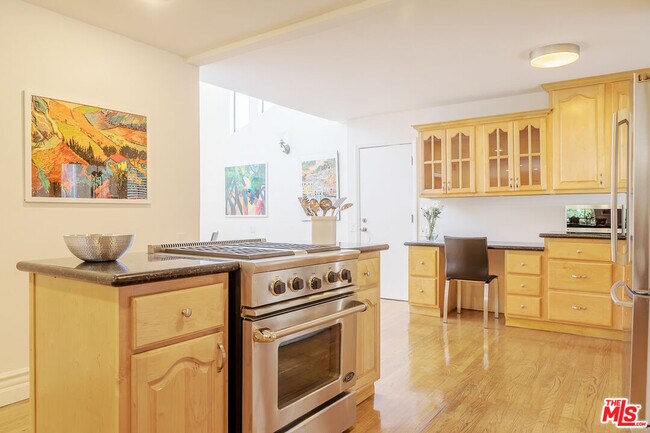
Dishwasher
Hardwood Floors
- Washer/Dryer
- Air Conditioning
- Dishwasher
- Disposal
- Microwave
- Freezer
- Instant Hot Water
- Hardwood Floors
- Den
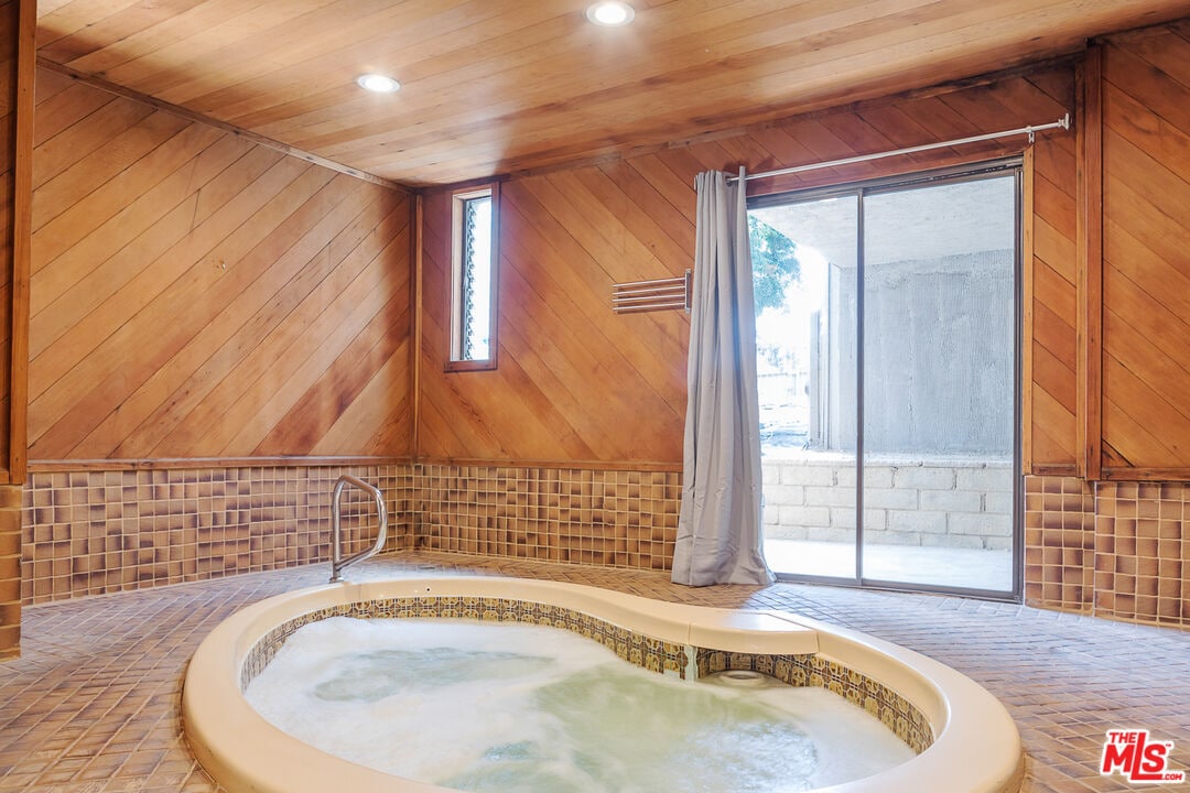
- Views
Location
Get Directions
Perched on LA’s Westside, at the base of the Santa Monica Mountains, Brentwood is an upscale neighborhood teeming with high-end boutiques, fine dining, and luxurious gardens. The main thoroughfare in the community is San Vicente Boulevard, where eateries, cafes, and the historic Brentwood County Mart sit along tree-lined avenues.
Brentwood is also home to the famous Getty Center, which boasts extensive museums, scenic gardens, and stunning views that draw millions of visitors every year. Sprawling estates and luxury apartments comprise the bulk of the rental market in Brentwood, providing many options for a lavish lifestyle in the hills.
Learn more about living in BrentwoodBelow are rent ranges for similar nearby apartments
| Beds | Average Size | Lowest | Typical | Premium |
|---|---|---|---|---|
| Studio Studio Studio | 453-455 Sq Ft | $1,455 | $2,281 | $5,000 |
| 1 Bed 1 Bed 1 Bed | 879-896 Sq Ft | $1,800 | $3,063 | $7,928 |
| 2 Beds 2 Beds 2 Beds | 1211-1219 Sq Ft | $2,200 | $4,830 | $12,760 |
| 3 Beds 3 Beds 3 Beds | 1884 Sq Ft | $3,200 | $8,798 | $20,000 |
| 4 Beds 4 Beds 4 Beds | 5309 Sq Ft | $6,900 | $32,676 | $150,000 |
Amenities
- Washer/Dryer
- Air Conditioning
- Dishwasher
- Disposal
- Microwave
- Freezer
- Instant Hot Water
- Hardwood Floors
- Den
- Views
Education
| Colleges & Universities | Distance | ||
|---|---|---|---|
| Colleges & Universities | Distance | ||
| Drive: | 6 min | 2.2 mi | |
| Drive: | 9 min | 2.3 mi | |
| Drive: | 8 min | 3.1 mi | |
| Drive: | 10 min | 4.1 mi |
110 N Barrington Ave is within 9 minutes or 2.3 miles from Mount St. Mary's Coll, Chalon. It is also near UCLA and Santa Monica Coll., Academy.
Schools


Public Elementary School
Grades K-5
611 Students
Nearby
Charter Elementary School
Grades K-5
454 Students
Attendance Zone
Charter Middle School
Grades 6-8
1,718 Students
Attendance Zone
Charter High School
Grades 9-12
2,959 Students
Attendance Zone
Private Elementary & Middle School
Grades PK-8
158 Students
Nearby
Private Elementary, Middle & High School
Grades K-12
996 Students
Nearby
Private Middle & High School
Grades 6-12
486 Students
Nearby
School data provided by
 The GreatSchools Rating helps parents compare schools within a state based on a variety of school quality indicators and provides a helpful picture of how effectively each school serves all of its students. Ratings are on a scale of 1 (below average) to 10 (above average) and can include test scores, college readiness, academic progress, advanced courses, equity, discipline and attendance data. We also advise parents to visit schools, consider other information on school performance and programs, and consider family needs as part of the school selection process.
View GreatSchools Rating Methodology
Data provided by GreatSchools.org © 2025. All rights reserved.
View GreatSchools Rating Methodology
Data provided by GreatSchools.org © 2025. All rights reserved.
Transportation options available in Los Angeles include 17 St/ Smc, located 3.9 miles from 110 N Barrington Ave. 110 N Barrington Ave is near Los Angeles International, located 11.7 miles or 18 minutes away, and Bob Hope, located 16.2 miles or 24 minutes away.
| Transit / Subway | Distance | ||
|---|---|---|---|
| Transit / Subway | Distance | ||
|
|
Drive: | 10 min | 3.9 mi |
| Drive: | 6 min | 4.0 mi | |
|
|
Drive: | 8 min | 4.7 mi |
|
|
Drive: | 7 min | 5.0 mi |
|
|
Drive: | 9 min | 6.2 mi |
| Commuter Rail | Distance | ||
|---|---|---|---|
| Commuter Rail | Distance | ||
|
|
Drive: | 18 min | 12.6 mi |
|
|
Drive: | 24 min | 16.2 mi |
|
|
Drive: | 24 min | 17.0 mi |
| Drive: | 25 min | 17.1 mi | |
|
|
Drive: | 25 min | 17.1 mi |
| Airports | Distance | ||
|---|---|---|---|
| Airports | Distance | ||
|
Los Angeles International
|
Drive: | 18 min | 11.7 mi |
|
Bob Hope
|
Drive: | 24 min | 16.2 mi |
Time and distance from 110 N Barrington Ave.
| Shopping Centers | Distance | ||
|---|---|---|---|
| Shopping Centers | Distance | ||
| Walk: | 2 min | 0.1 mi | |
| Walk: | 18 min | 1.0 mi | |
| Walk: | 20 min | 1.1 mi |
110 N Barrington Ave has 3 shopping centers within 1.1 miles, which is about a 20-minute walk. The miles and minutes will be for the farthest away property.
| Parks and Recreation | Distance | ||
|---|---|---|---|
| Parks and Recreation | Distance | ||
|
Mathias Botanical Garden
|
Drive: | 7 min | 2.5 mi |
|
Hannah Carter Japanese Garden
|
Drive: | 7 min | 2.9 mi |
|
Virginia Robinson Gardens
|
Drive: | 12 min | 4.6 mi |
|
Will Rogers State Historic Park
|
Drive: | 12 min | 4.9 mi |
|
Temescal Gateway Park
|
Drive: | 12 min | 5.4 mi |
110 N Barrington Ave has 5 parks within 5.4 miles, including Mathias Botanical Garden, Hannah Carter Japanese Garden, and Virginia Robinson Gardens.
| Hospitals | Distance | ||
|---|---|---|---|
| Hospitals | Distance | ||
| Drive: | 6 min | 2.4 mi | |
| Drive: | 7 min | 2.5 mi | |
| Drive: | 8 min | 3.2 mi |
110 N Barrington Ave has 3 hospitals within 3.2 miles, the nearest is Ronald Reagan UCLA Medical Center which is 2.4 miles away and a 6 minute drive.
| Military Bases | Distance | ||
|---|---|---|---|
| Military Bases | Distance | ||
| Drive: | 18 min | 14.3 mi |
110 N Barrington Ave is 14.3 miles and a 18 minute drive from Los Angeles Air Force Base.
You May Also Like
Similar Rentals Nearby


What Are Walk Score®, Transit Score®, and Bike Score® Ratings?
Walk Score® measures the walkability of any address. Transit Score® measures access to public transit. Bike Score® measures the bikeability of any address.
What is a Sound Score Rating?
A Sound Score Rating aggregates noise caused by vehicle traffic, airplane traffic and local sources
110 N Barrington Ave
Los Angeles, CA 90049