
The Vitagraph
1277 E 14th St,
Brooklyn, NY 11230
$3,424 - $4,304
2-3 Beds
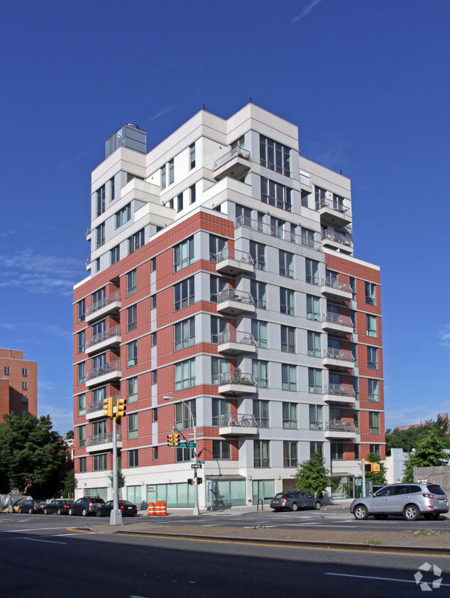

Beautiful, modern apartments with/without BALCONY ! Walk in closets ! Granite counters, gorgeous bathrooms!! Gym on-site. 24/7 doorman. Storage on site. Beautiful outdoor courtyard & rooftop with entertaining space. Package service. NO PET FEE !
110 Fourth Avenue is an apartment community located in Kings County and the 11217 ZIP Code. This area is served by the New York City Geographic District #15 attendance zone.
Unique Features
Fitness Center
Laundry Facilities
Elevator
Doorman
Washer/Dryer
Air Conditioning
Dishwasher
High Speed Internet Access
Located in northwestern Brooklyn, just south of downtown, Boerum Hill offers the serenity of a suburb and the excitement of a bustling urban environment. Residents enjoy access to a host of eclectic restaurants and unique shops strewn along the main commercial thoroughfares—Smith Street and Atlantic Avenue.
In more residential parts of the neighborhood, historic brownstones and townhouses nestle up to quiet, tree-lined streets. Boerum Hill has two sister neighborhoods, Cobble Hill and Carol Gardens, which are both situated west of Boerum Hill. The iconic Barclays Center lies just east of Boerum Hill, hosting exciting events like Brooklyn Nets basketball games, boxing matches, and concerts. Convenient subway access makes getting around from Boerum Hill easy.
Learn more about living in Boerum HillCompare neighborhood and city base rent averages by bedroom.
| Boerum Hill | Brooklyn, NY | |
|---|---|---|
| Studio | $3,376 | $2,680 |
| 1 Bedroom | $4,539 | $3,031 |
| 2 Bedrooms | $5,640 | $3,947 |
| 3 Bedrooms | $10,030 | $4,907 |
| Colleges & Universities | Distance | ||
|---|---|---|---|
| Colleges & Universities | Distance | ||
| Drive: | 4 min | 1.2 mi | |
| Drive: | 4 min | 1.2 mi | |
| Drive: | 4 min | 1.3 mi | |
| Drive: | 6 min | 1.5 mi |


Transportation options available in Brooklyn include Pacific Street, located 0.2 mile from 110 Fourth Avenue. 110 Fourth Avenue is near LaGuardia, located 10.9 miles or 22 minutes away, and Newark Liberty International, located 15.5 miles or 28 minutes away.
| Transit / Subway | Distance | ||
|---|---|---|---|
| Transit / Subway | Distance | ||
|
|
Walk: | 4 min | 0.2 mi |
|
|
Walk: | 5 min | 0.3 mi |
|
|
Walk: | 6 min | 0.3 mi |
|
|
Walk: | 7 min | 0.4 mi |
|
|
Drive: | 3 min | 1.1 mi |
| Commuter Rail | Distance | ||
|---|---|---|---|
| Commuter Rail | Distance | ||
|
|
Walk: | 7 min | 0.4 mi |
|
|
Drive: | 7 min | 2.2 mi |
|
|
Drive: | 14 min | 4.6 mi |
|
|
Drive: | 14 min | 4.7 mi |
|
|
Drive: | 20 min | 7.3 mi |
| Airports | Distance | ||
|---|---|---|---|
| Airports | Distance | ||
|
LaGuardia
|
Drive: | 22 min | 10.9 mi |
|
Newark Liberty International
|
Drive: | 28 min | 15.5 mi |
Scores provided by
Traffic
-Airport
-Businesses
-Scores provided by
HowLoud What is a Sound Score Rating? A Sound Score Rating aggregates noise caused by vehicle traffic, airplane traffic and local sources. How It WorksTime and distance from 110 Fourth Avenue.
| Shopping Centers | Distance | ||
|---|---|---|---|
| Shopping Centers | Distance | ||
| Walk: | 10 min | 0.5 mi | |
| Drive: | 6 min | 2.1 mi |
| Parks and Recreation | Distance | ||
|---|---|---|---|
| Parks and Recreation | Distance | ||
|
Gowanus Canal
|
Walk: | 17 min | 0.9 mi |
|
Cobble Hill Park
|
Drive: | 5 min | 1.2 mi |
|
Fort Greene Park
|
Drive: | 5 min | 1.4 mi |
|
Crispus Attucks Playground
|
Drive: | 5 min | 1.8 mi |
|
Commodore Barry Park
|
Drive: | 6 min | 1.9 mi |
| Hospitals | Distance | ||
|---|---|---|---|
| Hospitals | Distance | ||
| Drive: | 5 min | 1.3 mi | |
| Drive: | 6 min | 2.0 mi | |
| Drive: | 10 min | 2.9 mi |
| Military Bases | Distance | ||
|---|---|---|---|
| Military Bases | Distance | ||
| Drive: | 12 min | 5.5 mi | |
| Drive: | 14 min | 6.5 mi | |
| Drive: | 26 min | 12.9 mi |
What Are Walk Score®, Transit Score®, and Bike Score® Ratings?
Walk Score® measures the walkability of any address. Transit Score® measures access to public transit. Bike Score® measures the bikeability of any address.
What is a Sound Score Rating?
A Sound Score Rating aggregates noise caused by vehicle traffic, airplane traffic and local sources.

110 4th Ave
Brooklyn, NY 11217


