
Pioneer Endicott
141 4th St E,
Saint Paul, MN 55101
$1,137 - $2,425 Total Monthly Price
Studio - 2 Beds

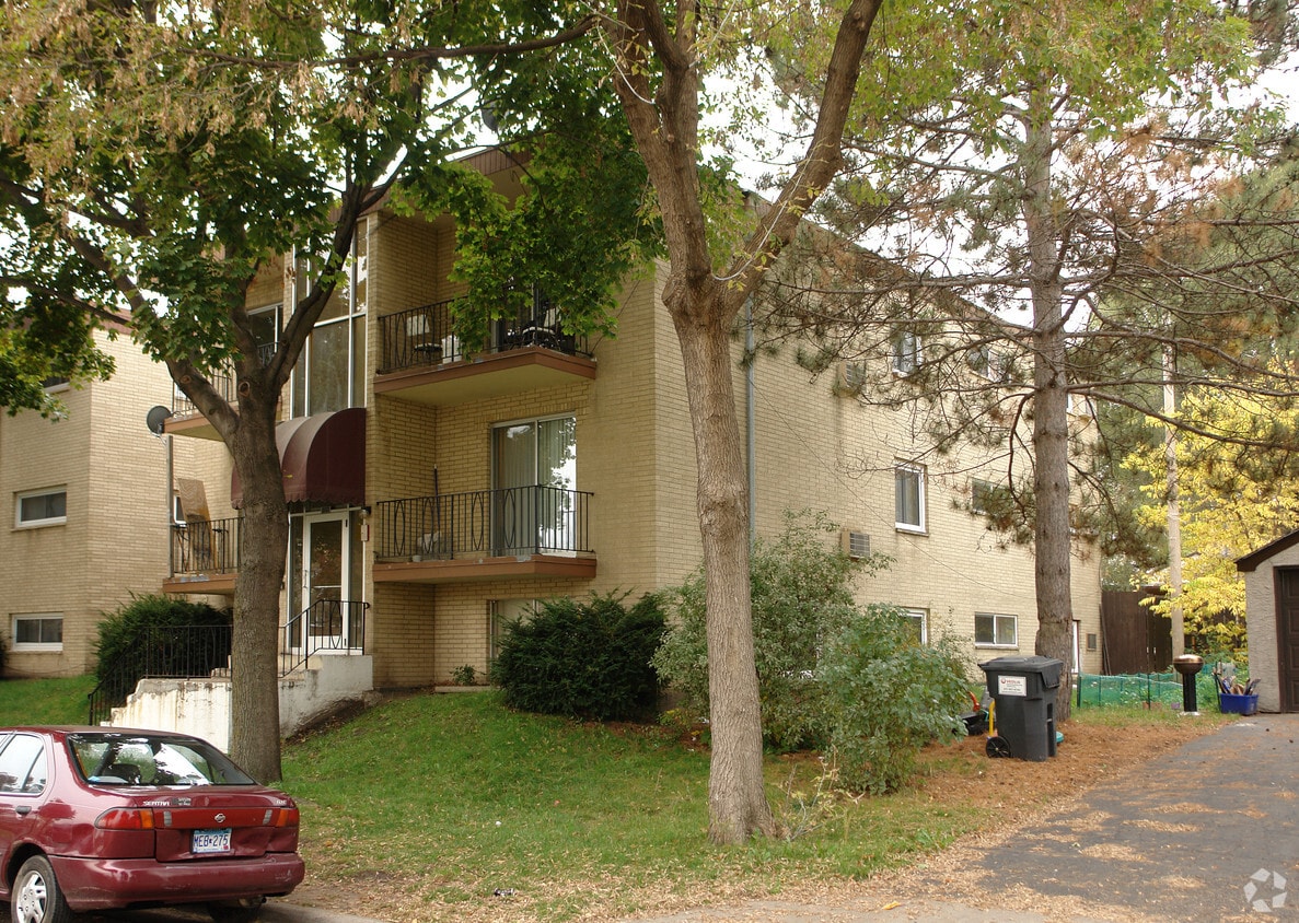
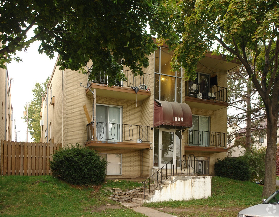
Experience St. Paul living at 1099 Burnquist St. This community is located at 1099 Burnquist St. in St. Paul. The professional leasing staff is ready to help you find the best floor plan for your lifestyle. Select from 1 to 2 bedroom apartments then schedule a tour of the community. Stop by the leasing office to schedule your tour.
1099 Burnquist St is an apartment community located in Ramsey County and the 55106 ZIP Code. This area is served by the St. Paul Public School District attendance zone.
Located just 12 miles east of the heart of Minneapolis, Payne-Phalen is large neighborhood outside of Downtown Saint Paul. While Downtown Saint Paul’s attractions and world-renowned eateries are at Payne-Phalen resident’s fingertips, cafes and a variety of restaurants can be found in the neighborhood off Payne Avenue. For shopping opportunities, residents can either travel downtown to get to Town Square Complex or stay in town to explore shopping plazas off Highway 61.
Within Payne-Phalen, family-friendly greenspaces and the lakefront Phalen Regional Park offer residents a variety of outdoor activities. Most of the neighborhood consist of residential areas, and renters will find that Payne-Phalen has a diverse rental market. From trendy lofts to quaint cottage-style homes, this neighborhood has a spot for just about every renter.
Learn more about living in Payne-PhalenCompare neighborhood and city base rent averages by bedroom.
| Payne-Phalen | Saint Paul, MN | |
|---|---|---|
| Studio | $839 | $1,145 |
| 1 Bedroom | $996 | $1,293 |
| 2 Bedrooms | $1,216 | $1,650 |
| 3 Bedrooms | $1,298 | $2,180 |
| Colleges & Universities | Distance | ||
|---|---|---|---|
| Colleges & Universities | Distance | ||
| Drive: | 5 min | 2.2 mi | |
| Drive: | 10 min | 5.3 mi | |
| Drive: | 12 min | 7.3 mi | |
| Drive: | 13 min | 7.4 mi |


Transportation options available in Saint Paul include Union Depot Station, located 3.3 miles from 1099 Burnquist St. 1099 Burnquist St is near Minneapolis-St Paul International/Wold-Chamberlain, located 12.8 miles or 22 minutes away.
| Transit / Subway | Distance | ||
|---|---|---|---|
| Transit / Subway | Distance | ||
| Drive: | 7 min | 3.3 mi | |
| Drive: | 8 min | 3.4 mi | |
| Drive: | 9 min | 3.6 mi | |
| Drive: | 8 min | 4.1 mi | |
| Drive: | 8 min | 4.3 mi |
| Commuter Rail | Distance | ||
|---|---|---|---|
| Commuter Rail | Distance | ||
|
|
Drive: | 8 min | 3.3 mi |
|
|
Drive: | 24 min | 14.1 mi |
|
|
Drive: | 23 min | 16.8 mi |
|
|
Drive: | 34 min | 24.9 mi |
|
|
Drive: | 35 min | 26.6 mi |
| Airports | Distance | ||
|---|---|---|---|
| Airports | Distance | ||
|
Minneapolis-St Paul International/Wold-Chamberlain
|
Drive: | 22 min | 12.8 mi |
Scores provided by
Traffic
-Airport
-Businesses
-Scores provided by
HowLoud What is a Sound Score Rating? A Sound Score Rating aggregates noise caused by vehicle traffic, airplane traffic and local sources. How It WorksTime and distance from 1099 Burnquist St.
| Shopping Centers | Distance | ||
|---|---|---|---|
| Shopping Centers | Distance | ||
| Walk: | 9 min | 0.5 mi | |
| Walk: | 9 min | 0.5 mi | |
| Drive: | 4 min | 2.0 mi |
| Parks and Recreation | Distance | ||
|---|---|---|---|
| Parks and Recreation | Distance | ||
|
Phalen Park
|
Drive: | 3 min | 1.2 mi |
|
Phelan Regional Park
|
Drive: | 4 min | 1.4 mi |
|
Keller Regional Park
|
Drive: | 5 min | 2.1 mi |
|
Indian Mounds Park
|
Drive: | 6 min | 2.4 mi |
|
Arlington/Arkwright Park
|
Drive: | 5 min | 2.5 mi |
| Hospitals | Distance | ||
|---|---|---|---|
| Hospitals | Distance | ||
| Drive: | 7 min | 3.5 mi | |
| Drive: | 7 min | 3.6 mi | |
| Drive: | 8 min | 3.8 mi |
| Military Bases | Distance | ||
|---|---|---|---|
| Military Bases | Distance | ||
| Drive: | 21 min | 11.5 mi |
Pets Allowed Fitness Center Pool Dishwasher Refrigerator Clubhouse Maintenance on site
High-Speed Internet Laundry Facilities
Pets Allowed Pool Dishwasher Microwave Granite Countertops
What Are Walk Score®, Transit Score®, and Bike Score® Ratings?
Walk Score® measures the walkability of any address. Transit Score® measures access to public transit. Bike Score® measures the bikeability of any address.
What is a Sound Score Rating?
A Sound Score Rating aggregates noise caused by vehicle traffic, airplane traffic and local sources.
1099 Burnquist St
Saint Paul, MN 55106


