$1,200
/ Month
109 Main Ave Unit 3
Wallington, NJ 07057
Favorites
109 Main Ave Unit 3

Favorites
Check Back Soon for Upcoming Availability
| Beds | Baths | Average SF |
|---|---|---|
| 1 Bedroom 1 Bedroom 1 Br | 1 Bath 1 Bath 1 Ba | — |
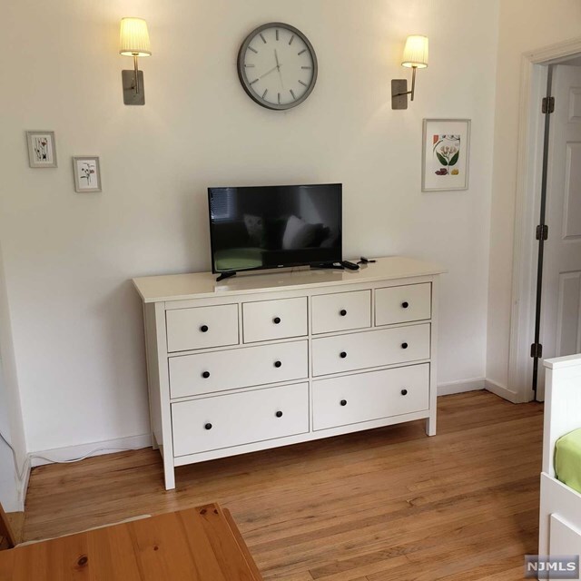
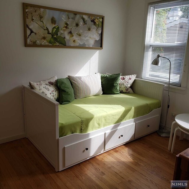
About This Property
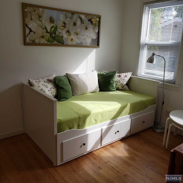
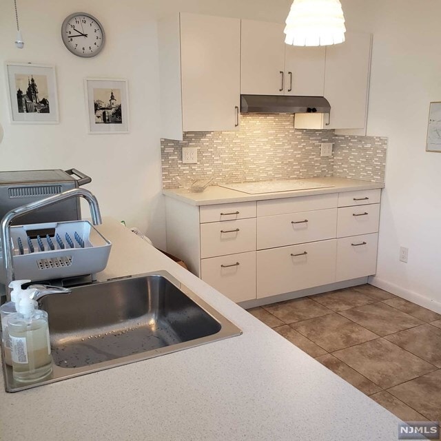
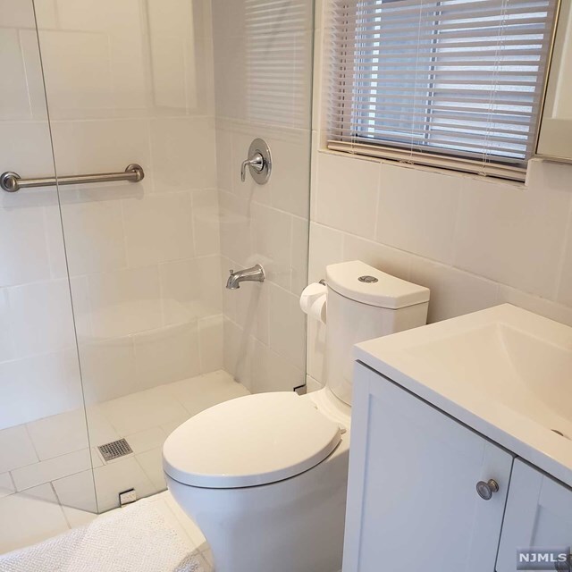
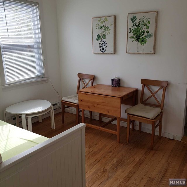
1 bdr apartment on the fist floor with use of the patio, one parking space on driveway. Washer/dryer in the basement. Entire unit recently updated. No smoking allowed of any kinds. Required: credit score over 680 FICO score, proof of income, brokers fee.
109 Main Ave is an apartment community located in Bergen County and the 07057 ZIP Code.
109 Main Ave,
Wallington,
NJ
07057
Wallington is a one-square-mile borough in Bergen County, sitting roughly 15 miles northwest of New York City, where a tight-knit small-town atmosphere meets the convenience of a major metro just outside its borders. Founded in 1895 and shaped by successive waves of Slovak and Polish settlement, the borough carries a genuine sense of history along its commercial spine on Main Avenue. Access to New Jersey Route 21 and County Route 624, along with the nearby Wesmont NJ Transit rail station, keeps commuters connected to the broader region without much effort. The Passaic and Saddle rivers run along the borough's northwestern edges, and Samuel Nelkin County Park provides a well-rounded green space with courts, dog parks, and skating. Wallington sits close to the Meadowlands Sports Complex and the Bergen Town Center, giving residents easy reach to entertainment and retail without leaving Bergen County.
Learn more about living in Wallington
Education
| Colleges & Universities | Distance | ||
|---|---|---|---|
| Colleges & Universities | Distance | ||
| Walk: | 9 min | 0.5 mi | |
| Drive: | 6 min | 1.9 mi | |
| Drive: | 5 min | 2.4 mi | |
| Drive: | 8 min | 4.6 mi |
109 Main Ave Unit 3 is within 9 minutes or 0.5 mile from Passaic County C.C., Passaic. It is also near Felician College, Lodi Campus and Felician College, Rutherford.
Transportation options available in Wallington include Tonnelle Avenue, located 8.5 miles from 109 Main Ave Unit 3. 109 Main Ave Unit 3 is near Newark Liberty International, located 15.0 miles or 19 minutes away, and LaGuardia, located 23.3 miles or 36 minutes away.
| Transit / Subway | Distance | ||
|---|---|---|---|
| Transit / Subway | Distance | ||
|
|
Drive: | 12 min | 8.5 mi |
|
|
Drive: | 13 min | 8.7 mi |
|
|
Drive: | 14 min | 9.1 mi |
|
|
Drive: | 14 min | 9.1 mi |
|
|
Drive: | 15 min | 10.9 mi |
| Commuter Rail | Distance | ||
|---|---|---|---|
| Commuter Rail | Distance | ||
|
|
Drive: | 3 min | 1.4 mi |
|
|
Drive: | 3 min | 1.6 mi |
| Drive: | 7 min | 2.6 mi | |
|
|
Drive: | 5 min | 2.9 mi |
|
|
Drive: | 6 min | 3.6 mi |
| Airports | Distance | ||
|---|---|---|---|
| Airports | Distance | ||
|
Newark Liberty International
|
Drive: | 19 min | 15.0 mi |
|
LaGuardia
|
Drive: | 36 min | 23.3 mi |
Walkability Near 109 Main Ave Wallington, NJ 07057
Getting Around
 What do Walkability, Transit, Drivability, and Bikeability mean?
Walkability measures the walking distance to day-to-day needs.
Transit measures access to public transportation.
Drivability measures congestion, parking availability, and access to major roads.
Bikeability measures the suitability for cycling.
How It Works
What do Walkability, Transit, Drivability, and Bikeability mean?
Walkability measures the walking distance to day-to-day needs.
Transit measures access to public transportation.
Drivability measures congestion, parking availability, and access to major roads.
Bikeability measures the suitability for cycling.
How It Works
Very Walkable
Walkability
80
/ 100
Some Public Transit
Transit
50
/ 100
Exceptionally Drivable
Drivability
90
/ 100
Fairly Bikeable
Bikeability
50
/ 100
Scores provided by
-
Soundscore™
-
/ 100
Traffic
-Airport
-Businesses
-Scores provided by
HowLoud What is a Sound Score Rating? A Sound Score Rating aggregates noise caused by vehicle traffic, airplane traffic and local sources. How It WorksTime and distance from 109 Main Ave Unit 3.
| Shopping Centers | Distance | ||
|---|---|---|---|
| Shopping Centers | Distance | ||
| Walk: | 17 min | 0.9 mi | |
| Walk: | 19 min | 1.0 mi | |
| Drive: | 3 min | 1.3 mi |
109 Main Ave Unit 3 has 3 shopping centers within 1.3 miles, which is about a 3-minute drive. The miles and minutes will be for the farthest away property.
| Parks and Recreation | Distance | ||
|---|---|---|---|
| Parks and Recreation | Distance | ||
|
Meadowlands Environment Center
|
Drive: | 15 min | 6.3 mi |
|
McDowell Observatory
|
Drive: | 16 min | 6.3 mi |
|
Presby Memorial Iris Gardens
|
Drive: | 12 min | 7.2 mi |
|
Richard W. DeKorte Park
|
Drive: | 15 min | 7.9 mi |
|
Teaneck Creek Conservancy
|
Drive: | 15 min | 9.3 mi |
109 Main Ave Unit 3 has 5 parks within 9.3 miles, including Meadowlands Environment Center, McDowell Observatory, and Presby Memorial Iris Gardens.
| Hospitals | Distance | ||
|---|---|---|---|
| Hospitals | Distance | ||
| Drive: | 3 min | 1.6 mi | |
| Drive: | 7 min | 4.5 mi | |
| Drive: | 10 min | 6.8 mi |
109 Main Ave Unit 3 has 3 hospitals within 6.8 miles, the nearest is St. Mary's General Hospital which is 1.6 miles away and a 3 minute drive.
| Military Bases | Distance | ||
|---|---|---|---|
| Military Bases | Distance | ||
| Drive: | 28 min | 16.6 mi | |
| Drive: | 26 min | 19.3 mi | |
| Drive: | 42 min | 27.4 mi |
109 Main Ave Unit 3 has 3 military bases within 27.4 miles, the nearest is Governors Island Support Center which is 16.6 miles away and a 28 minute drive.
You May Also Like
How do I access Social Services in New Jersey?
Statewide service is free, confidential, multilingual and always open. Three easy ways to reach Social Services in NJ: Dial 2-1-1; text your zip code to 898-211; or chat at https://www.nj211.org
Similar Rentals Nearby


What Are Walk Score®, Transit Score®, and Bike Score® Ratings?
Walk Score® measures the walkability of any address. Transit Score® measures access to public transit. Bike Score® measures the bikeability of any address.
What is a Sound Score Rating?
A Sound Score Rating aggregates noise caused by vehicle traffic, airplane traffic and local sources.
109 Main Ave
Wallington, NJ 07057