

$1,985
/ Month
10870 County Route 9
Clayton, NY 13624
Favorites
10870 County Route 9

Favorites
Check Back Soon for Upcoming Availability
| Beds | Baths | Average SF |
|---|---|---|
| 4 Bedrooms 4 Bedrooms 4 Br | 2 Baths 2 Baths 2 Ba | 1,560 SF |
About This Property
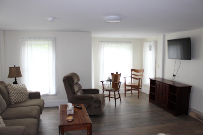
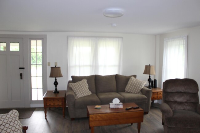
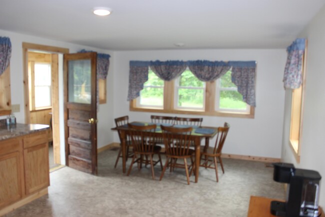
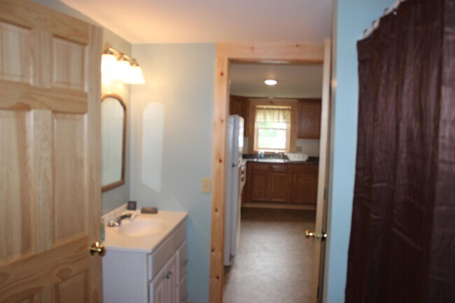
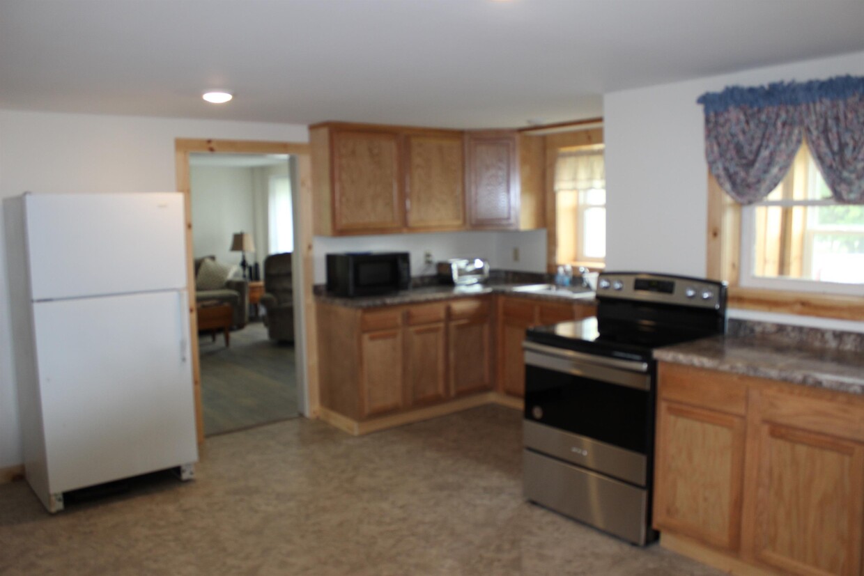
Nice fully furnished country home with plenty of space. 3 bedroom, 2 bath home with bonus room on first floor, possibly 4th bedroom or a play room for the kiddos. There isalso a nice sized kitchen, dining area, living room, with a front porch which opens into the living room. There is also a side entrance from the driveway. It has a mud room which opens up to the kitchen/eating area. Home has an electric stove, electric water heater and high efficiency furnace for the brazen winter's. There is a 250 gallon propane tank on the premises. This is on the tenant to refuel. Home has a well and septic system. The owner will mow the yard and snow plow the driveway. The kitchen comes with a microwave and a toaster oven. Place was set up to go on AirBnB/VRBO but it made more sense to rent it out, this is why it is fully furnished.
10870 County Route 9 is a house located in Jefferson County and the 13624 ZIP Code. This area is served by the Thousand Islands Central School District attendance zone.
10870 County Route 9,
Clayton,
NY
13624
Education
Schools


Public Elementary School
Grades PK-5
107 Students
Attendance Zone
Public Elementary, Middle & High School
Grades PK-12
336 Students
Nearby
Public Elementary School
Grades PK-5
243 Students
Nearby
Public Middle School
Grades 6-8
185 Students
Attendance Zone
Public High School
Grades 9-12
262 Students
Attendance Zone
Private Elementary School
Grades PK-5
Nearby
Private Middle & High School
Grades 6-12
169 Students
Nearby
School data provided by
 The GreatSchools Rating helps parents compare schools within a state based on a variety of school quality indicators and provides a helpful picture of how effectively each school serves all of its students. Ratings are on a scale of 1 (below average) to 10 (above average) and can include test scores, college readiness, academic progress, advanced courses, equity, discipline and attendance data. We also advise parents to visit schools, consider other information on school performance and programs, and consider family needs as part of the school selection process.
View GreatSchools Rating Methodology
Data provided by GreatSchools.org © 2026. All rights reserved.
View GreatSchools Rating Methodology
Data provided by GreatSchools.org © 2026. All rights reserved.
Walkability Near 10870 County Route 9 Clayton, NY 13624
Getting Around
 What do Walkability, Transit, Drivability, and Bikeability mean?
Walkability measures the walking distance to day-to-day needs.
Transit measures access to public transportation.
Drivability measures congestion, parking availability, and access to major roads.
Bikeability measures the suitability for cycling.
How It Works
What do Walkability, Transit, Drivability, and Bikeability mean?
Walkability measures the walking distance to day-to-day needs.
Transit measures access to public transportation.
Drivability measures congestion, parking availability, and access to major roads.
Bikeability measures the suitability for cycling.
How It Works
Not Walkable
Walkability
0
/ 100
Exceptionally Drivable
Drivability
100
/ 100
Somewhat Bikeable
Bikeability
20
/ 100
Scores provided by
-
Soundscore™
-
/ 100
Traffic
-Airport
-Businesses
-Scores provided by
HowLoud What is a Sound Score Rating? A Sound Score Rating aggregates noise caused by vehicle traffic, airplane traffic and local sources. How It WorksSimilar Rentals Nearby


What Are Walk Score®, Transit Score®, and Bike Score® Ratings?
Walk Score® measures the walkability of any address. Transit Score® measures access to public transit. Bike Score® measures the bikeability of any address.
What is a Sound Score Rating?
A Sound Score Rating aggregates noise caused by vehicle traffic, airplane traffic and local sources.
10870 County Route 9
Clayton, NY 13624