
$1,450 / Month
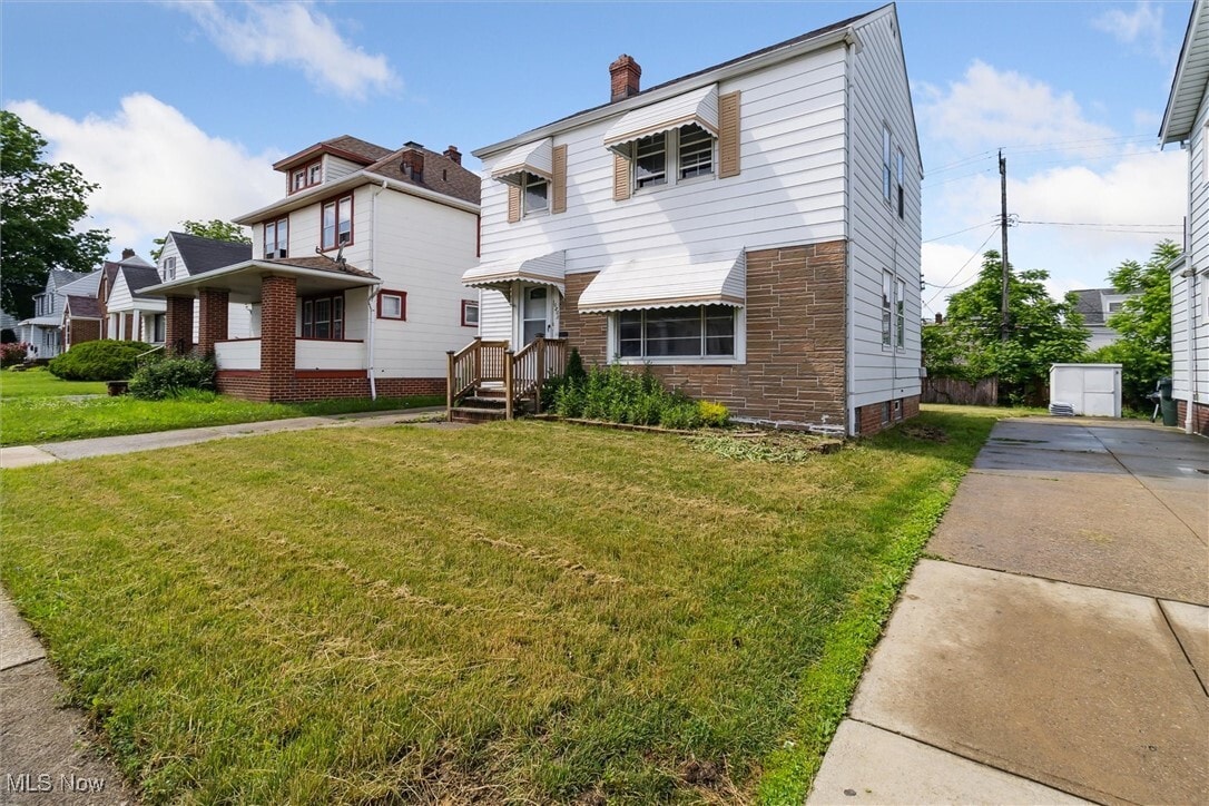
10805 Plymouth Ave
Garfield Heights, OH 44125
Today
Favorites
216-825-3577
-
Bedrooms
3
-
Bathrooms
1
-
Square Feet
--
-
Available
Available Now
Highlights
- Colonial Architecture
- Forced Air Heating and Cooling System
- 1 Car Garage
10805 Plymouth Ave

Favorites
About This Home
Available Now
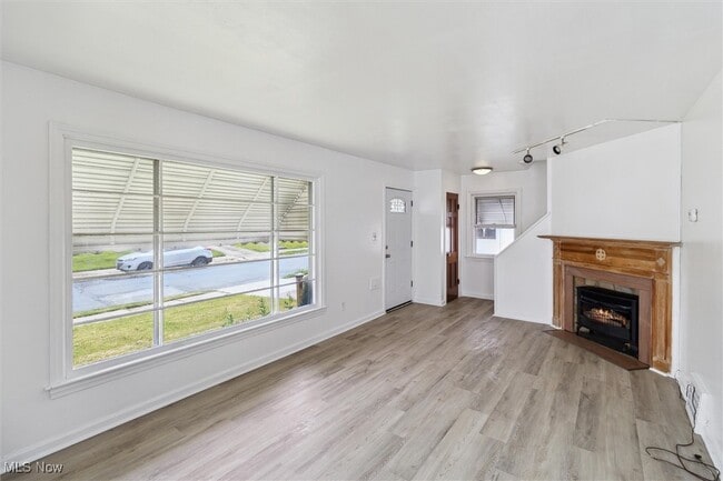
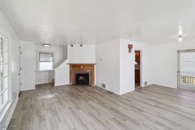
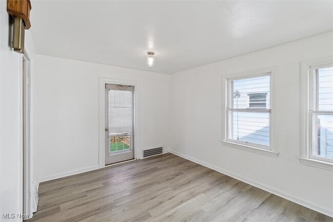
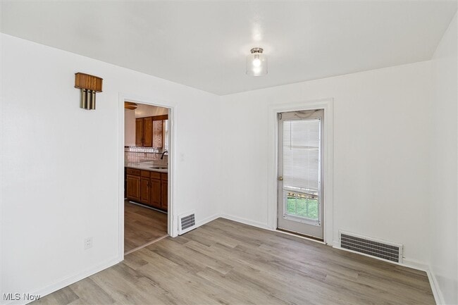
Welcome to 10805 Plymouth! The 1st floor Offers an open layout Living and Dining Space,Great Kitchen and a Large Deck Perfect for Summer Gril and Entertaining! 3 Bedrooms and a Full Bath on the 2nd Floor. Rec Room In the Basement. Home nestled in the heart of Garfield Heights,Situated on a quiet,tree-lined street,this home is minutes from Garfield Park Reservation,local schools,shopping centers,and dining options. New stove can be provided by owner for additional $35 per month. Tenant is responsible for electric,gas,water,sewer landscaping and snow removal. Easy application process,schedule a showing today!
10805 Plymouth Ave is a house located in Cuyahoga County and the 44125 ZIP Code. This area is served by the Garfield Heights City Schools attendance zone.
* Price shown is base rent and may not include non-optional fees and utilities.
Price, availability, fees, and any applicable rent special are subject to change without notice.
* Square footage definitions vary. Displayed square footage is approximate.
Home Details
Home Type
Single Family Detached Home
Year Built
Built in 1944
Bedrooms and Bathrooms
1 Full Bathroom
3 Bedrooms
Home Design
Colonial Architecture
Interior Spaces
1,100 Sq Ft Home
2-Story Property
Listing and Financial Details
Assessor Parcel Number 544-08-023
Tenant pays for all utilities
Lot Details
3,999 Sq Ft Lot
Parking
1 Car Garage
Utilities
Forced Air Heating and Cooling System
Community Details
Overview
Rosel Guarantee Realty Co Subdivision
Contact
- Listed by Avigail Y Harris | Equity Star Realty,LLC.
- Phone Number
- Contact
-
Source
 MLS Now
Copyright 2025 © MLS Now. All rights reserved.
Location
Get Directions
Located just ten miles south of Cleveland, Garfield Heights offers residents the best of suburban living on the outskirts of a big city. Convenience to multiple freeways makes commuting from Garfield Heights a breeze. Access to Garfield Park Reservation, Bacci Park, and the Cuyahoga River offers a host of opportunities for outdoor recreation near Garfield Heights at any moment.
Garfield Heights is also close to numerous golf courses in addition to major attractions like the Cleveland Metroparks Zoo and Cuyahoga Valley National Park. The commercial corridor in Garfield Heights stretches along Turney Road, with a variety of retailers, shops, and restaurants. Garfield Heights residents can also venture into Downtown Cleveland to catch a sporting event at Quicken Loans Arena or Progressive Field, peruse Tower City Center, and purchase fresh meat and produce at the West Side Market.
Learn more about living in Garfield Heights
Education
| Colleges & Universities | Distance | ||
|---|---|---|---|
| Colleges & Universities | Distance | ||
| Drive: | 17 min | 7.5 mi | |
| Drive: | 16 min | 7.5 mi | |
| Drive: | 13 min | 7.8 mi | |
| Drive: | 15 min | 8.3 mi |
10805 Plymouth Ave is within 13 minutes or 7.8 miles from Cuyahoga C.C., Metropolitan. It is also near Case Western Reserve and Cuyahoga C.C., East.
Schools


Public Elementary School
Grades K-5
323 Students
Attendance Zone
Public Elementary School
Grades PK-5
511 Students
Nearby
Public Middle School
Grades 6-8
746 Students
Attendance Zone
Public High School
Grades 9-12
1,109 Students
Attendance Zone
Private Elementary & Middle School
Grades PK-8
245 Students
Nearby
Private High School
Grades 9-12
355 Students
Nearby
School data provided by
 The GreatSchools Rating helps parents compare schools within a state based on a variety of school quality indicators and provides a helpful picture of how effectively each school serves all of its students. Ratings are on a scale of 1 (below average) to 10 (above average) and can include test scores, college readiness, academic progress, advanced courses, equity, discipline and attendance data. We also advise parents to visit schools, consider other information on school performance and programs, and consider family needs as part of the school selection process.
View GreatSchools Rating Methodology
Data provided by GreatSchools.org © 2025. All rights reserved.
View GreatSchools Rating Methodology
Data provided by GreatSchools.org © 2025. All rights reserved.
Transportation options available in Garfield Heights include Van Aken & Lee Station, located 5.4 miles from 10805 Plymouth Ave. 10805 Plymouth Ave is near Cleveland-Hopkins International, located 14.7 miles or 25 minutes away.
| Transit / Subway | Distance | ||
|---|---|---|---|
| Transit / Subway | Distance | ||
| Drive: | 13 min | 5.4 mi | |
| Drive: | 14 min | 5.7 mi | |
| Drive: | 14 min | 5.9 mi | |
| Drive: | 14 min | 6.0 mi | |
| Drive: | 15 min | 6.1 mi |
| Commuter Rail | Distance | ||
|---|---|---|---|
| Commuter Rail | Distance | ||
| Drive: | 8 min | 3.4 mi | |
| Drive: | 11 min | 5.1 mi | |
|
|
Drive: | 21 min | 10.9 mi |
| Drive: | 22 min | 11.3 mi | |
|
Boston Mill
|
Drive: | 30 min | 17.5 mi |
| Airports | Distance | ||
|---|---|---|---|
| Airports | Distance | ||
|
Cleveland-Hopkins International
|
Drive: | 25 min | 14.7 mi |
Time and distance from 10805 Plymouth Ave.
| Shopping Centers | Distance | ||
|---|---|---|---|
| Shopping Centers | Distance | ||
| Walk: | 5 min | 0.3 mi | |
| Drive: | 4 min | 1.5 mi | |
| Drive: | 8 min | 3.5 mi |
10805 Plymouth Ave has 3 shopping centers within 3.5 miles, which is about a 8-minute walk. The miles and minutes will be for the farthest away property.
| Parks and Recreation | Distance | ||
|---|---|---|---|
| Parks and Recreation | Distance | ||
|
Garfield Park Nature Center
|
Drive: | 4 min | 1.7 mi |
|
CanalWay Center
|
Drive: | 11 min | 4.6 mi |
|
Ohio & Erie Canal Reservation
|
Drive: | 9 min | 4.8 mi |
|
Bedford Reservation
|
Drive: | 14 min | 5.7 mi |
|
Nature Center at Shaker Lakes
|
Drive: | 16 min | 6.8 mi |
10805 Plymouth Ave has 5 parks within 6.8 miles, including Garfield Park Nature Center, Ohio & Erie Canal Reservation, and CanalWay Center.
| Hospitals | Distance | ||
|---|---|---|---|
| Hospitals | Distance | ||
| Walk: | 13 min | 0.7 mi | |
| Drive: | 12 min | 5.0 mi | |
| Drive: | 12 min | 6.3 mi |
10805 Plymouth Ave has 3 hospitals within 6.3 miles, the nearest is Marymount Hospital which is 0.7 mile away and a 13 minute walk.
| Military Bases | Distance | ||
|---|---|---|---|
| Military Bases | Distance | ||
| Drive: | 96 min | 78.8 mi | |
| Drive: | 106 min | 86.7 mi |
10805 Plymouth Ave is 78.8 miles from Mansfield Lahm Airport Air Guard Station, and is convenient to other military bases, including Camp Perry Air Guard Station.
You May Also Like
Similar Rentals Nearby


What Are Walk Score®, Transit Score®, and Bike Score® Ratings?
Walk Score® measures the walkability of any address. Transit Score® measures access to public transit. Bike Score® measures the bikeability of any address.
What is a Sound Score Rating?
A Sound Score Rating aggregates noise caused by vehicle traffic, airplane traffic and local sources

10805 Plymouth Ave
Garfield Heights, OH 44125