$2,200
Total Monthly Price
1080 Aileen St Unit G. Beans
Oakland, CA 94608
Favorites
1080 Aileen St Unit G. Beans

Favorites
Check Back Soon for Upcoming Availability
| Beds | Baths | Average SF |
|---|---|---|
| 2 Bedrooms 2 Bedrooms 2 Br | 1 Bath 1 Bath 1 Ba | 756 SF |
Fees and Policies
The fees listed below are community-provided and may exclude utilities or add-ons. All payments are made directly to the property and are non-refundable unless otherwise specified.
- Cats Allowed
-
Fees not specified
-
Weight limit--
-
Pet Limit--
- Parking
-
Surface Lot--
Details
Utilities Included
-
Trash Removal
-
Sewer
Property Information
-
3 units
About This Property
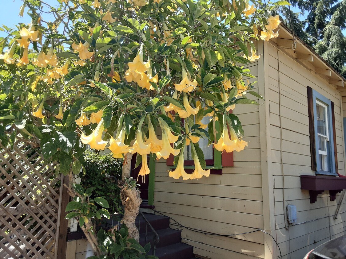
Secluded Cottage in desirable Gaskil Street neighborhood on Emeryville/Oakland border. 2bdrms, 1 bath, yard, off street parking. Close to colleges, shopping and transportation: UC Berkeley, Lincoln University, JFK University, walk to Ashby BART, Emeryville Marina, Trader Joe's, Ike's, Safeway, Gazalli's, Target, Pizza, Arizmendi Bakery, Stanford Health.
1080 Aileen St is an apartment community located in Alameda County and the 94608 ZIP Code.
Apartment Features
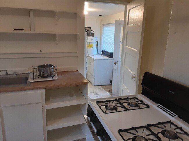
Washer/Dryer
Refrigerator
Tub/Shower
Tile Floors
- Washer/Dryer
- Heating
- Smoke Free
- Cable Ready
- Tub/Shower
- Eat-in Kitchen
- Kitchen
- Oven
- Range
- Refrigerator
- Tile Floors
- Dining Room
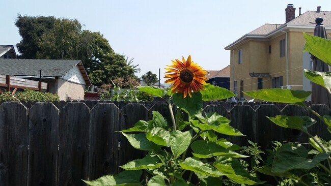
- Yard
- Garden
1080 Aileen St,
Oakland,
CA
94608
Oakland sits on the eastern shore of San Francisco Bay, anchored by Lake Merritt—the nation's first official wildlife refuge—and backed by redwood-covered hills that stretch toward the horizon. As the county seat of Alameda County and a major port city, Oakland carries real economic weight in the Bay Area, drawing employers in technology, healthcare, logistics, and the arts. California College of the Arts and Mills College contribute to a strong creative and academic presence that shapes the city's character.
Neighborhoods here cover a wide range of personalities. Rockridge offers tree-lined streets and walkable retail along College Avenue, while Temescal draws those who want a lively, arts-forward atmosphere. Uptown sits close to the historic Fox Theater and Paramount Theatre, and Jack London Square puts residents at the waterfront with ferry access to San Francisco. The Oakland Hills neighborhoods like Montclair offer sweeping Bay views and proximity to regional parks.
Learn more about living in OaklandBelow are rent ranges for similar nearby apartments
Amenities
- Washer/Dryer
- Heating
- Smoke Free
- Cable Ready
- Tub/Shower
- Eat-in Kitchen
- Kitchen
- Oven
- Range
- Refrigerator
- Tile Floors
- Dining Room
- Yard
- Garden
Expenses
Utilities Included
Trash Removal, Sewer
Included
Education
| Colleges & Universities | Distance | ||
|---|---|---|---|
| Colleges & Universities | Distance | ||
| Drive: | 6 min | 2.1 mi | |
| Drive: | 8 min | 2.6 mi | |
| Drive: | 7 min | 2.8 mi | |
| Drive: | 12 min | 3.8 mi |
1080 Aileen St Unit G. Beans is within 6 minutes or 2.1 miles from Samuel Merritt University. It is also near Berkeley City College and Lincoln University, Oakland.
Transportation options available in Oakland include Ashby Station, located 1.4 miles from 1080 Aileen St Unit G. Beans. 1080 Aileen St Unit G. Beans is near Metro Oakland International, located 12.1 miles or 20 minutes away, and San Francisco International, located 22.1 miles or 34 minutes away.
| Transit / Subway | Distance | ||
|---|---|---|---|
| Transit / Subway | Distance | ||
|
|
Drive: | 4 min | 1.4 mi |
|
|
Drive: | 7 min | 2.3 mi |
|
|
Drive: | 6 min | 2.5 mi |
|
|
Drive: | 8 min | 2.8 mi |
|
|
Drive: | 7 min | 3.1 mi |
| Commuter Rail | Distance | ||
|---|---|---|---|
| Commuter Rail | Distance | ||
| Walk: | 14 min | 0.7 mi | |
|
|
Drive: | 5 min | 3.0 mi |
|
|
Drive: | 8 min | 3.6 mi |
| Drive: | 14 min | 9.2 mi | |
| Drive: | 16 min | 9.7 mi |
| Airports | Distance | ||
|---|---|---|---|
| Airports | Distance | ||
|
Metro Oakland International
|
Drive: | 20 min | 12.1 mi |
|
San Francisco International
|
Drive: | 34 min | 22.1 mi |
Walkability Near 1080 Aileen St Oakland, CA 94608
Getting Around
 What do Walkability, Transit, Drivability, and Bikeability mean?
Walkability measures the walking distance to day-to-day needs.
Transit measures access to public transportation.
Drivability measures congestion, parking availability, and access to major roads.
Bikeability measures the suitability for cycling.
How It Works
What do Walkability, Transit, Drivability, and Bikeability mean?
Walkability measures the walking distance to day-to-day needs.
Transit measures access to public transportation.
Drivability measures congestion, parking availability, and access to major roads.
Bikeability measures the suitability for cycling.
How It Works
Moderately Walkable
Walkability
70
/ 100
Strong Public Transit
Transit
80
/ 100
Moderately Drivable
Drivability
70
/ 100
Moderately Bikeable
Bikeability
70
/ 100
Scores provided by
-
Soundscore™
-
/ 100
Traffic
-Airport
-Businesses
-Scores provided by
HowLoud What is a Sound Score Rating? A Sound Score Rating aggregates noise caused by vehicle traffic, airplane traffic and local sources. How It WorksTime and distance from 1080 Aileen St Unit G. Beans.
| Shopping Centers | Distance | ||
|---|---|---|---|
| Shopping Centers | Distance | ||
| Walk: | 10 min | 0.5 mi | |
| Walk: | 17 min | 0.9 mi | |
| Drive: | 6 min | 1.9 mi |
1080 Aileen St Unit G. Beans has 3 shopping centers within 1.9 miles, which is about a 6-minute drive. The miles and minutes will be for the farthest away property.
| Parks and Recreation | Distance | ||
|---|---|---|---|
| Parks and Recreation | Distance | ||
|
San Francisco Bay Trail (at Emeryville)
|
Drive: | 4 min | 1.6 mi |
|
Strawberry Creek Park
|
Drive: | 6 min | 2.2 mi |
|
Willard Park
|
Drive: | 7 min | 2.4 mi |
|
Habitot Children's Museum
|
Drive: | 8 min | 2.5 mi |
|
People's Park
|
Drive: | 9 min | 2.8 mi |
1080 Aileen St Unit G. Beans has 5 parks within 2.8 miles, including San Francisco Bay Trail (at Emeryville), Strawberry Creek Park, and Willard Park.
| Hospitals | Distance | ||
|---|---|---|---|
| Hospitals | Distance | ||
| Walk: | 19 min | 1.0 mi | |
| Drive: | 6 min | 2.1 mi | |
| Drive: | 6 min | 2.1 mi |
1080 Aileen St Unit G. Beans has 3 hospitals within 2.1 miles, the nearest is Children's Hospital & Research Center Oakland which is 1.0 mile away and a 19 minute walk.
| Military Bases | Distance | ||
|---|---|---|---|
| Military Bases | Distance | ||
| Drive: | 13 min | 5.1 mi | |
| Drive: | 15 min | 6.3 mi | |
| Drive: | 16 min | 6.5 mi |
1080 Aileen St Unit G. Beans has 3 military bases within 6.5 miles, the nearest is Oakland Army Base which is 5.1 miles away and a 13 minute drive.
You May Also Like
Similar Rentals Nearby
-
-
2 Beds$5,130Total Monthly Price12 Month LeaseTotal Monthly Price NewPrices include base rent and required monthly fees. Variable costs based on usage may apply.Specials
Pets Allowed Fitness Center In Unit Washer & Dryer Stainless Steel Appliances Business Center Package Service Elevator
-
-
-
-
-
-
-
-


What Are Walk Score®, Transit Score®, and Bike Score® Ratings?
Walk Score® measures the walkability of any address. Transit Score® measures access to public transit. Bike Score® measures the bikeability of any address.
What is a Sound Score Rating?
A Sound Score Rating aggregates noise caused by vehicle traffic, airplane traffic and local sources.

1080 Aileen St
Oakland, CA 94608