

$1,695
/ Month
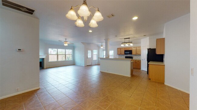
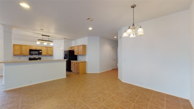
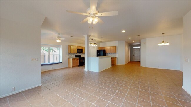
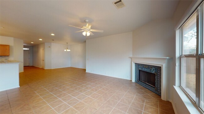
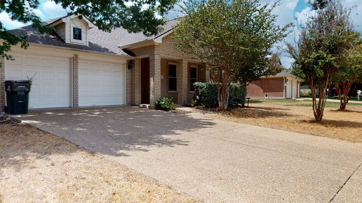
107 Hoot Owl Ln N
Leander, TX 78641
Favorites
-
Bedrooms
3
-
Bathrooms
2
-
Square Feet
1,757 sq ft
107 Hoot Owl Ln N

Favorites
Contact
- Listed by Locayt
Location
Get Directions
Located 22 miles northwest of Austin, Leander combines Hill Country scenery with suburban living. The city features established neighborhoods like Mason Creek, Travisso, and Crystal Falls, each offering their own mix of housing options from single-family homes to townhouses.
Parks and outdoor spaces define Leander's landscape, including Benbrook Ranch Park's skating facilities and Robin Bledsoe Park's pool and sports courts. The city's natural limestone formations and rolling hills provide scenic backdrops for hiking and biking trails throughout the area.
Archaeological significance adds to Leander's character, as the site of the "Leanderthal Lady" discovery represents one of North America's oldest burial sites. The MetroRail Red Line's Leander Station connects residents to downtown Austin, while major thoroughfares provide access to the region's employment centers.
Learn more about living in Leander
Education
| Colleges & Universities | Distance | ||
|---|---|---|---|
| Colleges & Universities | Distance | ||
| Drive: | 16 min | 12.1 mi | |
| Drive: | 24 min | 15.2 mi | |
| Drive: | 24 min | 17.6 mi | |
| Drive: | 27 min | 18.0 mi |
107 Hoot Owl Ln N is within 16 minutes or 12.1 miles from Austin C.C., Cypress Creek. It is also near Southwestern University and Austin C.C., Round Rock Campus.
Transportation options available in Leander include Leander Station, located 3.3 miles from 107 Hoot Owl Ln N. 107 Hoot Owl Ln N is near Robert Gray AAF, located 36.6 miles or 57 minutes away, and Austin-Bergstrom International, located 39.9 miles or 52 minutes away.
| Transit / Subway | Distance | ||
|---|---|---|---|
| Transit / Subway | Distance | ||
| Drive: | 5 min | 3.3 mi |
| Commuter Rail | Distance | ||
|---|---|---|---|
| Commuter Rail | Distance | ||
|
|
Drive: | 35 min | 28.8 mi |
|
|
Drive: | 48 min | 40.2 mi |
| Airports | Distance | ||
|---|---|---|---|
| Airports | Distance | ||
|
Robert Gray AAF
|
Drive: | 57 min | 36.6 mi |
|
Austin-Bergstrom International
|
Drive: | 52 min | 39.9 mi |
Getting Around
 What do Walkability, Transit, Drivability, and Bikeability mean?
Walkability measures the walking distance to day-to-day needs.
Transit measures access to public transportation.
Drivability measures congestion, parking availability, and access to major roads.
Bikeability measures the suitability for cycling.
How It Works
What do Walkability, Transit, Drivability, and Bikeability mean?
Walkability measures the walking distance to day-to-day needs.
Transit measures access to public transportation.
Drivability measures congestion, parking availability, and access to major roads.
Bikeability measures the suitability for cycling.
How It Works
Somewhat Walkable
Walkability
20
/ 100
Minimal Public Transit
Transit
0
/ 100
Exceptionally Drivable
Drivability
100
/ 100
Somewhat Bikeable
Bikeability
30
/ 100
Scores provided by
-
Soundscore™
-
/ 100
Traffic
-Airport
-Businesses
-Scores provided by
HowLoud What is a Sound Score Rating? A Sound Score Rating aggregates noise caused by vehicle traffic, airplane traffic and local sources. How It WorksTime and distance from 107 Hoot Owl Ln N.
| Shopping Centers | Distance | ||
|---|---|---|---|
| Shopping Centers | Distance | ||
| Walk: | 3 min | 0.2 mi | |
| Drive: | 2 min | 1.4 mi | |
| Drive: | 4 min | 2.2 mi |
107 Hoot Owl Ln N has 3 shopping centers within 2.2 miles, which is about a 4-minute drive. The miles and minutes will be for the farthest away property.
| Parks and Recreation | Distance | ||
|---|---|---|---|
| Parks and Recreation | Distance | ||
|
Garey Park
|
Drive: | 18 min | 8.3 mi |
|
Austin Steam Train
|
Drive: | 11 min | 8.8 mi |
107 Hoot Owl Ln N has 2 parks within 8.8 miles, including Garey Park, and Austin Steam Train.
| Hospitals | Distance | ||
|---|---|---|---|
| Hospitals | Distance | ||
| Drive: | 12 min | 8.7 mi |
107 Hoot Owl Ln N is 8.7 miles and a 12 minute drive from Cedar Park Regional Medical Center.
| Military Bases | Distance | ||
|---|---|---|---|
| Military Bases | Distance | ||
| Drive: | 62 min | 47.8 mi |
107 Hoot Owl Ln N is 47.8 miles and a 62 minute drive from Fort Hood.
You May Also Like
Similar Rentals Nearby
-
-

-

-

-

-

-
 4 Beds, 2 Baths, 1,781 sq ft$2,450Total Monthly PriceTotal Monthly Price NewPrices include all required monthly fees.201 Merrick Rd
 -
 3 Beds, 3 Baths, 1,570 sq ft$1,850Total Monthly Price12 Month LeaseTotal Monthly Price NewPrices include all required monthly fees.73 Verde Ranch Loop
 -
 4 Beds, 3 Baths, 2,267 sq ft$2,100Total Monthly Price12 Month LeaseTotal Monthly Price NewPrices include all required monthly fees.2105 Tiger Trail Unit 103
 -
 3 Beds, 2 Baths, 1,562 sq ft$2,000Total Monthly Price12 Month LeaseTotal Monthly Price NewPrices include all required monthly fees.6044 Urbano Bnd Unit 147
What Are Walk Score®, Transit Score®, and Bike Score® Ratings?
Walk Score® measures the walkability of any address. Transit Score® measures access to public transit. Bike Score® measures the bikeability of any address.
What is a Sound Score Rating?
A Sound Score Rating aggregates noise caused by vehicle traffic, airplane traffic and local sources.
107 Hoot Owl Ln N
Leander, TX 78641