$1,600
/ Month
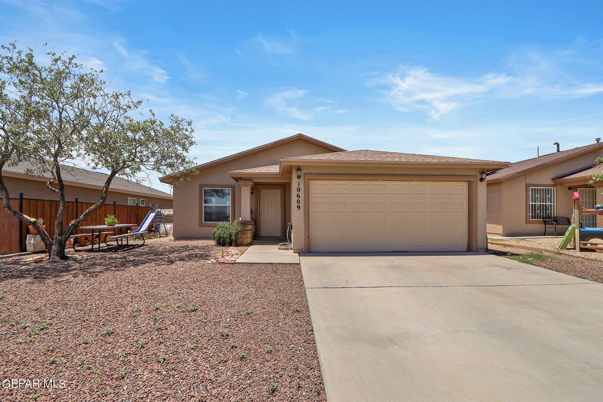
10609 Canyon Sage Dr
El Paso, TX 79924
Favorites
10609 Canyon Sage Dr

Favorites
Check Back Soon for Upcoming Availability
| Beds | Baths | Average SF |
|---|---|---|
| 4 Bedrooms 4 Bedrooms 4 Br | 2 Baths 2 Baths 2 Ba | 1,324 SF |
About This Property
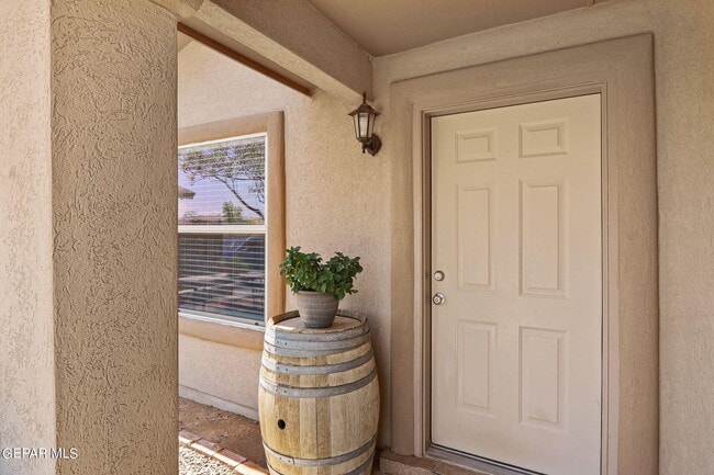
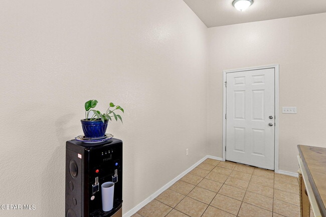
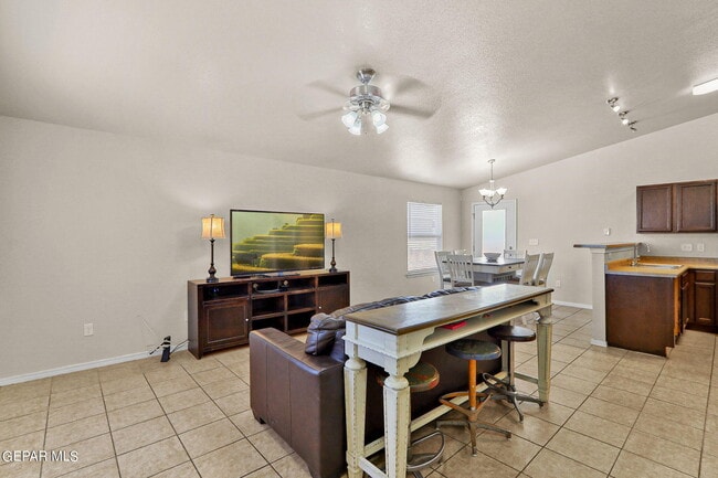
Looking for a comfortable and energy-efficient home? Single story 4-bedroom and 2 bath home with Refrigerated Air, and solar panels. Cozy kitchen with stainless steel appliances including refrigerator. A big open living area connects the dining area and kitchen. The large master bedroom has its own bathroom. Tile flooring throughout the house. The park across the street provides a great space for recreation and relaxation. Great location minutes away from schools, shopping centers, parks, library, restaurants & hospital. Easy access to the 54 provides an easy commute to Fort Bliss. Credit, criminal, and rental history reports for all occupants over the age of 18 are required. $50 Non-Refundable application fee for each applicant. Animals with landlords' approval. $300 non-refundable animal fee each. Property is currently occupied. A lease can begin after August 5, 2024.
10609 Canyon Sage Dr is a house located in El Paso County and the 79924 ZIP Code. This area is served by the Ysleta Independent School District attendance zone.
House Features
Microwave
Refrigerator
Tile Floors
Ceiling Fans
- Ceiling Fans
- Microwave
- Refrigerator
- Tile Floors
10609 Canyon Sage Dr,
El Paso,
TX
79924
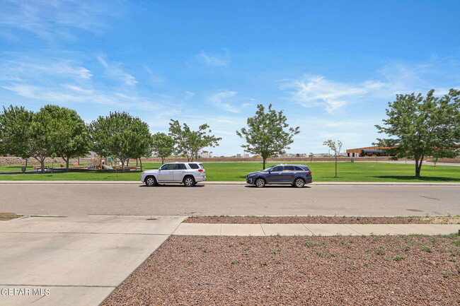
El Paso sits where West Texas, New Mexico, and the Mexican state of Chihuahua converge, giving the city a cross-border identity that shapes everything from its architecture to its daily rhythm. With the Franklin Mountains rising inside city limits and the Rio Grande forming its southern edge, the geography alone sets it apart from anywhere else in Texas. Fort Bliss, one of the largest U.S. Army installations in the country, and the University of Texas at El Paso are two of the city's most significant economic and institutional anchors. The Chamizal National Memorial marks the site of a peacefully resolved international border dispute, a piece of history few American cities can claim.
Neighborhoods range widely in character. Manhattan Heights offers historic homes close to downtown, while Northeast El Paso spreads out with newer residential development near Fort Bliss. Kern Place, adjacent to UTEP's campus, has an established, walkable feel.
Learn more about living in El Paso
Amenities
- Ceiling Fans
- Microwave
- Refrigerator
- Tile Floors
Education
| Colleges & Universities | Distance | ||
|---|---|---|---|
| Colleges & Universities | Distance | ||
| Drive: | 14 min | 5.8 mi | |
| Drive: | 28 min | 15.2 mi | |
| Drive: | 31 min | 15.7 mi | |
| Drive: | 27 min | 16.5 mi |
10609 Canyon Sage Dr is within 14 minutes or 5.8 miles from El Paso C.C., Transmountain. It is also near UT El Paso and El Paso C.C., Valle Verde.
Schools


Public Elementary School
Grades PK-5
589 Students
Attendance Zone
Public Middle School
Grades 6-8
1,166 Students
Attendance Zone
Public High School
Grades 9-12
1,674 Students
Attendance Zone
Private Elementary, Middle & High School
Grades PK-12
85 Students
Nearby
Private Elementary & Middle School
Grades PK-8
Nearby
School data provided by
 The GreatSchools Rating helps parents compare schools within a state based on a variety of school quality indicators and provides a helpful picture of how effectively each school serves all of its students. Ratings are on a scale of 1 (below average) to 10 (above average) and can include test scores, college readiness, academic progress, advanced courses, equity, discipline and attendance data. We also advise parents to visit schools, consider other information on school performance and programs, and consider family needs as part of the school selection process.
View GreatSchools Rating Methodology
Data provided by GreatSchools.org © 2026. All rights reserved.
View GreatSchools Rating Methodology
Data provided by GreatSchools.org © 2026. All rights reserved.
Walkability Near 10609 Canyon Sage Dr El Paso, TX 79924
Getting Around
 What do Walkability, Transit, Drivability, and Bikeability mean?
Walkability measures the walking distance to day-to-day needs.
Transit measures access to public transportation.
Drivability measures congestion, parking availability, and access to major roads.
Bikeability measures the suitability for cycling.
How It Works
What do Walkability, Transit, Drivability, and Bikeability mean?
Walkability measures the walking distance to day-to-day needs.
Transit measures access to public transportation.
Drivability measures congestion, parking availability, and access to major roads.
Bikeability measures the suitability for cycling.
How It Works
Somewhat Walkable
Walkability
20
/ 100
Minimal Public Transit
Transit
10
/ 100
Exceptionally Drivable
Drivability
90
/ 100
Somewhat Bikeable
Bikeability
30
/ 100
Scores provided by
-
Soundscore™
-
/ 100
Traffic
-Airport
-Businesses
-Scores provided by
HowLoud What is a Sound Score Rating? A Sound Score Rating aggregates noise caused by vehicle traffic, airplane traffic and local sources. How It WorksYou May Also Like
Similar Rentals Nearby
-
-

-

-

-

-

-

-

-
 4 Beds, 3 Baths, 1,881 sq ft$1,890Total Monthly Price12 Month LeaseTotal Monthly Price NewPrices include all required monthly fees.3629 Cave Palm Pl
 -
 4 Beds, 3 Baths, 1,929 sq ft$2,400Total Monthly Price12 Month LeaseTotal Monthly Price NewPrices include all required monthly fees.6763 Dakota Ridge Dr

What Are Walk Score®, Transit Score®, and Bike Score® Ratings?
Walk Score® measures the walkability of any address. Transit Score® measures access to public transit. Bike Score® measures the bikeability of any address.
What is a Sound Score Rating?
A Sound Score Rating aggregates noise caused by vehicle traffic, airplane traffic and local sources.

10609 Canyon Sage Dr
El Paso, TX 79924