
98-10-9863 63rd Rd
98-10-9863 63rd Rd,
rego park, NY 11375
$3,300
1 Bed
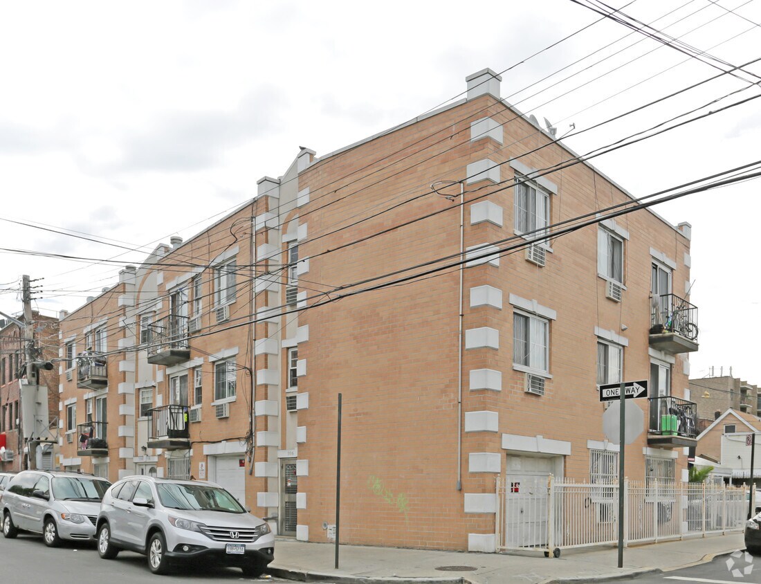
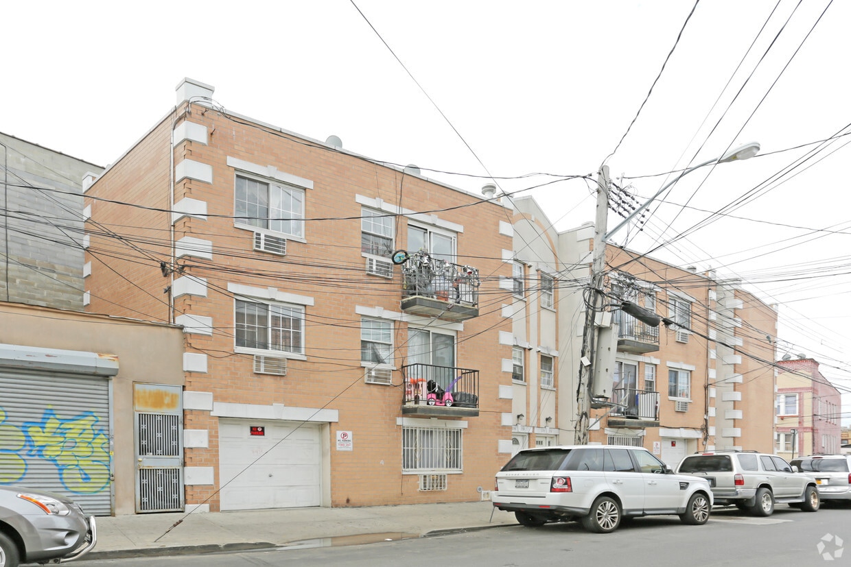

Experience Corona living at 10602-10608 53rd Ave. This property is situated in the 11368 area of Corona. The professional leasing team is available to help you find your dream apartment. Give us a call now to learn more about our community.
10602-10608 53rd Ave is an apartment community located in Queens County and the 11368 ZIP Code. This area is served by the New York City Geographic District #24 attendance zone.
Corona is a Queens neighborhood where nearly a century of immigration has layered Latin American culture over earlier Italian and African-American roots, producing a streetscape that feels nothing like the rest of New York City. Sitting just west of Flushing Meadows-Corona Park, the area gives residents direct access to 1,255 acres that include the Queens Museum, the New York Hall of Science, and Meadow Lake. The Unisphere, a 140-foot steel globe built for the 1964 World's Fair, still stands at the park's center as one of the most recognizable landmarks in the borough. Corona borders Jackson Heights to the west and Flushing to the east, placing renters within easy reach of two of Queens' most active commercial corridors. The IRT Flushing Line 7 train connects the neighborhood to Midtown Manhattan in roughly 30 minutes. Louis Armstrong lived here for nearly three decades, and Lemon Ice King of Corona has been serving Italian ice on 108th Street since 1944.
Learn more about living in Corona| Colleges & Universities | Distance | ||
|---|---|---|---|
| Colleges & Universities | Distance | ||
| Drive: | 6 min | 2.8 mi | |
| Drive: | 9 min | 5.1 mi | |
| Drive: | 11 min | 5.3 mi | |
| Drive: | 9 min | 5.6 mi |


Transportation options available in Corona include 103 Street-Corona Plaza, located 0.8 mile from 10602-10608 53rd Ave. 10602-10608 53rd Ave is near LaGuardia, located 3.0 miles or 8 minutes away, and John F Kennedy International, located 9.4 miles or 13 minutes away.
| Transit / Subway | Distance | ||
|---|---|---|---|
| Transit / Subway | Distance | ||
|
|
Walk: | 14 min | 0.8 mi |
|
|
Walk: | 15 min | 0.8 mi |
|
|
Drive: | 3 min | 1.3 mi |
|
|
Drive: | 4 min | 1.4 mi |
|
|
Drive: | 3 min | 1.5 mi |
| Commuter Rail | Distance | ||
|---|---|---|---|
| Commuter Rail | Distance | ||
|
|
Drive: | 5 min | 1.7 mi |
|
|
Drive: | 7 min | 2.4 mi |
|
|
Drive: | 6 min | 2.5 mi |
|
|
Drive: | 7 min | 3.1 mi |
|
|
Drive: | 7 min | 3.3 mi |
| Airports | Distance | ||
|---|---|---|---|
| Airports | Distance | ||
|
LaGuardia
|
Drive: | 8 min | 3.0 mi |
|
John F Kennedy International
|
Drive: | 13 min | 9.4 mi |
Scores provided by
Traffic
-Airport
-Businesses
-Scores provided by
HowLoud What is a Sound Score Rating? A Sound Score Rating aggregates noise caused by vehicle traffic, airplane traffic and local sources. How It WorksTime and distance from 10602-10608 53rd Ave.
| Shopping Centers | Distance | ||
|---|---|---|---|
| Shopping Centers | Distance | ||
| Walk: | 9 min | 0.5 mi | |
| Walk: | 11 min | 0.6 mi | |
| Walk: | 13 min | 0.7 mi |
| Parks and Recreation | Distance | ||
|---|---|---|---|
| Parks and Recreation | Distance | ||
|
Queens Zoo
|
Walk: | 4 min | 0.3 mi |
|
New York Hall of Science
|
Walk: | 10 min | 0.5 mi |
|
Linden Park
|
Walk: | 13 min | 0.7 mi |
|
Flushing Meadows Corona Park
|
Drive: | 5 min | 2.2 mi |
|
Queens Botanical Garden
|
Drive: | 5 min | 2.3 mi |
| Hospitals | Distance | ||
|---|---|---|---|
| Hospitals | Distance | ||
| Drive: | 6 min | 2.4 mi | |
| Drive: | 7 min | 3.3 mi | |
| Drive: | 7 min | 3.9 mi |
| Military Bases | Distance | ||
|---|---|---|---|
| Military Bases | Distance | ||
| Drive: | 14 min | 7.2 mi | |
| Drive: | 27 min | 12.4 mi | |
| Drive: | 35 min | 18.2 mi |
What Are Walk Score®, Transit Score®, and Bike Score® Ratings?
Walk Score® measures the walkability of any address. Transit Score® measures access to public transit. Bike Score® measures the bikeability of any address.
What is a Sound Score Rating?
A Sound Score Rating aggregates noise caused by vehicle traffic, airplane traffic and local sources.


