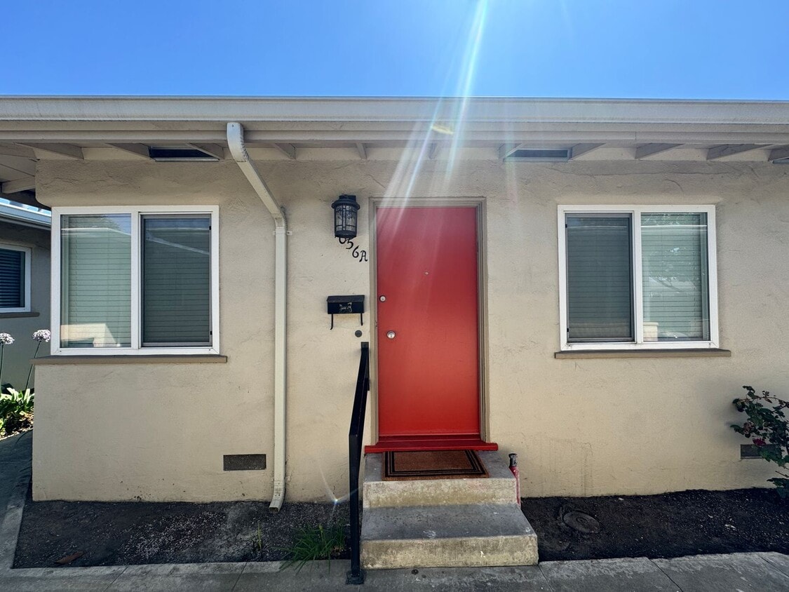
$3,100 / Month

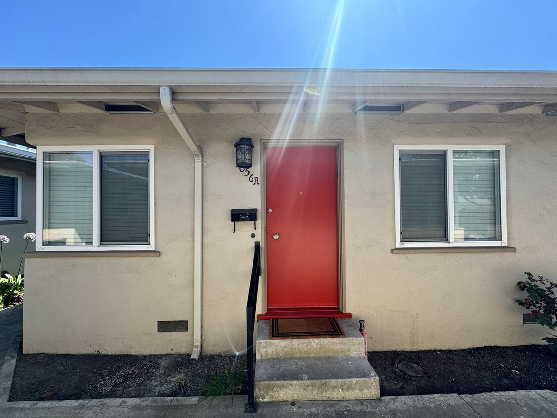
1056 Pajaro St Unit 1056 Pajaro St.

,

Salinas, CA 93901

Today
Share Listing
Favorites
831-809-7301
  • Bedrooms

    2

  • Bathrooms

    1

  • Square Feet

    --

  • Available

    Available Now

1056 Pajaro St Unit 1056 Pajaro St.
Share Listing
Favorites

Contact

  • Listed by Bay | Bay Capital Property Management
  • Phone Number
  • Contact
Neighborhood

With a diverse population and a mix of residential and commercial areas, as well as a large golf course and municipal airport, Greater Salinas supports numerous lifestyles. Set around the small Californian city of Salinas, with rural agricultural areas stretching east and south from the airport, the neighborhood combines urban grit with a small-town feel.

As with many areas of Salinas, the agricultural business plays a major role as an employer in the area. Downtown Salinas lies at the heart of the region, and just five miles from the outer reaches of the area. Within Greater Salinas you’ll find the municipal airport, and a collection of shops, restaurants, neighborhoods, and more.

Learn more about living in Greater Salinas 
Education
Colleges & Universities Distance
Drive: 6 min 1.9 mi
Drive: 20 min 10.3 mi
Drive: 24 min 17.7 mi
Drive: 26 min 17.9 mi
1056 Pajaro St Unit 1056 Pajaro St. is within 6 minutes or 1.9 miles from Hartnell College. It is also near Cal State Monterey Bay and Naval Postgraduate School.
Transportation

1056 Pajaro St Unit 1056 Pajaro St. is near Monterey Regional, located 14.7 miles or 20 minutes away.

Commuter Rail Distance
Drive: 4 min 1.7 mi
Drive: 37 min 29.1 mi
Drive: 37 min 29.3 mi
Drive: 45 min 36.0 mi
Drive: 45 min 36.1 mi
Airports Distance
Airports Distance
Monterey Regional
Drive: 20 min 14.7 mi
Very Walkable
85
Walk Score®
Out of 100
If you enjoy walking, you’ll enjoy renting in this area! It’s a very walkable neighborhood.
Some Transit
28
Transit Score®
Out of 100
You'll likely want a car when living in this area since it has few transit options.
Bikeable
54
Bike Score®
Out of 100
While there’s some bike infrastructure in this area, you’ll still need a car for many errands.
-
-
Soundscore
Out of 100

Traffic:

-

Airport:

-

Businesses:

-

Score provided by

Scores provided by  and

Score provided by

Points of Interest

Time and distance from 1056 Pajaro St Unit 1056 Pajaro St..

Shopping Centers Distance
Walk: 7 min 0.4 mi
Walk: 8 min 0.4 mi
Walk: 12 min 0.6 mi
1056 Pajaro St Unit 1056 Pajaro St. has 3 shopping centers within 0.6 mile, which is about a 12-minute walk. The miles and minutes will be for the farthest away property.
Parks and Recreation Distance
Fort Ord National Monument
Drive: 7 min 3.8 mi
Toro County Park
Drive: 7 min 5.9 mi
Monterey Institute for Research in Astronomy
Drive: 18 min 10.6 mi
Marina State Beach
Drive: 18 min 10.8 mi
Fort Ord Dunes State Park
Drive: 19 min 11.6 mi
1056 Pajaro St Unit 1056 Pajaro St. has 5 parks within 11.6 miles, including Fort Ord National Monument, Toro County Park, and Marina State Beach.
Hospitals Distance
Hospitals Distance
Walk: 13 min 0.7 mi
Drive: 7 min 3.6 mi
1056 Pajaro St Unit 1056 Pajaro St. is 0.7 mile from Salinas Valley Memorial Hospital, and is convenient to other hospitals, including Natividad Medical Center.
Military Bases Distance
Drive: 28 min 19.0 mi
Drive: 34 min 21.9 mi
1056 Pajaro St Unit 1056 Pajaro St. is 19.0 miles from Presidio of Monterey, and is convenient to other military bases, including Coast Guard Facilities.

You May Also Like