
$1,695 / Month
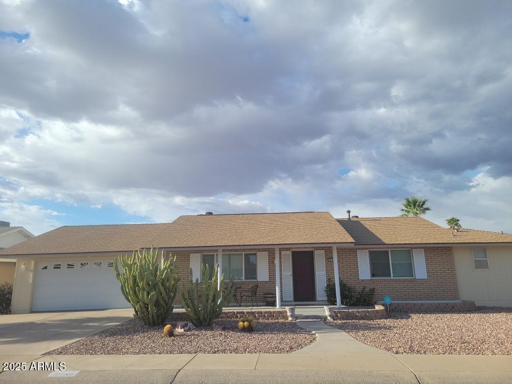
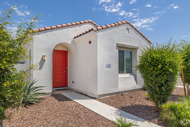
10544 W Cheryl Dr
Sun City, AZ 85351
Today
Favorites
602-696-6999
-
Bedrooms
2
-
Bathrooms
2
-
Square Feet
1,605 sq ft
-
Available
Available Now
Highlight
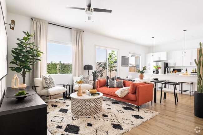
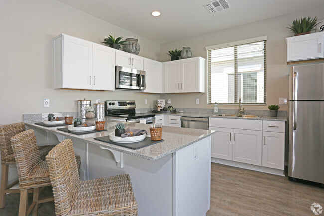
- Furnished
10544 W Cheryl Dr

Favorites
10544 W Cheryl Dr is a house located in Maricopa County and the 85351 ZIP Code.
* Price shown is base rent and may not include non-optional fees and utilities.
Price, availability, fees, and any applicable rent special are subject to change without notice.
* Square footage definitions vary. Displayed square footage is approximate.
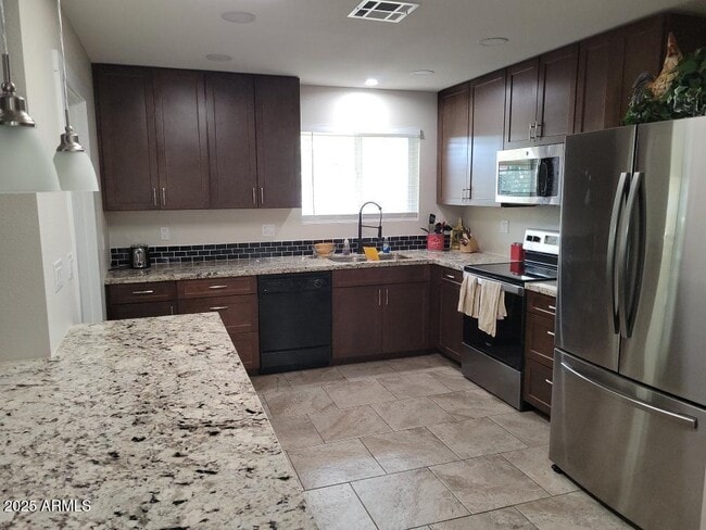
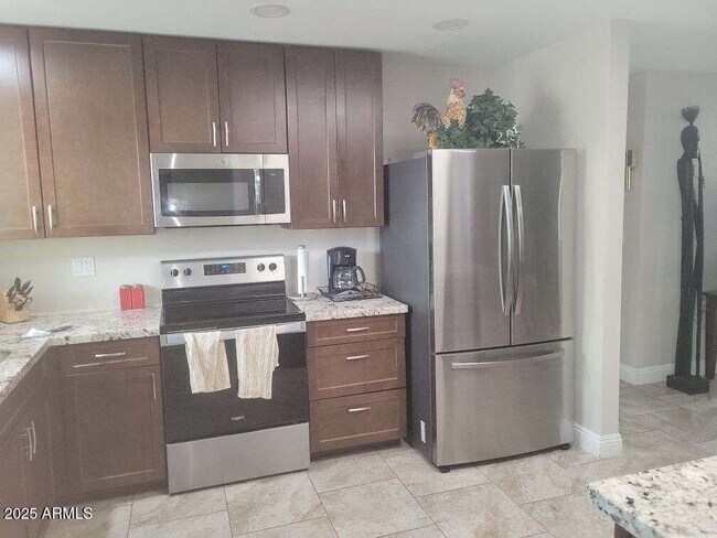
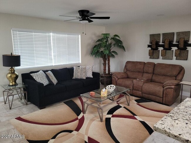
House Features
- Furnished
Fees and Policies
Details
Property Information
-
Furnished Units Available
Contact
- Listed by Keenan J Mcguire | West USA Realty
- Phone Number
- Contact
-
Source
Arizona Regional MLS
Copyright 2025 Arizona Regional MLS. All rights reserved. Information is deemed reliable but not guaranteed.
Location
Get Directions
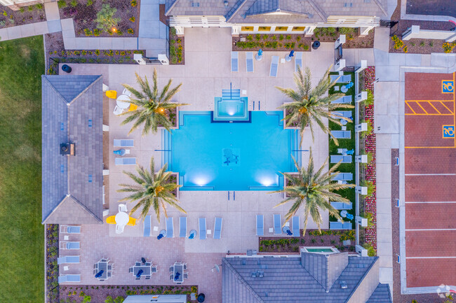
Amenities
- Furnished
The Weedville and North 75th Avenue/West Country Gable Drive areas that make up the Outer Deer Valley neighborhood are upscale suburbs of Peoria, Arizona. They lie along the southern bank of the Arizona Canal about 5 miles north of downtown Peoria, part of an area of newer residential developments that stretches unbroken between Peoria and the small city of Deer Valley to the northeast. The area is distinguished by the presence of many large homes set on oversized rancho lots subdivided from the canal-irrigated agricultural fields that formerly occupied the entire area.
Wealthy homeowners make up the population of these neighborhoods, placing them among the top 15 percent of American highest income neighborhoods. Another notable local feature, the Peoria Sports Complex just to the west, hosts the spring training home of the San Diego Padres and Seattle Mariners Major League Baseball teams.
Learn more about living in Sun City Lakes Fe
Education
| Colleges & Universities | Distance | ||
|---|---|---|---|
| Colleges & Universities | Distance | ||
| Drive: | 15 min | 6.4 mi | |
| Drive: | 19 min | 8.9 mi | |
| Drive: | 20 min | 9.5 mi | |
| Drive: | 19 min | 9.8 mi |
10544 W Cheryl Dr is within 15 minutes or 6.4 miles from Glendale Community College. It is also near Thunderbird, West Campus and Arizona State University, West.
Transportation options available in Sun City include Metro Pkwy, located 10.8 miles from 10544 W Cheryl Dr. 10544 W Cheryl Dr is near Phoenix Sky Harbor International, located 26.4 miles or 37 minutes away.
| Transit / Subway | Distance | ||
|---|---|---|---|
| Transit / Subway | Distance | ||
|
|
Drive: | 23 min | 10.8 mi |
| Airports | Distance | ||
|---|---|---|---|
| Airports | Distance | ||
|
Phoenix Sky Harbor International
|
Drive: | 37 min | 26.4 mi |
Time and distance from 10544 W Cheryl Dr.
| Shopping Centers | Distance | ||
|---|---|---|---|
| Shopping Centers | Distance | ||
| Walk: | 9 min | 0.5 mi | |
| Walk: | 16 min | 0.8 mi | |
| Walk: | 16 min | 0.9 mi |
10544 W Cheryl Dr has 3 shopping centers within 0.9 mile, which is about a 16-minute walk. The miles and minutes will be for the farthest away property.
| Parks and Recreation | Distance | ||
|---|---|---|---|
| Parks and Recreation | Distance | ||
|
Wildlife World Zoo
|
Drive: | 17 min | 9.0 mi |
|
Challenger Space Center
|
Drive: | 17 min | 9.7 mi |
|
El Oso Park
|
Drive: | 18 min | 9.8 mi |
|
Maryvale Park
|
Drive: | 23 min | 12.4 mi |
|
Friendship Park
|
Drive: | 22 min | 12.8 mi |
10544 W Cheryl Dr has 5 parks within 12.8 miles, including Wildlife World Zoo, Challenger Space Center, and El Oso Park.
| Hospitals | Distance | ||
|---|---|---|---|
| Hospitals | Distance | ||
| Drive: | 6 min | 2.6 mi | |
| Drive: | 15 min | 6.3 mi | |
| Drive: | 14 min | 8.2 mi |
10544 W Cheryl Dr has 3 hospitals within 8.2 miles, the nearest is Banner Boswell Medical Center which is 2.6 miles away and a 6 minute drive.
| Military Bases | Distance | ||
|---|---|---|---|
| Military Bases | Distance | ||
| Drive: | 12 min | 6.3 mi | |
| Drive: | 38 min | 26.2 mi | |
| Drive: | 97 min | 71.2 mi |
10544 W Cheryl Dr has 3 military bases within 71.2 miles, the nearest is Luke Air Force Base which is 6.3 miles away and a 12 minute drive.
You May Also Like
Similar Rentals Nearby


What Are Walk Score®, Transit Score®, and Bike Score® Ratings?
Walk Score® measures the walkability of any address. Transit Score® measures access to public transit. Bike Score® measures the bikeability of any address.
What is a Sound Score Rating?
A Sound Score Rating aggregates noise caused by vehicle traffic, airplane traffic and local sources

10544 W Cheryl Dr
Sun City, AZ 85351