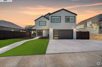
$4,400 / Month
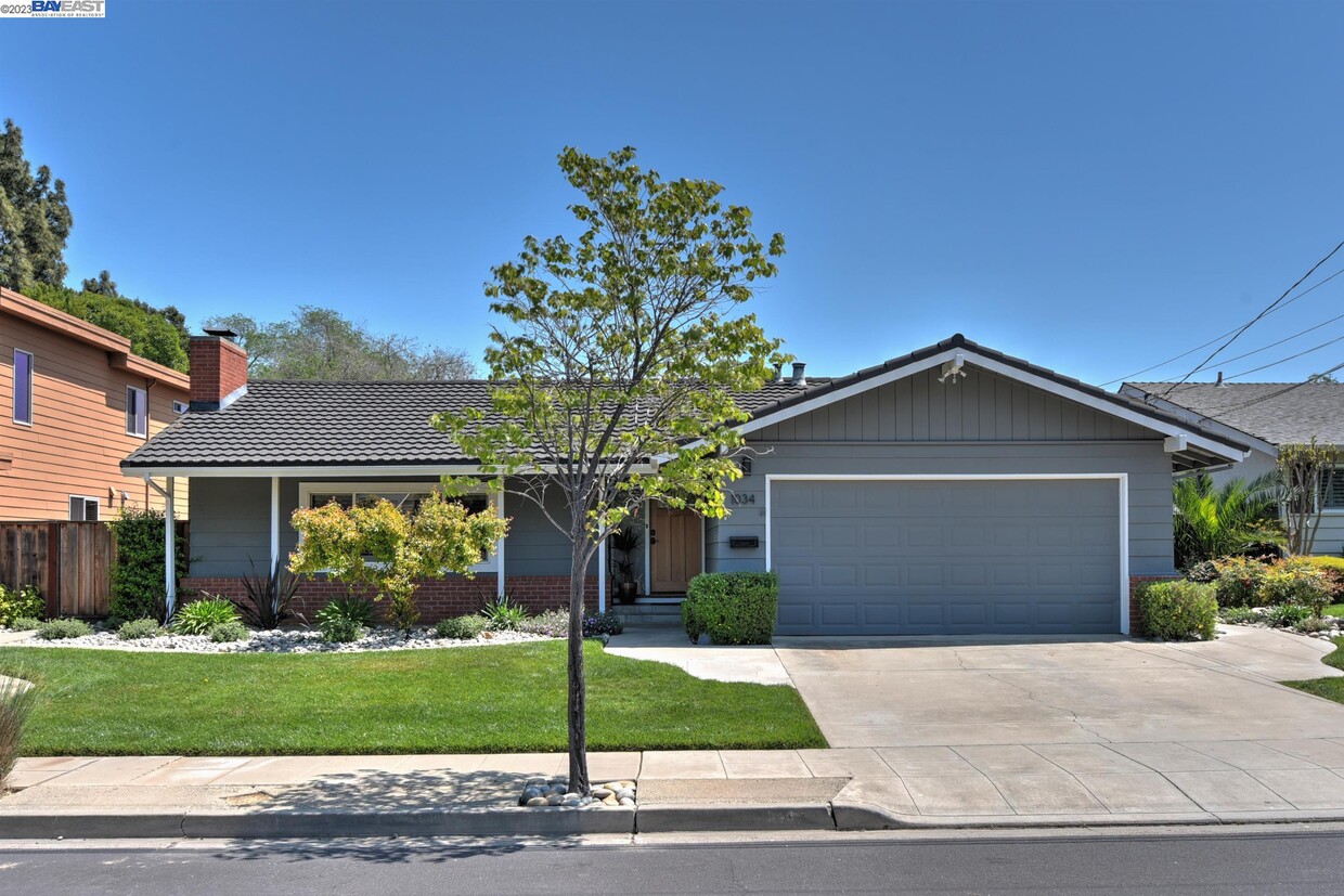
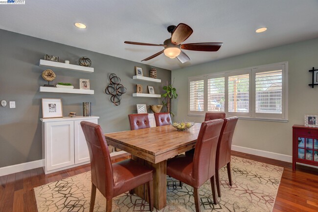
1034 Angelica Way
Livermore, CA 94550
2 Weeks Ago
Favorites
1034 Angelica Way

Favorites
Check Back Soon for Upcoming Availability
| Beds | Baths | Average SF |
|---|---|---|
| 3 Bedrooms 3 Bedrooms 3 Br | 2 Baths 2 Baths 2 Ba | 1,597 SF |
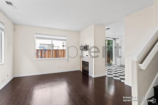
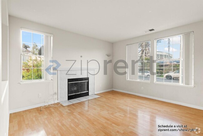
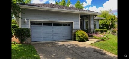
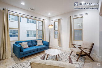
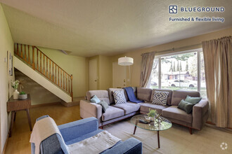
About This Property
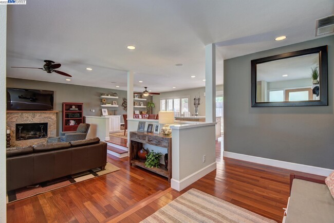
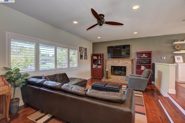
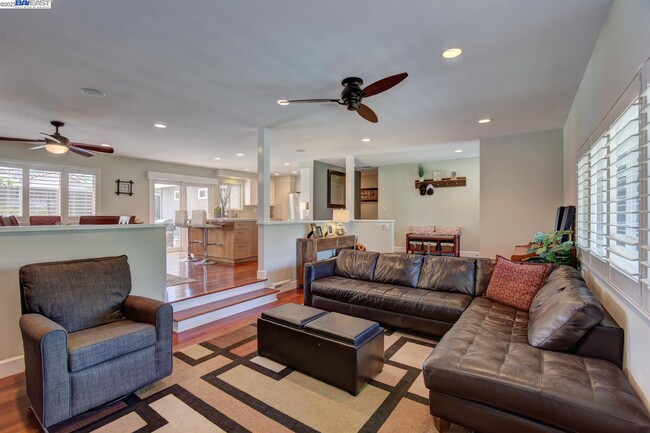
Updated 3 bd 2 bath home Conveniently located near downtown,farmers market,public library,winery’s,walking trails and more!,you'll have easy access to everything you need. The open-concept layout seamlessly connects the kitchen,dining,and living areas,providing a perfect setting for gathering and socializing. Hardwood floors,Gas stovetop,kitchen sink water filter,dishwasher,garbage disposal,refrigerator,washer/dryer hook ups. Will consider pets on a case-by-case basis.
1034 Angelica Way is a house located in Alameda County and the 94550 ZIP Code. This area is served by the Livermore Valley Joint Unified attendance zone.
Location
Get Directions
The cities of Livermore, Dublin and Pleasanton form a loosely shaped triangle within California's Tri-Valley region, a cluster of three small valleys about 33 miles east of San Francisco and 35 miles northeast of San Jose. Known for its Mediterranean climate, rolling hills and historic vineyards, this once bucolic region now boasts three separate downtown areas, a bustling business community and some of the best wineries in the state.
At the eastern end of the region lies the city of Livermore. Once known as Livermores, Livermore Ranch and Nottingham, the city sits at the center of Livermore Valley, a historic region dotted with more than 5,000 acres of mostly family-owned vineyards. A pastoral neighborhood known for its charming yet functional hilltop windmills, Livermore hosts the internationally recognized and sometimes controversial center of scientific research, Lawrence Livermore National Laboratories.
Learn more about living in Dublin/Pleasanton/LivermoreBelow are rent ranges for similar nearby apartments
| Beds | Average Size | Lowest | Typical | Premium |
|---|---|---|---|---|
| Studio Studio Studio | 576 Sq Ft | $1,859 | $2,678 | $5,305 |
| 1 Bed 1 Bed 1 Bed | 733-734 Sq Ft | $700 | $2,755 | $6,245 |
| 2 Beds 2 Beds 2 Beds | 1028 Sq Ft | $2,295 | $3,347 | $12,142 |
| 3 Beds 3 Beds 3 Beds | 1433-1434 Sq Ft | $2,636 | $4,100 | $8,686 |
| 4 Beds 4 Beds 4 Beds | 2556 Sq Ft | $2,892 | $5,080 | $9,800 |
Education
| Colleges & Universities | Distance | ||
|---|---|---|---|
| Colleges & Universities | Distance | ||
| Drive: | 11 min | 5.0 mi | |
| Drive: | 21 min | 13.5 mi | |
| Drive: | 22 min | 14.7 mi | |
| Drive: | 25 min | 15.5 mi |
1034 Angelica Way is within 11 minutes or 5.0 miles from Las Positas College. It is also near Diablo Valley Coll, San Ramon and San Joaquin Delta, Mtn. House.
Schools


Public Elementary School
Grades K-5
478 Students
Nearby
Public Elementary School
Grades K-5
756 Students
Attendance Zone
Public Middle School
Grades 6-8
547 Students
Attendance Zone
Public High School
Grades 9-12
1,765 Students
Attendance Zone
Private Elementary, Middle & High School
Grades 1-12
6 Students
Nearby
Private Elementary School
Grades PK-3
64 Students
Nearby
Private Elementary & Middle School
Grades K-8
233 Students
Nearby
School data provided by
 The GreatSchools Rating helps parents compare schools within a state based on a variety of school quality indicators and provides a helpful picture of how effectively each school serves all of its students. Ratings are on a scale of 1 (below average) to 10 (above average) and can include test scores, college readiness, academic progress, advanced courses, equity, discipline and attendance data. We also advise parents to visit schools, consider other information on school performance and programs, and consider family needs as part of the school selection process.
View GreatSchools Rating Methodology
View GreatSchools Rating Methodology
Transportation options available in Livermore include Dublin Pleasanton Station, located 10.3 miles from 1034 Angelica Way. 1034 Angelica Way is near Metro Oakland International, located 29.1 miles or 38 minutes away, and Norman Y Mineta San Jose International, located 30.4 miles or 43 minutes away.
| Transit / Subway | Distance | ||
|---|---|---|---|
| Transit / Subway | Distance | ||
|
|
Drive: | 15 min | 10.3 mi |
|
|
Drive: | 15 min | 10.7 mi |
| Commuter Rail | Distance | ||
|---|---|---|---|
| Commuter Rail | Distance | ||
| Drive: | 3 min | 1.3 mi | |
| Drive: | 9 min | 4.5 mi | |
| Drive: | 14 min | 7.3 mi | |
| Drive: | 32 min | 19.6 mi | |
|
|
Drive: | 31 min | 21.6 mi |
| Airports | Distance | ||
|---|---|---|---|
| Airports | Distance | ||
|
Metro Oakland International
|
Drive: | 38 min | 29.1 mi |
|
Norman Y Mineta San Jose International
|
Drive: | 43 min | 30.4 mi |
Time and distance from 1034 Angelica Way.
| Shopping Centers | Distance | ||
|---|---|---|---|
| Shopping Centers | Distance | ||
| Walk: | 10 min | 0.6 mi | |
| Walk: | 15 min | 0.8 mi | |
| Drive: | 2 min | 1.1 mi |
1034 Angelica Way has 3 shopping centers within 1.1 miles, which is about a 2-minute walk. The miles and minutes will be for the farthest away property.
| Parks and Recreation | Distance | ||
|---|---|---|---|
| Parks and Recreation | Distance | ||
|
Shadow Cliffs Regional Recreation Area
|
Drive: | 10 min | 4.9 mi |
|
Brushy Peak Regional Preserve
|
Drive: | 16 min | 7.5 mi |
|
Del Valle Regional Park
|
Drive: | 23 min | 8.1 mi |
|
Los Vaqueros Watershed
|
Drive: | 17 min | 9.0 mi |
|
Carnegie State Vehicle Recreation Area
|
Drive: | 20 min | 11.3 mi |
1034 Angelica Way has 5 parks within 11.3 miles, including Shadow Cliffs Regional Recreation Area, Brushy Peak Regional Preserve, and Del Valle Regional Park.
| Hospitals | Distance | ||
|---|---|---|---|
| Hospitals | Distance | ||
| Drive: | 13 min | 7.5 mi |
1034 Angelica Way is 7.5 miles and a 13 minute drive from Stanford Health Care - ValleyCare.
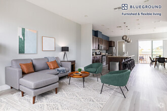
You May Also Like
Similar Rentals Nearby
What Are Walk Score®, Transit Score®, and Bike Score® Ratings?
Walk Score® measures the walkability of any address. Transit Score® measures access to public transit. Bike Score® measures the bikeability of any address.
What is a Sound Score Rating?
A Sound Score Rating aggregates noise caused by vehicle traffic, airplane traffic and local sources

1034 Angelica Way
Livermore, CA 94550