
1360 N 1st Ave
1360 N 1st Ave,
Melrose Park, IL 60160
$1,250
1 Bed
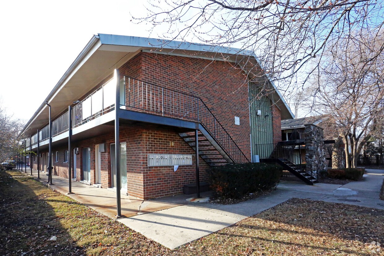

Consider making a move to 10315 W Lyndale Ave in Melrose Park. This apartment community is located on W. Lyndale Ave in the 60164 area of Melrose Park. Schedule a time to view the available floorplans. The leasing team is ready to match you with your perfect new apartment. Come see 10315 W Lyndale Ave today.
10315 W Lyndale Ave is an apartment community located in Cook County and the 60164 ZIP Code. This area is served by the Mannheim School District 83 attendance zone.
West Cook is a multicultural neighborhood south of O’Hare International Airport. Golfers in the community enjoy its numerous golf greens, including Oak Park Country Club and Edgewood Valley Country Club.
Public transit abounds in West Cook, attracting renters who wish to live outside the cities in which they work. Residents appreciate the shopping opportunities at Fashion Outlets of Chicago and North Riverside Park Mall.
The Brookfield Zoo is a fun-filled attraction in West Cook which houses hundreds of animals. Locals adore the neighborhood’s lush green spaces – many of which are in walking distance of affordable West Cook apartments. Direct access to Interstate 55 and Interstate 294 makes commuting easy, whether you’re traveling into Chicago or a neighboring state.
Learn more about living in West CookCompare neighborhood and city base rent averages by bedroom.
| West Cook | Melrose Park, IL | |
|---|---|---|
| Studio | $919 | $679 |
| 1 Bedroom | $1,120 | $905 |
| 2 Bedrooms | $1,399 | $1,040 |
| 3 Bedrooms | $1,582 | - |
| Colleges & Universities | Distance | ||
|---|---|---|---|
| Colleges & Universities | Distance | ||
| Drive: | 9 min | 4.1 mi | |
| Drive: | 10 min | 4.8 mi | |
| Drive: | 12 min | 5.2 mi | |
| Drive: | 14 min | 5.8 mi |


Transportation options available in Melrose Park include Rosemont Station, located 5.4 miles from 10315 W Lyndale Ave. 10315 W Lyndale Ave is near Chicago O'Hare International, located 6.5 miles or 11 minutes away, and Chicago Midway International, located 14.6 miles or 26 minutes away.
| Transit / Subway | Distance | ||
|---|---|---|---|
| Transit / Subway | Distance | ||
|
|
Drive: | 9 min | 5.4 mi |
|
|
Drive: | 13 min | 6.1 mi |
|
|
Drive: | 13 min | 6.1 mi |
|
|
Drive: | 13 min | 7.0 mi |
|
|
Drive: | 13 min | 7.4 mi |
| Commuter Rail | Distance | ||
|---|---|---|---|
| Commuter Rail | Distance | ||
|
|
Drive: | 5 min | 2.2 mi |
|
|
Drive: | 6 min | 2.4 mi |
|
|
Drive: | 5 min | 2.4 mi |
|
|
Drive: | 6 min | 2.7 mi |
|
|
Drive: | 10 min | 4.2 mi |
| Airports | Distance | ||
|---|---|---|---|
| Airports | Distance | ||
|
Chicago O'Hare International
|
Drive: | 11 min | 6.5 mi |
|
Chicago Midway International
|
Drive: | 26 min | 14.6 mi |
Scores provided by
Traffic
-Airport
-Businesses
-Scores provided by
HowLoud What is a Sound Score Rating? A Sound Score Rating aggregates noise caused by vehicle traffic, airplane traffic and local sources. How It WorksTime and distance from 10315 W Lyndale Ave.
| Shopping Centers | Distance | ||
|---|---|---|---|
| Shopping Centers | Distance | ||
| Walk: | 10 min | 0.5 mi | |
| Walk: | 15 min | 0.8 mi | |
| Walk: | 15 min | 0.8 mi |
| Parks and Recreation | Distance | ||
|---|---|---|---|
| Parks and Recreation | Distance | ||
|
Cernan Earth and Space Center
|
Drive: | 8 min | 3.8 mi |
|
Schiller Woods
|
Drive: | 11 min | 4.8 mi |
|
Lizzadro Museum of Lapidary Art
|
Drive: | 10 min | 4.9 mi |
|
Wilder Park Conservatory
|
Drive: | 10 min | 4.9 mi |
|
Tyrell Trailside Museum / Thatcher Woods
|
Drive: | 10 min | 5.0 mi |
| Hospitals | Distance | ||
|---|---|---|---|
| Hospitals | Distance | ||
| Drive: | 7 min | 3.4 mi | |
| Drive: | 7 min | 3.5 mi | |
| Drive: | 10 min | 5.0 mi |
| Military Bases | Distance | ||
|---|---|---|---|
| Military Bases | Distance | ||
| Drive: | 23 min | 15.8 mi | |
| Drive: | 30 min | 20.3 mi | |
| Drive: | 41 min | 25.4 mi |
What Are Walk Score®, Transit Score®, and Bike Score® Ratings?
Walk Score® measures the walkability of any address. Transit Score® measures access to public transit. Bike Score® measures the bikeability of any address.
What is a Sound Score Rating?
A Sound Score Rating aggregates noise caused by vehicle traffic, airplane traffic and local sources.


