
Pleasant View Apartments
1390 N Heritage Ln,
Tahlequah, OK 74464
$865 - $1,109
1-2 Beds
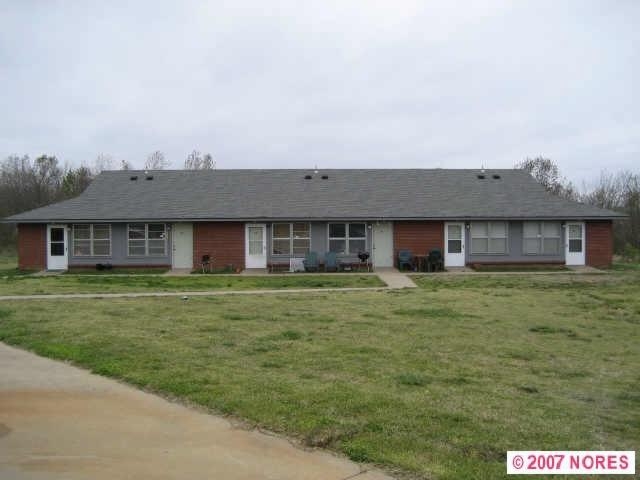

At 1030 S 82A Hwy in Tahlequah, OK, find a great place to live. In a location on S. 82a Hwy. in Tahlequah's 74464 area, renters can easily connect with a number of points of interest in the surrounding area. Come for a visit to check out the current floorplan options. The professional leasing staff is ready to match you with the perfect floorplan. Contact us or drop by to find out the availability today and see 1030 S 82A Hwy.
1030 S 82A Hwy is a townhouse community located in Cherokee County and the 74464 ZIP Code. This area is served by the Lowrey School District attendance zone.
Air Conditioning
Refrigerator
Tub/Shower
Oven
| Colleges & Universities | Distance | ||
|---|---|---|---|
| Colleges & Universities | Distance | ||
| Drive: | 31 min | 22.1 mi | |
| Drive: | 39 min | 23.2 mi |

Scores provided by
Traffic
-Airport
-Businesses
-Scores provided by
HowLoud What is a Sound Score Rating? A Sound Score Rating aggregates noise caused by vehicle traffic, airplane traffic and local sources. How It Works


What Are Walk Score®, Transit Score®, and Bike Score® Ratings?
Walk Score® measures the walkability of any address. Transit Score® measures access to public transit. Bike Score® measures the bikeability of any address.
What is a Sound Score Rating?
A Sound Score Rating aggregates noise caused by vehicle traffic, airplane traffic and local sources.

1030 S 82A Hwy
Tahlequah, OK 74464


