
$4,750
/ Month
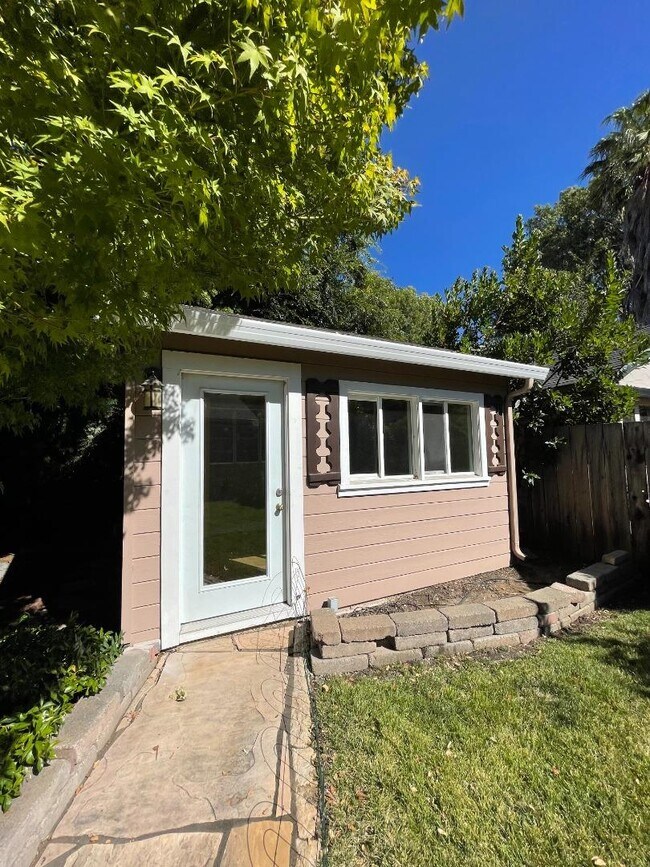
1028 Sevier Ave
Menlo Park, CA 94025
2 Weeks Ago
|
Edit
Favorites
1028 Sevier Ave

Favorites
Check Back Soon for Upcoming Availability
| Beds | Baths | Average SF |
|---|---|---|
| 2 Bedrooms 2 Bedrooms 2 Br | 1 Bath 1 Bath 1 Ba | 1,070 SF |
Fees and Policies
The fees listed below are community-provided and may exclude utilities or add-ons. All payments are made directly to the property and are non-refundable unless otherwise specified.
About This Property
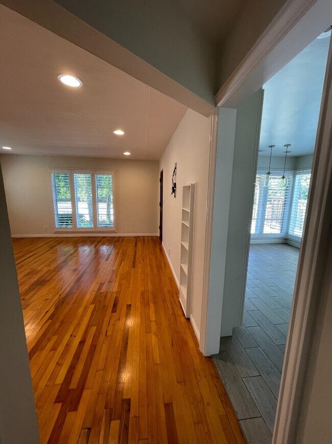
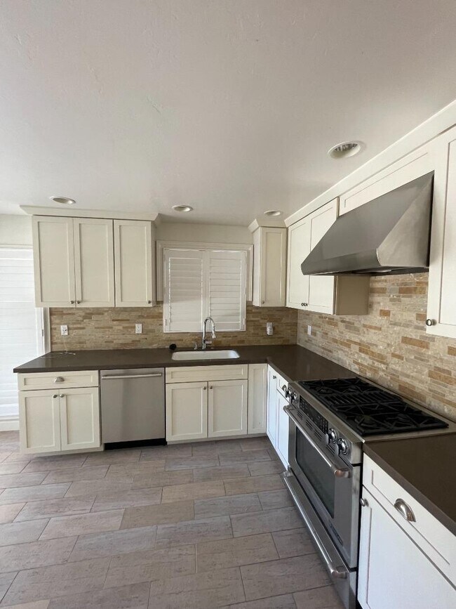
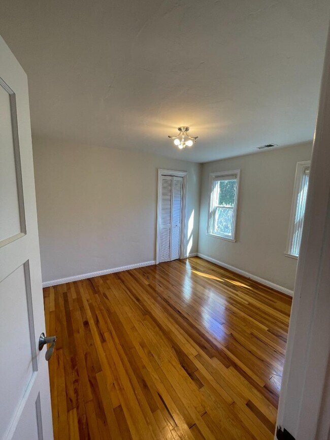
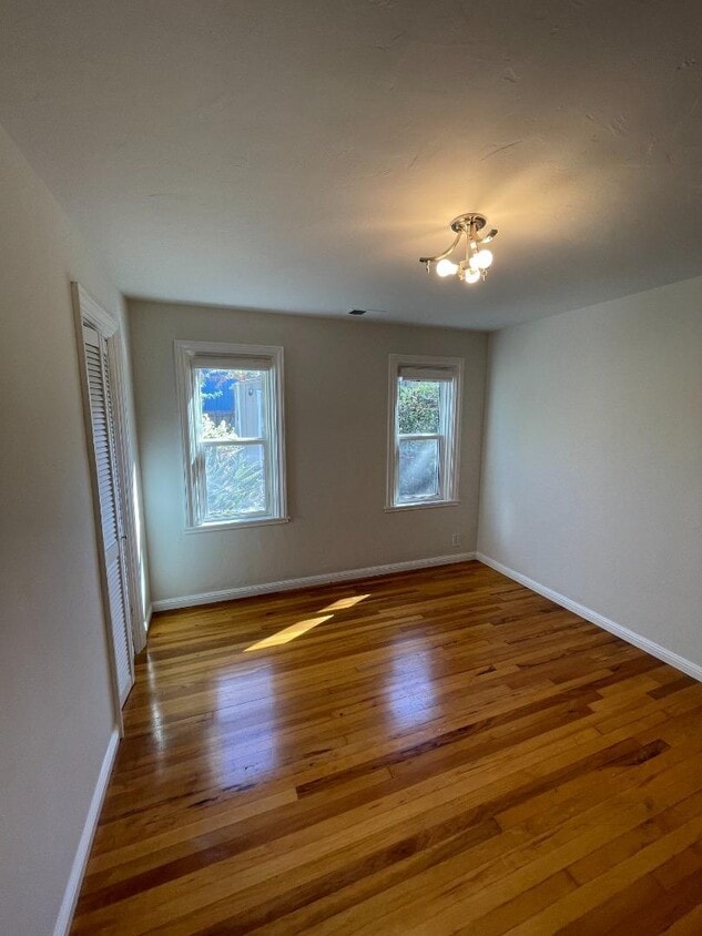
This charming, updated two bed, one bath home features Menlo Park schools plus an additional cottage--a perfect place to work from home. Huge mudroom. Wood floors. Private backyard. Sunny and inviting. One car garage plus parking in driveway. Easy access to 101, Facebook, downtown Menlo Park and Palo Alto.
1028 Sevier Ave is a house located in San Mateo County and the 94025 ZIP Code. This area is served by the Menlo Park City Elementary School District attendance zone.
House Features
- Fireplace
1028 Sevier Ave,
Menlo Park,
CA
94025
Located in Silicon Valley, Menlo Park combines residential comfort with technological innovation. As home to Meta's headquarters and numerous venture capital firms along Sand Hill Road, the city maintains its community atmosphere with established neighborhoods and a downtown district along Santa Cruz Avenue. Housing includes both traditional homes and apartment communities, with current rental data showing one-bedroom apartments averaging $3,411 monthly and two-bedroom units at $4,626.
Menlo Park offers abundant outdoor spaces, including the 160-acre Bedwell Bayfront Park with bay views and walking trails. Downtown features independent shops and eateries, while the farmers' market operates at the historic Menlo Park train station, which holds the distinction of being California's oldest operating rail station. The proximity to Stanford University enhances educational opportunities, and commuters benefit from Caltrain service and highway access to both San Francisco and San Jose.
Learn more about living in Menlo ParkBelow are rent ranges for similar nearby apartments
Amenities
- Fireplace
Education
| Colleges & Universities | Distance | ||
|---|---|---|---|
| Colleges & Universities | Distance | ||
| Drive: | 9 min | 3.1 mi | |
| Drive: | 14 min | 4.5 mi | |
| Drive: | 10 min | 5.8 mi | |
| Drive: | 19 min | 9.1 mi |
1028 Sevier Ave is within 9 minutes or 3.1 miles from Menlo College. It is also near Stanford University and Foothill College, Middlefield.
Schools


Public Elementary School
Grades K-5
407 Students
Nearby
Public Elementary School
Grades K-5
658 Students
Attendance Zone
Public Middle School
Grades 6-8
846 Students
Attendance Zone
Public High School
Grades 9-12
2,158 Students
Attendance Zone
Private Elementary, Middle & High School
Grades PK-12
247 Students
Nearby
Private Elementary & Middle School
Grades PK-8
254 Students
Nearby
Private High School
Grades 9-12
137 Students
Nearby
School data provided by
 The GreatSchools Rating helps parents compare schools within a state based on a variety of school quality indicators and provides a helpful picture of how effectively each school serves all of its students. Ratings are on a scale of 1 (below average) to 10 (above average) and can include test scores, college readiness, academic progress, advanced courses, equity, discipline and attendance data. We also advise parents to visit schools, consider other information on school performance and programs, and consider family needs as part of the school selection process.
View GreatSchools Rating Methodology
Data provided by GreatSchools.org © 2026. All rights reserved.
View GreatSchools Rating Methodology
Data provided by GreatSchools.org © 2026. All rights reserved.
Transportation options available in Menlo Park include Bayshore Nasa Station, located 8.1 miles from 1028 Sevier Ave. 1028 Sevier Ave is near Norman Y Mineta San Jose International, located 15.7 miles or 21 minutes away, and San Francisco International, located 18.7 miles or 25 minutes away.
| Transit / Subway | Distance | ||
|---|---|---|---|
| Transit / Subway | Distance | ||
| Drive: | 11 min | 8.1 mi | |
| Drive: | 12 min | 8.5 mi | |
|
|
Drive: | 13 min | 8.7 mi |
|
|
Drive: | 13 min | 8.8 mi |
| Drive: | 13 min | 9.1 mi |
| Commuter Rail | Distance | ||
|---|---|---|---|
| Commuter Rail | Distance | ||
| Drive: | 6 min | 2.2 mi | |
| Drive: | 7 min | 2.5 mi | |
| Drive: | 10 min | 5.1 mi | |
| Drive: | 10 min | 5.7 mi | |
| Drive: | 12 min | 6.6 mi |
| Airports | Distance | ||
|---|---|---|---|
| Airports | Distance | ||
|
Norman Y Mineta San Jose International
|
Drive: | 21 min | 15.7 mi |
|
San Francisco International
|
Drive: | 25 min | 18.7 mi |
Walkability Near 1028 Sevier Ave Menlo Park, CA 94025
Getting Around
 What do Walkability, Transit, Drivability, and Bikeability mean?
Walkability measures the walking distance to day-to-day needs.
Transit measures access to public transportation.
Drivability measures congestion, parking availability, and access to major roads.
Bikeability measures the suitability for cycling.
How It Works
What do Walkability, Transit, Drivability, and Bikeability mean?
Walkability measures the walking distance to day-to-day needs.
Transit measures access to public transportation.
Drivability measures congestion, parking availability, and access to major roads.
Bikeability measures the suitability for cycling.
How It Works
Fairly Walkable
Walkability
40
/ 100
Limited Public Transit
Transit
30
/ 100
Exceptionally Drivable
Drivability
90
/ 100
Moderately Bikeable
Bikeability
70
/ 100
Scores provided by
-
Soundscore™
-
/ 100
Traffic
-Airport
-Businesses
-Scores provided by
HowLoud What is a Sound Score Rating? A Sound Score Rating aggregates noise caused by vehicle traffic, airplane traffic and local sources. How It WorksTime and distance from 1028 Sevier Ave.
| Shopping Centers | Distance | ||
|---|---|---|---|
| Shopping Centers | Distance | ||
| Drive: | 4 min | 1.5 mi | |
| Drive: | 5 min | 1.9 mi | |
| Drive: | 7 min | 2.4 mi |
1028 Sevier Ave has 3 shopping centers within 2.4 miles, which is about a 7-minute drive. The miles and minutes will be for the farthest away property.
| Parks and Recreation | Distance | ||
|---|---|---|---|
| Parks and Recreation | Distance | ||
|
Seminary Oaks Park
|
Drive: | 4 min | 1.2 mi |
|
Hopkins Creekside Park
|
Drive: | 4 min | 1.4 mi |
|
El Palo Alto Park
|
Drive: | 7 min | 2.1 mi |
|
Burgess Park
|
Drive: | 7 min | 2.3 mi |
|
Bayfront Park
|
Drive: | 8 min | 3.1 mi |
1028 Sevier Ave has 5 parks within 3.1 miles, including Seminary Oaks Park, Hopkins Creekside Park, and El Palo Alto Park.
| Hospitals | Distance | ||
|---|---|---|---|
| Hospitals | Distance | ||
| Drive: | 11 min | 3.9 mi | |
| Drive: | 11 min | 4.3 mi | |
| Drive: | 8 min | 5.1 mi |
1028 Sevier Ave has 3 hospitals within 5.1 miles, the nearest is Lucile Salter Packard Children's Hospital at Stanford which is 3.9 miles away and a 11 minute drive.
| Military Bases | Distance | ||
|---|---|---|---|
| Military Bases | Distance | ||
| Drive: | 14 min | 8.6 mi |
1028 Sevier Ave is 8.6 miles and a 14 minute drive from Ames Research Center.
You May Also Like
Similar Rentals Nearby


What Are Walk Score®, Transit Score®, and Bike Score® Ratings?
Walk Score® measures the walkability of any address. Transit Score® measures access to public transit. Bike Score® measures the bikeability of any address.
What is a Sound Score Rating?
A Sound Score Rating aggregates noise caused by vehicle traffic, airplane traffic and local sources.
1028 Sevier Ave
Menlo Park, CA 94025