
$2,375
/ Month
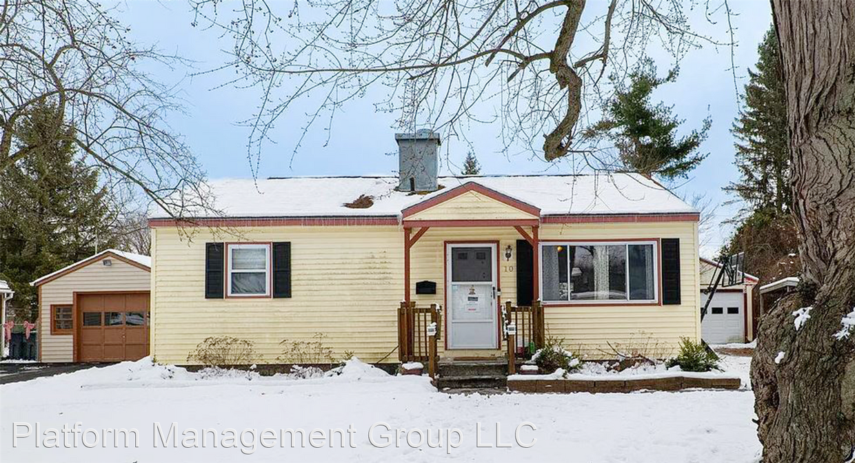
10 Sherwood Dr
Latham, NY 12110
Favorites
10 Sherwood Dr

Favorites
Check Back Soon for Upcoming Availability
| Beds | Baths | Average SF |
|---|---|---|
| 2 Bedrooms 2 Bedrooms 2 Br | 1 Bath 1 Bath 1 Ba | 1,259 SF |
Fees and Policies
The fees listed below are community-provided and may exclude utilities or add-ons. All payments are made directly to the property and are non-refundable unless otherwise specified.
- Dogs Allowed
-
Fees not specified
-
Weight limit--
-
Pet Limit--
About This Property
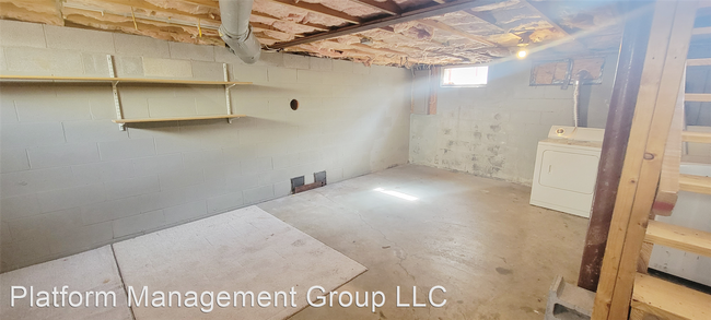
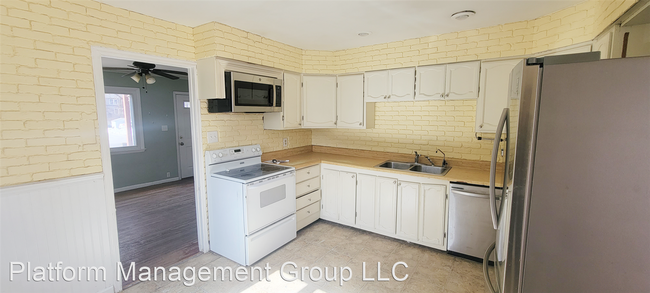
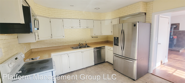
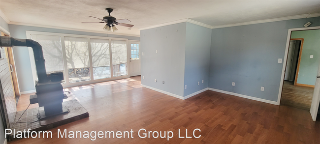
- COMING SOON!! Home For Rent - Super cozy (2) bedroom, 1,259 SF Ranch in Latham. North Colonie Schools. This (2) bedroom, (1) bath, ranch offers a spacious master bedroom with walk-in closet, sliding glass doors that leads to a large deck, family room with fireplace, kitchen, dining room, and laundry in basement. Gas forced air and central air. Has (1) car garage and a fenced yard. (RLNE7957518) Pet policies: Small Dogs Allowed, Cats Allowed, Large Dogs Allowed.
10 Sherwood Dr is a house located in Albany County and the 12110 ZIP Code. This area is served by the South Colonie Central School District attendance zone.
10 Sherwood Dr,
Latham,
NY
12110
Education
| Colleges & Universities | Distance | ||
|---|---|---|---|
| Colleges & Universities | Distance | ||
| Drive: | 6 min | 2.9 mi | |
| Drive: | 12 min | 5.7 mi | |
| Drive: | 12 min | 6.4 mi | |
| Drive: | 13 min | 7.6 mi |
10 Sherwood Dr is within 6 minutes or 2.9 miles from Siena College. It is also near The Sage Colleges, Troy Campus and Excelsior College.
Schools

Public Elementary School
Grades PK-5
351 Students
Nearby
Private Elementary, Middle & High School
Grades PK-12
84 Students
Nearby
Private Elementary & Middle School
Grades PK-8
138 Students
Nearby
School data provided by
 The GreatSchools Rating helps parents compare schools within a state based on a variety of school quality indicators and provides a helpful picture of how effectively each school serves all of its students. Ratings are on a scale of 1 (below average) to 10 (above average) and can include test scores, college readiness, academic progress, advanced courses, equity, discipline and attendance data. We also advise parents to visit schools, consider other information on school performance and programs, and consider family needs as part of the school selection process.
View GreatSchools Rating Methodology
Data provided by GreatSchools.org © 2026. All rights reserved.
View GreatSchools Rating Methodology
Data provided by GreatSchools.org © 2026. All rights reserved.
Walkability Near 10 Sherwood Dr Latham, NY 12110
Getting Around
 What do Walkability, Transit, Drivability, and Bikeability mean?
Walkability measures the walking distance to day-to-day needs.
Transit measures access to public transportation.
Drivability measures congestion, parking availability, and access to major roads.
Bikeability measures the suitability for cycling.
How It Works
What do Walkability, Transit, Drivability, and Bikeability mean?
Walkability measures the walking distance to day-to-day needs.
Transit measures access to public transportation.
Drivability measures congestion, parking availability, and access to major roads.
Bikeability measures the suitability for cycling.
How It Works
Fairly Walkable
Walkability
40
/ 100
Minimal Public Transit
Transit
10
/ 100
Exceptionally Drivable
Drivability
100
/ 100
Somewhat Bikeable
Bikeability
30
/ 100
Scores provided by
-
Soundscore™
-
/ 100
Traffic
-Airport
-Businesses
-Scores provided by
HowLoud What is a Sound Score Rating? A Sound Score Rating aggregates noise caused by vehicle traffic, airplane traffic and local sources. How It WorksYou May Also Like
Similar Rentals Nearby


What Are Walk Score®, Transit Score®, and Bike Score® Ratings?
Walk Score® measures the walkability of any address. Transit Score® measures access to public transit. Bike Score® measures the bikeability of any address.
What is a Sound Score Rating?
A Sound Score Rating aggregates noise caused by vehicle traffic, airplane traffic and local sources.

10 Sherwood Dr
Latham, NY 12110