$4,200
Total Monthly Price3 Beds, 2 Baths, 1,672 sq ft


Bedrooms
3
Bathrooms
2
Square Feet
1,320 sq ft
Available
Available Now

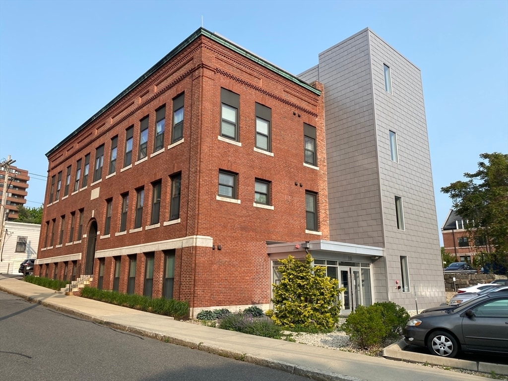
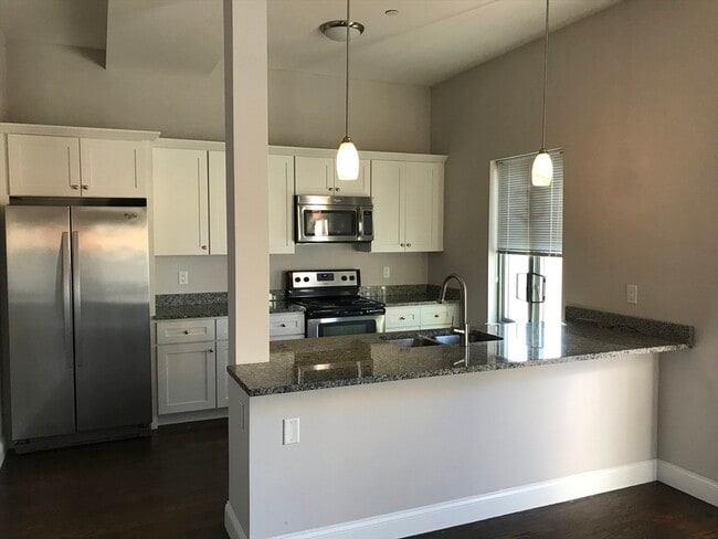
Ten M Apartment Community in Quincy. Luxury Apartments in a Historic Building. Ideally located near Quincy Cent Easy access to MBTA transportation services on the Red lines and to major highways. near to restaurants,pubs,schools and shops. Condo quality units with an open floor plan,modern kitchens beautiful hardwood floors,central air,granite counter-tops,stainless steel appliances,washer and dryer in each unit. Pet friendly... Photos may be of similar unit in building. Don't miss out,schedule a showing today. MLS# 73421316
10 Merrymount Rd is a condo located in Norfolk County and the 02169 ZIP Code.
Home Type
Year Built
Bedrooms and Bathrooms
Home Design
Interior Spaces
Kitchen
Laundry
Listing and Financial Details
Location
Lot Details
Utilities
Amenities
Overview
Pet Policy
Recreation
The fees below are based on community-supplied data and may exclude additional fees and utilities.
Quincy Center covers the historic downtown district of Quincy, Massachusetts. Known as the “City of Presidents,” Quincy boasts unique shops, local restaurants, and admired historic sites. In fact, Quincy Center houses the United States First Parish Church, which is the location of both President John Adams and his son, President John Quincy Adams’ burial sites.
If you become a resident of this vibrant town, you can visit the Adams’ birthplaces and explore their historic homes, which are the oldest presidential birthplaces in the country. If you’re a political history buff, Quincy Center is the place for you! With an abundance of upscale apartments and the occasional historic house, condo, and townhome, finding your perfect rental in this area should be a breeze.
A coastal neighborhood situated on Quincy Bay, Quincy Center is just 10 miles south of Downtown Boston.
Learn more about living in Quincy Center| Colleges & Universities | Distance | ||
|---|---|---|---|
| Colleges & Universities | Distance | ||
| Drive: | 12 min | 5.7 mi | |
| Drive: | 16 min | 6.9 mi | |
| Drive: | 15 min | 8.1 mi | |
| Drive: | 18 min | 9.3 mi |
Transportation options available in Quincy include Wollaston Station, located 1.2 miles from 10 Merrymount Rd Unit 104. 10 Merrymount Rd Unit 104 is near General Edward Lawrence Logan International, located 11.0 miles or 20 minutes away.
| Transit / Subway | Distance | ||
|---|---|---|---|
| Transit / Subway | Distance | ||
|
|
Drive: | 2 min | 1.2 mi |
|
|
Drive: | 5 min | 2.1 mi |
|
|
Drive: | 5 min | 2.2 mi |
|
|
Drive: | 8 min | 4.0 mi |
|
|
Drive: | 8 min | 4.3 mi |
| Commuter Rail | Distance | ||
|---|---|---|---|
| Commuter Rail | Distance | ||
|
|
Walk: | 9 min | 0.5 mi |
| Drive: | 8 min | 3.5 mi | |
|
|
Drive: | 8 min | 4.0 mi |
|
|
Drive: | 10 min | 5.1 mi |
| Drive: | 11 min | 5.7 mi |
| Airports | Distance | ||
|---|---|---|---|
| Airports | Distance | ||
|
General Edward Lawrence Logan International
|
Drive: | 20 min | 11.0 mi |
Time and distance from 10 Merrymount Rd Unit 104.
| Shopping Centers | Distance | ||
|---|---|---|---|
| Shopping Centers | Distance | ||
| Walk: | 16 min | 0.8 mi | |
| Walk: | 17 min | 0.9 mi | |
| Walk: | 17 min | 0.9 mi |
| Parks and Recreation | Distance | ||
|---|---|---|---|
| Parks and Recreation | Distance | ||
|
Adams National Historical Park
|
Walk: | 6 min | 0.3 mi |
|
Squantum Point Park
|
Drive: | 10 min | 3.7 mi |
|
Webb Memorial State Park
|
Drive: | 12 min | 5.3 mi |
|
Dorchester Shores Reservation
|
Drive: | 11 min | 5.6 mi |
|
Franklin Park Zoo
|
Drive: | 13 min | 7.0 mi |
| Hospitals | Distance | ||
|---|---|---|---|
| Hospitals | Distance | ||
| Drive: | 9 min | 4.3 mi | |
| Drive: | 8 min | 4.4 mi | |
| Drive: | 12 min | 7.6 mi |
$4,200
Total Monthly Price3 Beds, 2 Baths, 1,672 sq ft
$3,300
Total Monthly Price3 Beds, 2 Baths, 1,041 sq ft
What Are Walk Score®, Transit Score®, and Bike Score® Ratings?
Walk Score® measures the walkability of any address. Transit Score® measures access to public transit. Bike Score® measures the bikeability of any address.
What is a Sound Score Rating?
A Sound Score Rating aggregates noise caused by vehicle traffic, airplane traffic and local sources