
10 Lee Road 2141
10 Lee Road 2141
Phenix City, AL 36870
2 Weeks Ago
|
Edit
Favorites
10 Lee Road 2141

Favorites
Check Back Soon for Upcoming Availability
| Beds | Baths | Average SF |
|---|---|---|
| 3 Bedrooms 3 Bedrooms 3 Br | 2 Baths 2 Baths 2 Ba | — |
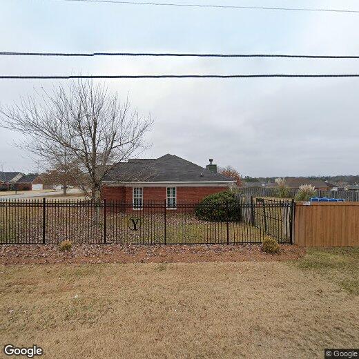
10 Lee Road 2141,
Phenix City,
AL
36870
Phenix City sits on the Alabama side of the Chattahoochee River, directly across from Columbus, Georgia, and the two cities function as one interconnected metro area. That relationship gives Phenix City residents access to a much larger job market, including Fort Moore, one of the country's largest Army installations just outside Columbus, along with healthcare systems, retail corridors, and Columbus State University. The city even observes Eastern Time rather than Central, reflecting just how closely its daily rhythms align with its Georgia neighbor. Closer to home, tree-lined streets and quiet residential pockets define much of the landscape, with the downtown riverfront area offering a more active, walkable scene. Housing options range from traditional single-family rental homes and townhomes to smaller apartment communities that tend to offer more square footage than comparable options in larger metros.
Learn more about living in Phenix City
Education
| Colleges & Universities | Distance | ||
|---|---|---|---|
| Colleges & Universities | Distance | ||
| Drive: | 14 min | 7.1 mi | |
| Drive: | 16 min | 8.8 mi | |
| Drive: | 20 min | 11.2 mi | |
| Drive: | 50 min | 29.0 mi |
10 Lee Road 2141 is within 14 minutes or 7.1 miles from Columbus State, River Park. It is also near Chattahoochee Valley C.C. and Columbus State Univ., Main.
Walkability Near 10 Lee Road 2141 Phenix City, AL 36870
Getting Around
 What do Walkability, Transit, Drivability, and Bikeability mean?
Walkability measures the walking distance to day-to-day needs.
Transit measures access to public transportation.
Drivability measures congestion, parking availability, and access to major roads.
Bikeability measures the suitability for cycling.
How It Works
What do Walkability, Transit, Drivability, and Bikeability mean?
Walkability measures the walking distance to day-to-day needs.
Transit measures access to public transportation.
Drivability measures congestion, parking availability, and access to major roads.
Bikeability measures the suitability for cycling.
How It Works
Somewhat Walkable
Walkability
30
/ 100
Exceptionally Drivable
Drivability
90
/ 100
Somewhat Bikeable
Bikeability
30
/ 100
Scores provided by
-
Soundscore™
-
/ 100
Traffic
-Airport
-Businesses
-Scores provided by
HowLoud What is a Sound Score Rating? A Sound Score Rating aggregates noise caused by vehicle traffic, airplane traffic and local sources. How It WorksYou May Also Like
-
6914 Aldora Dr
Columbus, GA 31907
$1,720
3 Br 12.8 mi
-
Charming 4 Bedroom Home in East Point of Opelika
2102 Crossing Dr
Opelika, AL 36804
$2,500
4 Br 17.4 mi
-
RESIDENTIAL/COMMERCIAL RENTAL - Charming historic home located downtown Opelika! (*Partially Furn...
108 N 9th St
Opelika, AL 36801
$2,100
3 Br 20.8 mi
Similar Rentals Nearby


What Are Walk Score®, Transit Score®, and Bike Score® Ratings?
Walk Score® measures the walkability of any address. Transit Score® measures access to public transit. Bike Score® measures the bikeability of any address.
What is a Sound Score Rating?
A Sound Score Rating aggregates noise caused by vehicle traffic, airplane traffic and local sources.

10 Lee Road 2141
Phenix City, AL 36870