$1,525
/ Month
10 Adrian Ave Unit 4H
Bronx, NY 10463
Favorites
10 Adrian Ave Unit 4H

Favorites
Check Back Soon for Upcoming Availability
| Beds | Baths | Average SF |
|---|---|---|
| 2 Bedrooms 2 Bedrooms 2 Br | 1 Bath 1 Bath 1 Ba | 700 SF |
About This Property
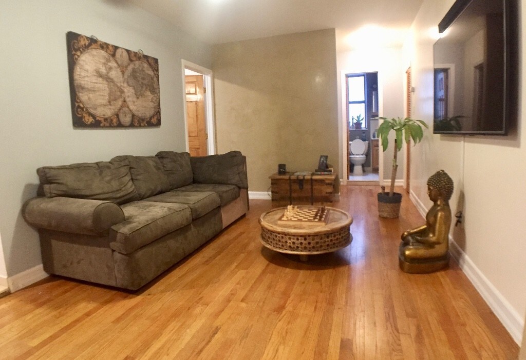
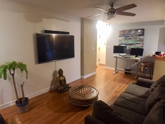
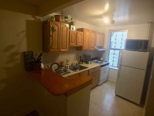
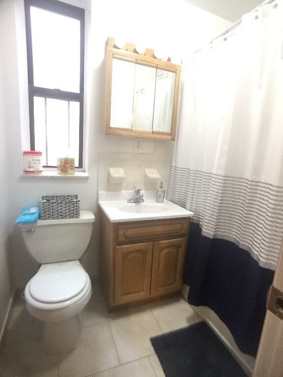
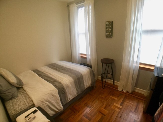
Marble Hill Junior 4 Near Metro North and 1-TrainJunior 4 or small 2Bedroom. Renovated apartment with hardwood floors, about 700 square feet in all.2 blocks to the metro north Hudson Line train, 20 minutes to Grand Central, or 4 blocks to the 1-Train at W 225th St. Broadway bus stops also on W 225th St.Target, supermarkets and $10-a-month gym all within a few minutes walk.To see this apt call Manny 646-474-0946 or email emmanuel@sovereignrealestate.com for a quick response. SoveRE75063
10 Adrian Ave is a condo located in New York County and the 10463 ZIP Code. This area is served by the New York City Geographic District #10 attendance zone.
Condo Features
- Air Conditioning
10 Adrian Ave,
Bronx,
NY
10463
Situated just east of Spuyten Duyvil, Marble Hill is a hidden gem. The neighborhood offers a blend of urban and suburban amenities, boasting a compact, walkable layout as well as charming homes with lawns and porches. Marble Hill also touts an array of Art Deco apartment buildings on tree-lined streets.
Although the neighborhood is largely residential, Marble Hill features a bevy of commercial offerings along Broadway and 225th Street that range from locally owned businesses to national retailers. The popular River Plaza is located in the southeastern-most portion of the neighborhood, offering residents quick access to a variety of suburban staples. Commuting from Marble Hill is simple with convenience to the Hudson Line and the 1 Train.
Learn more about living in Marble HillBelow are rent ranges for similar nearby apartments
Amenities
- Air Conditioning
Education
| Colleges & Universities | Distance | ||
|---|---|---|---|
| Colleges & Universities | Distance | ||
| Drive: | 4 min | 1.8 mi | |
| Drive: | 5 min | 1.8 mi | |
| Drive: | 5 min | 2.0 mi | |
| Drive: | 7 min | 2.2 mi |
10 Adrian Ave Unit 4H is within 5 minutes or 2.0 miles from Monroe College, Bronx Campus. It is also near Lehman College and Manhattan College.
Schools


Public Elementary School
Grades PK-5
367 Students
Nearby
Public Elementary & Middle School
Grades K-8
445 Students
Attendance Zone
Public Middle & High School
Grades 6-12
955 Students
Attendance Zone
Private Elementary & Middle School
Grades PK-8
198 Students
Nearby
Private High School
Grades 9-12
60 Students
Nearby
School data provided by
 The GreatSchools Rating helps parents compare schools within a state based on a variety of school quality indicators and provides a helpful picture of how effectively each school serves all of its students. Ratings are on a scale of 1 (below average) to 10 (above average) and can include test scores, college readiness, academic progress, advanced courses, equity, discipline and attendance data. We also advise parents to visit schools, consider other information on school performance and programs, and consider family needs as part of the school selection process.
View GreatSchools Rating Methodology
Data provided by GreatSchools.org © 2026. All rights reserved.
View GreatSchools Rating Methodology
Data provided by GreatSchools.org © 2026. All rights reserved.
Transportation options available in Bronx include Marble Hill-225 Street, located 0.3 mile from 10 Adrian Ave Unit 4H. 10 Adrian Ave Unit 4H is near LaGuardia, located 11.9 miles or 22 minutes away, and Westchester County, located 22.8 miles or 35 minutes away.
| Transit / Subway | Distance | ||
|---|---|---|---|
| Transit / Subway | Distance | ||
|
|
Walk: | 6 min | 0.3 mi |
|
|
Walk: | 11 min | 0.6 mi |
|
|
Walk: | 12 min | 0.6 mi |
|
|
Walk: | 18 min | 0.9 mi |
|
|
Drive: | 3 min | 1.3 mi |
| Commuter Rail | Distance | ||
|---|---|---|---|
| Commuter Rail | Distance | ||
|
|
Walk: | 2 min | 0.1 mi |
|
|
Drive: | 5 min | 1.6 mi |
|
|
Drive: | 5 min | 1.9 mi |
|
|
Drive: | 5 min | 2.1 mi |
|
|
Drive: | 8 min | 2.8 mi |
| Airports | Distance | ||
|---|---|---|---|
| Airports | Distance | ||
|
LaGuardia
|
Drive: | 22 min | 11.9 mi |
|
Westchester County
|
Drive: | 35 min | 22.8 mi |
Walkability Near 10 Adrian Ave Bronx, NY 10463
Getting Around
 What do Walkability, Transit, Drivability, and Bikeability mean?
Walkability measures the walking distance to day-to-day needs.
Transit measures access to public transportation.
Drivability measures congestion, parking availability, and access to major roads.
Bikeability measures the suitability for cycling.
How It Works
What do Walkability, Transit, Drivability, and Bikeability mean?
Walkability measures the walking distance to day-to-day needs.
Transit measures access to public transportation.
Drivability measures congestion, parking availability, and access to major roads.
Bikeability measures the suitability for cycling.
How It Works
Exceptionally Walkable
Walkability
100
/ 100
Exceptional Public Transit
Transit
100
/ 100
Fairly Drivable
Drivability
50
/ 100
Moderately Bikeable
Bikeability
60
/ 100
Scores provided by
-
Soundscore™
-
/ 100
Traffic
-Airport
-Businesses
-Scores provided by
HowLoud What is a Sound Score Rating? A Sound Score Rating aggregates noise caused by vehicle traffic, airplane traffic and local sources. How It WorksTime and distance from 10 Adrian Ave Unit 4H.
| Shopping Centers | Distance | ||
|---|---|---|---|
| Shopping Centers | Distance | ||
| Walk: | 8 min | 0.5 mi | |
| Walk: | 9 min | 0.5 mi | |
| Drive: | 4 min | 1.3 mi |
10 Adrian Ave Unit 4H has 3 shopping centers within 1.3 miles, which is about a 4-minute drive. The miles and minutes will be for the farthest away property.
| Parks and Recreation | Distance | ||
|---|---|---|---|
| Parks and Recreation | Distance | ||
|
Dyckman House Park
|
Walk: | 20 min | 1.0 mi |
|
Henry Hudson Park
|
Drive: | 4 min | 1.5 mi |
|
St. James Park
|
Drive: | 4 min | 1.6 mi |
|
Poe Park
|
Drive: | 4 min | 1.7 mi |
|
Inwood Hill Park
|
Drive: | 5 min | 2.0 mi |
10 Adrian Ave Unit 4H has 5 parks within 2.0 miles, including Dyckman House Park, Inwood Hill Park, and St. James Park.
| Hospitals | Distance | ||
|---|---|---|---|
| Hospitals | Distance | ||
| Drive: | 7 min | 2.9 mi | |
| Drive: | 6 min | 2.9 mi | |
| Drive: | 8 min | 3.3 mi |
10 Adrian Ave Unit 4H has 3 hospitals within 3.3 miles, the nearest is St. Barnabas Hospital which is 2.9 miles away and a 7 minute drive.
| Military Bases | Distance | ||
|---|---|---|---|
| Military Bases | Distance | ||
| Drive: | 25 min | 13.1 mi | |
| Drive: | 32 min | 14.9 mi | |
| Drive: | 37 min | 23.2 mi |
10 Adrian Ave Unit 4H has 3 military bases within 23.2 miles, the nearest is Fort Totten US Govt Reservation which is 13.1 miles away and a 25 minute drive.
You May Also Like
Similar Rentals Nearby


What Are Walk Score®, Transit Score®, and Bike Score® Ratings?
Walk Score® measures the walkability of any address. Transit Score® measures access to public transit. Bike Score® measures the bikeability of any address.
What is a Sound Score Rating?
A Sound Score Rating aggregates noise caused by vehicle traffic, airplane traffic and local sources.

10 Adrian Ave
Bronx, NY 10463