$1,800 / Month
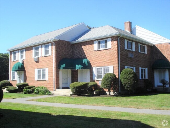
1 High St Unit 6
Reading, MA 01867
2 Weeks Ago
Favorites
1 High St Unit 6

Favorites
Check Back Soon for Upcoming Availability
| Beds | Baths | Average SF |
|---|---|---|
| 2 Bedrooms 2 Bedrooms 2 Br | 1 Bath 1 Bath 1 Ba | — |
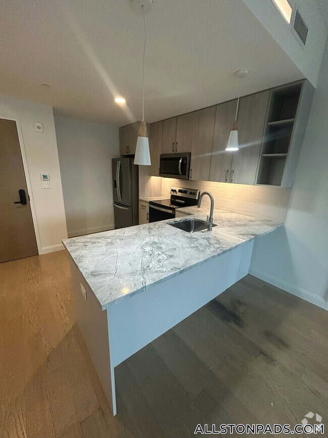
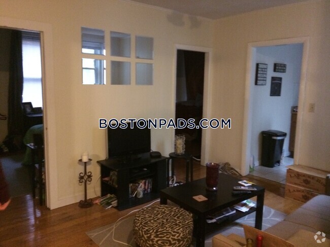
About This Property
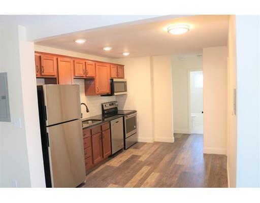
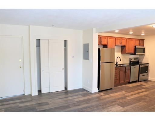
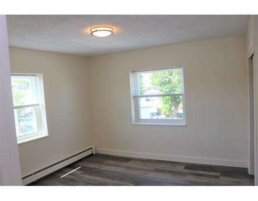
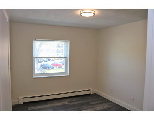
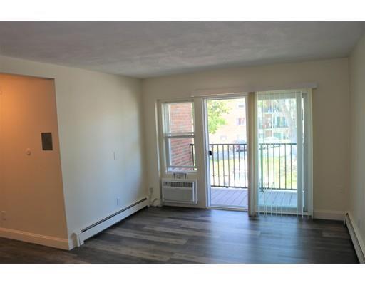
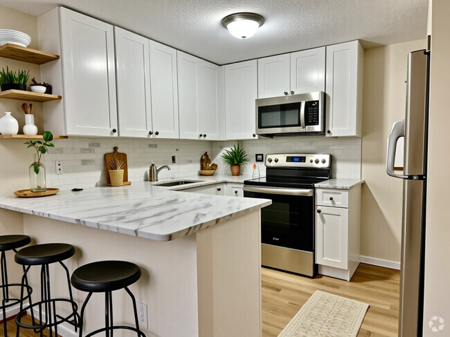
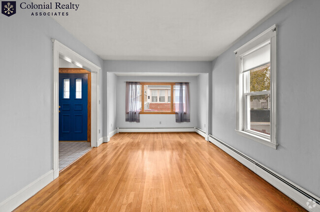
Remodeled 2 bedroom with beautiful kitchen,stainless appliances,ct bath,living room with slider to a deck,hardwood floors,common laundry. parking for 2 cars. Reading MBTA Commuter Rail across the street, Close distance to Reading Square,shopping and restaurants.Convenient location!
1 High St is a condo located in Middlesex County and the 01867 ZIP Code. This area is served by the Woburn attendance zone.
Location
Get Directions
North Woburn is a small residential community that’s just three miles from the city center. Downtown Woburn is centered around Woburn Common, a community green space, and is lined with local restaurants, bars, and shops. Residents enjoy having easy access to this charming downtown district. Several MBTA stations sit in North Woburn, and the neighborhood sits along Interstate 95 and 93, so commuting to and from the area is a breeze. Many residents choose to commute to Boston for work or leisure, located just 13 miles south via Interstate 93. The neighborhood also offers proximity to Woburn Village and nearby shopping centers, where you’ll find big-box stores, favored retailers, and restaurants. Middlesex Fells Reservation, a 2,575-acre state park, is just a few minutes south of town along the interstate. This dog-friendly spot is the perfect place for hiking, biking, and enjoying the state’s beautiful natural landscape.
Learn more about living in North WoburnBelow are rent ranges for similar nearby apartments
Expenses
Utilities Included
Water, Heat
Included
Education
| Colleges & Universities | Distance | ||
|---|---|---|---|
| Colleges & Universities | Distance | ||
| Drive: | 21 min | 9.6 mi | |
| Drive: | 16 min | 10.4 mi | |
| Drive: | 19 min | 12.1 mi | |
| Drive: | 23 min | 14.5 mi |
1 High St Unit 6 is within 21 minutes or 9.6 miles from Middlesex C.C., Bedford Campus. It is also near Tufts Univ., Medford and Lesley University, Porter.
Schools


Public Elementary School
Grades PK-5
284 Students
Nearby
Public Elementary School
Grades K-5
203 Students
Attendance Zone
Public Middle School
Grades 6-8
514 Students
Attendance Zone
Public High School
Grades 9-12
1,178 Students
Attendance Zone
Private Elementary, Middle & High School
Grades PK-12
50 Students
Nearby
Private Elementary, Middle & High School
Grades 2-11
23 Students
Nearby
School data provided by
 The GreatSchools Rating helps parents compare schools within a state based on a variety of school quality indicators and provides a helpful picture of how effectively each school serves all of its students. Ratings are on a scale of 1 (below average) to 10 (above average) and can include test scores, college readiness, academic progress, advanced courses, equity, discipline and attendance data. We also advise parents to visit schools, consider other information on school performance and programs, and consider family needs as part of the school selection process.
View GreatSchools Rating Methodology
View GreatSchools Rating Methodology
Transportation options available in Reading include Oak Grove Station, located 8.8 miles from 1 High St Unit 6. 1 High St Unit 6 is near General Edward Lawrence Logan International, located 16.7 miles or 26 minutes away, and Manchester Boston Regional, located 40.1 miles or 57 minutes away.
| Transit / Subway | Distance | ||
|---|---|---|---|
| Transit / Subway | Distance | ||
|
|
Drive: | 16 min | 8.8 mi |
|
|
Drive: | 20 min | 9.8 mi |
|
|
Drive: | 16 min | 10.1 mi |
| Drive: | 16 min | 10.3 mi | |
| Drive: | 17 min | 10.8 mi |
| Commuter Rail | Distance | ||
|---|---|---|---|
| Commuter Rail | Distance | ||
|
|
Drive: | 3 min | 1.4 mi |
|
|
Drive: | 5 min | 2.8 mi |
|
|
Drive: | 8 min | 4.6 mi |
|
|
Drive: | 9 min | 4.8 mi |
|
|
Drive: | 9 min | 4.8 mi |
| Airports | Distance | ||
|---|---|---|---|
| Airports | Distance | ||
|
General Edward Lawrence Logan International
|
Drive: | 26 min | 16.7 mi |
|
Manchester Boston Regional
|
Drive: | 57 min | 40.1 mi |
Time and distance from 1 High St Unit 6.
| Shopping Centers | Distance | ||
|---|---|---|---|
| Shopping Centers | Distance | ||
| Walk: | 20 min | 1.0 mi | |
| Drive: | 5 min | 2.3 mi | |
| Drive: | 6 min | 2.3 mi |
1 High St Unit 6 has 3 shopping centers within 2.3 miles, which is about a 6-minute walk. The miles and minutes will be for the farthest away property.
| Parks and Recreation | Distance | ||
|---|---|---|---|
| Parks and Recreation | Distance | ||
|
Walter D. Stone Memorial Zoo
|
Drive: | 12 min | 6.6 mi |
|
Middlesex Fells Reservation
|
Drive: | 12 min | 7.0 mi |
|
Breakheart Reservation
|
Drive: | 18 min | 8.2 mi |
|
Friends of Middlesex Fells Reservation
|
Drive: | 16 min | 8.2 mi |
|
Ralph Hill Conservation Area
|
Drive: | 23 min | 12.9 mi |
1 High St Unit 6 has 5 parks within 12.9 miles, including Walter D. Stone Memorial Zoo, Middlesex Fells Reservation, and Friends of Middlesex Fells Reservation.
| Hospitals | Distance | ||
|---|---|---|---|
| Hospitals | Distance | ||
| Drive: | 7 min | 3.9 mi | |
| Drive: | 11 min | 4.8 mi | |
| Drive: | 15 min | 8.0 mi |
1 High St Unit 6 has 3 hospitals within 8.0 miles, the nearest is Lahey Hospital & Medical Center, Burlington which is 3.9 miles away and a 7 minute drive.
| Military Bases | Distance | ||
|---|---|---|---|
| Military Bases | Distance | ||
| Drive: | 14 min | 8.2 mi | |
| Drive: | 32 min | 18.5 mi |
1 High St Unit 6 is 8.2 miles from Hanscom Air Force Base, and is convenient to other military bases, including Fort Pickering.
You May Also Like
Similar Rentals Nearby
What Are Walk Score®, Transit Score®, and Bike Score® Ratings?
Walk Score® measures the walkability of any address. Transit Score® measures access to public transit. Bike Score® measures the bikeability of any address.
What is a Sound Score Rating?
A Sound Score Rating aggregates noise caused by vehicle traffic, airplane traffic and local sources

1 High St
Reading, MA 01867