
$2,800
/ Month
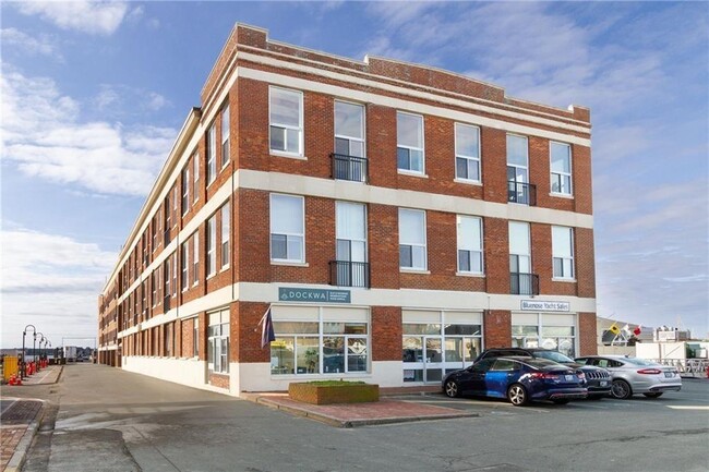
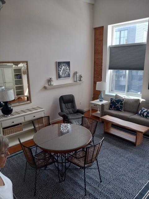
1 Commercial Wharf Unit 57
Newport, RI 02840
2 Weeks Ago
|
Edit
Favorites
1 Commercial Wharf Unit 57

Favorites
Check Back Soon for Upcoming Availability
| Beds | Baths | Average SF |
|---|---|---|
| 2 Bedrooms 2 Bedrooms 2 Br | 2 Baths 2 Baths 2 Ba | 927 SF |
Fees and Policies
The fees listed below are community-provided and may exclude utilities or add-ons. All payments are made directly to the property and are non-refundable unless otherwise specified.
- Parking
-
Other--
Details
Utilities Included
-
Water
-
Air Conditioning
Property Information
-
Furnished Units Available
About This Property
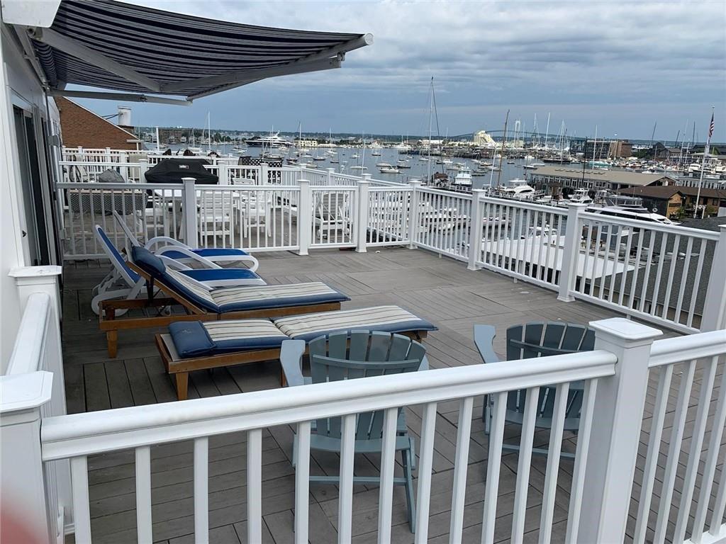
Waterfront Newport Harbor de alquiler de invierno! Excelente ubicación en el corazón de Newport - dos habitaciones, dos baños - plano de planta abierto, techos estilo catedral, lavadora y secadora, espacio de garaje cubierto -one incluidos- hermosas vistas al puerto, la terraza en la azotea, esto independientes disponibles el 1 de octubre, 2022 al 31 de mayo de 2023. Prepárese para disfrutar de una fabulosa invierno en NEWPORT. Con extraordinaria ubicación, excelentes restaurantes, excelente manera de pasar el invierno. Llama para reservar!
1 Commercial Wharf is a condo located in Newport County and the 02840 ZIP Code. This area is served by the Newport School District attendance zone.
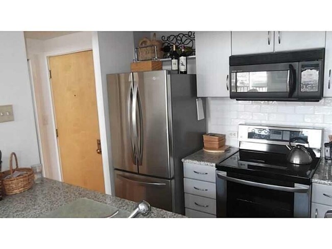
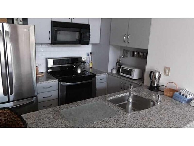
Condo Features
Lavavajillas
Suelos de madera maciza
Microondas
Nevera
- Ventiladores de techo
- Sistema de seguridad
- Chimenea
- Lavavajillas
- Zona de eliminación de desechos
- Microondas
- Fogón
- Nevera
- Suelos de madera maciza
- Suelos de baldosas
- Ático
- Vistas
- Lucernarios
- Amueblado
- Piscina exterior
- Frente al mar
- Cubierta
1 Commercial Wharf,
Newport,
RI
02840
Welcome to Newport, Rhode Island, where historic charm meets coastal elegance. As the "Sailing Capital of the World," Newport combines rich maritime heritage with modern coastal living. The rental market reflects the city's desirability, with one-bedroom apartments averaging $1,561, two-bedrooms at $1,953, and three-bedrooms at $2,057, showing year-over-year increases between 4.4% and 7.4%. Housing options include downtown apartments in preserved colonial buildings and waterfront residences overlooking the Atlantic.
Newport's waterfront defines daily life here. The Cliff Walk, stretching 3.5 miles along the shoreline, offers residents sweeping ocean views and glimpses of the city's magnificent Gilded Age mansions. Thames Street forms the heart of downtown, while The Point neighborhood showcases colonial-era architecture and tree-lined streets. Easton's Beach and Fort Adams State Park provide year-round recreation, with the park hosting the celebrated Newport Folk and Jazz Festivals.
Learn more about living in Newport
Amenities
- Ventiladores de techo
- Sistema de seguridad
- Chimenea
- Lavavajillas
- Zona de eliminación de desechos
- Microondas
- Fogón
- Nevera
- Suelos de madera maciza
- Suelos de baldosas
- Ático
- Vistas
- Lucernarios
- Amueblado
- Frente al mar
- Cubierta
- Piscina exterior
Expenses
Utilities Included
Water, Air Conditioning
Included
Education
| Colleges & Universities | Distance | ||
|---|---|---|---|
| Colleges & Universities | Distance | ||
| Drive: | 5 min | 1.6 mi | |
| Drive: | 7 min | 2.8 mi | |
| Drive: | 22 min | 12.2 mi | |
| Drive: | 32 min | 17.7 mi |
1 Commercial Wharf Unit 57 is within 5 minutes or 1.6 miles from Salve Regina University. It is also near C.C. of Rhode Island, Newport and Rhode Island, Narragansett.
Schools


Public Elementary School
Grades PK-5
716 Students
Nearby
Public Elementary & Middle School
Grades K-8
516 Students
Nearby
Public High School
Grades 9-12
633 Students
Attendance Zone
Private Elementary & Middle School
Grades PK-8
204 Students
Nearby
Private High School
Grades 9-12
360 Students
Nearby
School data provided by
 The GreatSchools Rating helps parents compare schools within a state based on a variety of school quality indicators and provides a helpful picture of how effectively each school serves all of its students. Ratings are on a scale of 1 (below average) to 10 (above average) and can include test scores, college readiness, academic progress, advanced courses, equity, discipline and attendance data. We also advise parents to visit schools, consider other information on school performance and programs, and consider family needs as part of the school selection process.
View GreatSchools Rating Methodology
Data provided by GreatSchools.org © 2026. All rights reserved.
View GreatSchools Rating Methodology
Data provided by GreatSchools.org © 2026. All rights reserved.
Walkability Near 1 Commercial Wharf Newport, RI 02840
Getting Around
 What do Walkability, Transit, Drivability, and Bikeability mean?
Walkability measures the walking distance to day-to-day needs.
Transit measures access to public transportation.
Drivability measures congestion, parking availability, and access to major roads.
Bikeability measures the suitability for cycling.
How It Works
What do Walkability, Transit, Drivability, and Bikeability mean?
Walkability measures the walking distance to day-to-day needs.
Transit measures access to public transportation.
Drivability measures congestion, parking availability, and access to major roads.
Bikeability measures the suitability for cycling.
How It Works
Somewhat Walkable
Walkability
30
/ 100
Minimal Public Transit
Transit
0
/ 100
Exceptionally Drivable
Drivability
100
/ 100
Not Bikeable
Bikeability
0
/ 100
Scores provided by
-
Soundscore™
-
/ 100
Traffic
-Airport
-Businesses
-Scores provided by
HowLoud What is a Sound Score Rating? A Sound Score Rating aggregates noise caused by vehicle traffic, airplane traffic and local sources. How It WorksYou May Also Like
Similar Rentals Nearby


What Are Walk Score®, Transit Score®, and Bike Score® Ratings?
Walk Score® measures the walkability of any address. Transit Score® measures access to public transit. Bike Score® measures the bikeability of any address.
What is a Sound Score Rating?
A Sound Score Rating aggregates noise caused by vehicle traffic, airplane traffic and local sources.

1 Commercial Wharf
Newport, RI 02840