

0 Newport Avenue Extension
0 Newport Avenue Extension
Quincy, MA 02171
2 Weeks Ago
Favorites
0 Newport Avenue Extension

Favorites
Check Back Soon for Upcoming Availability
| Beds | Baths | Average SF |
|---|---|---|
| Studio Studio 0 Br | 1 Bath 1 Bath 1 Ba | 4,000 SF |
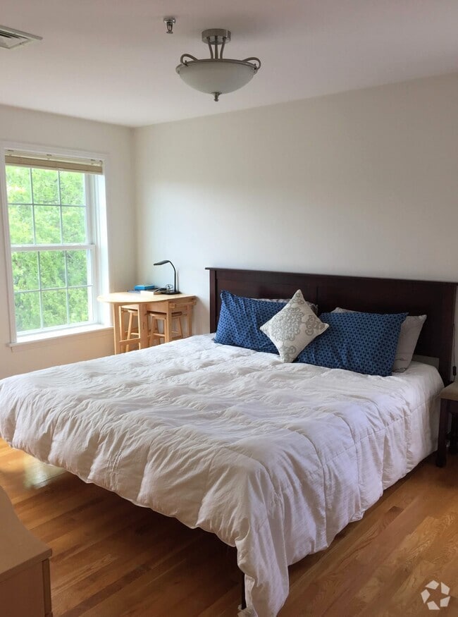
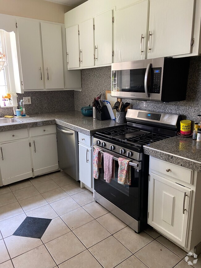
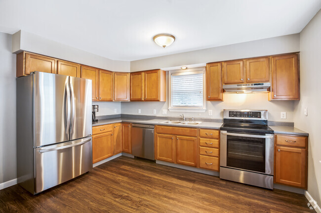
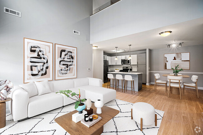
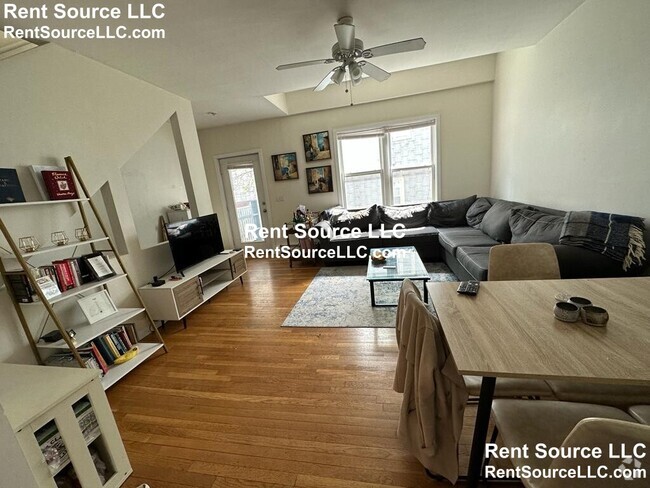
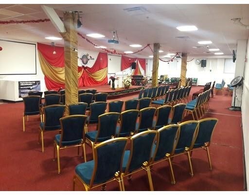
About This Property
Shared church space. Only if you worship after 12p on Sunday. Saturday can be any time of the day.
0 Newport Avenue Extension is a townhome located in Norfolk County and the 02171 ZIP Code. This area is served by the Quincy attendance zone.
Location
Get Directions
Across the Neponset River from Downtown Boston lies the Quincy neighborhood of Montclair. Commuters drive eight miles north on Interstate 93 to reach downtown, while residents without a car enjoy easy access using several bus lines or the Red Line's North Quincy subway station. This quiet residential community of apartments and bungalow-style houses provides a small-town atmosphere within a larger urban environment.
There’s a diverse mix of cuisine that belies Montclair’s relatively small size. Most of Montclair's businesses are found along Hancock Street near North Quincy station. Residents gather at Assembly Bar on Sundays for comfort food while watching the New England Patriots.
Learn more about living in MontclairBelow are rent ranges for similar nearby apartments
Expenses
Utilities Included
Heat
Included
Education
| Colleges & Universities | Distance | ||
|---|---|---|---|
| Colleges & Universities | Distance | ||
| Drive: | 7 min | 3.2 mi | |
| Drive: | 10 min | 5.6 mi | |
| Drive: | 11 min | 5.7 mi | |
| Drive: | 10 min | 5.9 mi |
0 Newport Avenue Extension is within 7 minutes or 3.2 miles from UMass Boston. It is also near Northeastern University and Wentworth Inst. of Technology.
Schools


Public Elementary School
Grades PK-6
316 Students
Nearby
Public Elementary School
Grades K-5
352 Students
Attendance Zone
Public Middle School
Grades 6-8
551 Students
Attendance Zone
Public High School
Grades 9-12
1,476 Students
Attendance Zone
Private Elementary & Middle School
Grades PK-8
339 Students
Nearby
Private High School
Grades 9-12
95 Students
Nearby
School data provided by
 The GreatSchools Rating helps parents compare schools within a state based on a variety of school quality indicators and provides a helpful picture of how effectively each school serves all of its students. Ratings are on a scale of 1 (below average) to 10 (above average) and can include test scores, college readiness, academic progress, advanced courses, equity, discipline and attendance data. We also advise parents to visit schools, consider other information on school performance and programs, and consider family needs as part of the school selection process.
View GreatSchools Rating Methodology
View GreatSchools Rating Methodology
Transportation options available in Quincy include North Quincy, located 0.5 mile from 0 Newport Avenue Extension. 0 Newport Avenue Extension is near General Edward Lawrence Logan International, located 8.6 miles or 15 minutes away.
| Transit / Subway | Distance | ||
|---|---|---|---|
| Transit / Subway | Distance | ||
|
|
Walk: | 10 min | 0.5 mi |
|
|
Drive: | 3 min | 1.4 mi |
|
|
Drive: | 3 min | 1.9 mi |
|
|
Drive: | 4 min | 2.0 mi |
|
|
Drive: | 5 min | 2.4 mi |
| Commuter Rail | Distance | ||
|---|---|---|---|
| Commuter Rail | Distance | ||
|
|
Drive: | 6 min | 2.7 mi |
|
|
Drive: | 5 min | 3.1 mi |
| Drive: | 8 min | 3.1 mi | |
| Drive: | 6 min | 3.3 mi | |
|
|
Drive: | 6 min | 3.6 mi |
| Airports | Distance | ||
|---|---|---|---|
| Airports | Distance | ||
|
General Edward Lawrence Logan International
|
Drive: | 15 min | 8.6 mi |
Time and distance from 0 Newport Avenue Extension.
| Shopping Centers | Distance | ||
|---|---|---|---|
| Shopping Centers | Distance | ||
| Walk: | 20 min | 1.0 mi | |
| Drive: | 2 min | 1.1 mi | |
| Drive: | 3 min | 1.2 mi |
0 Newport Avenue Extension has 3 shopping centers within 1.2 miles, which is about a 3-minute walk. The miles and minutes will be for the farthest away property.
| Parks and Recreation | Distance | ||
|---|---|---|---|
| Parks and Recreation | Distance | ||
|
Squantum Point Park
|
Drive: | 6 min | 1.9 mi |
|
Adams National Historical Park
|
Drive: | 6 min | 2.6 mi |
|
Dorchester Shores Reservation
|
Drive: | 6 min | 3.2 mi |
|
Franklin Park Zoo
|
Drive: | 8 min | 4.9 mi |
|
Lower Neponset River Trail
|
Drive: | 8 min | 5.0 mi |
0 Newport Avenue Extension has 5 parks within 5.0 miles, including Squantum Point Park, Adams National Historical Park, and Dorchester Shores Reservation.
| Hospitals | Distance | ||
|---|---|---|---|
| Hospitals | Distance | ||
| Drive: | 3 min | 2.1 mi | |
| Drive: | 8 min | 4.3 mi | |
| Drive: | 7 min | 4.7 mi |
0 Newport Avenue Extension has 3 hospitals within 4.7 miles, the nearest is Carney Hospital which is 2.1 miles away and a 3 minute drive.
You May Also Like
Similar Rentals Nearby


What Are Walk Score®, Transit Score®, and Bike Score® Ratings?
Walk Score® measures the walkability of any address. Transit Score® measures access to public transit. Bike Score® measures the bikeability of any address.
What is a Sound Score Rating?
A Sound Score Rating aggregates noise caused by vehicle traffic, airplane traffic and local sources
0 Newport Avenue Extension
Quincy, MA 02171